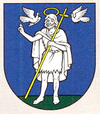
Zemianske Kostoľany
| Zemianske Kostoľany | ||
|---|---|---|
| coat of arms | map | |

|
|
|
| Basic data | ||
| State : | Slovakia | |
| Kraj : | Trenčiansky kraj | |
| Okres : | Prievidza | |
| Region : | Horná Nitra | |
| Area : | 12.772 km² | |
| Residents : | 1,752 (Dec. 31, 2019) | |
| Population density : | 137 inhabitants per km² | |
| Height : | 232 m nm | |
| Postal code : | 972 43 | |
| Telephone code : | 0 46 | |
| Geographic location : | 48 ° 41 ' N , 18 ° 31' E | |
| License plate : | PD | |
| Kód obce : | 514454 | |
| structure | ||
| Community type : | local community | |
| Structure of the municipality: | 2 parts of the community | |
| Administration (as of November 2018) | ||
| Mayor : | Jana Školíková | |
| Address: | Obecný úrad Zemianske Kostoľany ulica 4th apríla 60/28 97243 Zemianske Kostoľany |
|
| Website: | www.zemianskekostolany.sk | |
| Statistics information on statistics.sk | ||
Zemianske Kostoľany (until 1948 "Zemianske Kostolany" - until 1927 "Zemanské Kostolany"; German Edl-Kostolany , Hungarian Nemeskosztolány ) is a municipality in the Okres Prievidza of the Trenčin Regional Association in western Slovakia .
The place was first mentioned in writing as Coztulan in 1331 .
In addition to the main town, the municipality Dolné Lelovce (German Unterlelotz ), which was incorporated in 1902, belongs to the municipality .
There is a renaissance castle from the first half of the 17th century, the Catholic church was built in 1699–1701.
Web links
Commons : Zemianske Kostoľany - collection of pictures, videos and audio files

