Oslany
| Oslany | ||
|---|---|---|
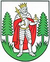
| coat of arms | map | |

|
|
|
| Basic data | ||
| State : | Slovakia | |
| Kraj : | Trenčiansky kraj | |
| Okres : | Prievidza | |
| Region : | Horná Nitra | |
| Area : | 25,153 km² | |
| Residents : | 2,375 (Dec. 31, 2019) | |
| Population density : | 94 inhabitants per km² | |
| Height : | 274 m nm | |
| Postal code : | 972 47 | |
| Telephone code : | 0 46 | |
| Geographic location : | 48 ° 38 ' N , 18 ° 28' E | |
| License plate : | PD | |
| Kód obce : | 514292 | |
| structure | ||
| Community type : | local community | |
| Structure of the municipality: | 2 parts of the community | |
| Administration (as of November 2018) | ||
| Mayor : | František Priekala | |
| Address: | Obecný úrad Oslany Námestie Slobody 3 97247 Oslany |
|
| Website: | www.oslany.sk | |
| Statistics information on statistics.sk | ||
Oslany (1973 to June 30, 1995 in Slovak "Osľany"; Hungarian Oszlány ) is a municipality in Slovakia .
The place in the valley of the Nitra River east of Partizánske .
The place was mentioned for the first time in 1254 and recorded in writing as Hoslan in 1322 . In 1503 the place received city rights.
In 1603 the inhabitants of the place suffered a lot from the Turks. They also took 200 people who had fled to the church with them into captivity. In 1830 Oslany had 208 houses and 1,460 Slovak residents, all of whom believed in the Catholic Church.
Until 1918, the municipality in Bars County belonged to the Kingdom of Hungary (where it was the seat of a chair district administration) and then came to the newly formed Czechoslovakia . It has been part of Slovakia since 1993.
The Ľubianka district in the southeast also belongs to it .
Personalities
- Eduard Nécsey (born February 9, 1892 in Oslany; † June 19, 1968), in Nitra Bishop of Nitra (1949–1968)
Web links
Remarks
- ↑ GF carpenter: Oszlán in: Johann Samuel Ersch , Johann Gottfried Gruber (Ed.): General Encyclopedia of Sciences and Arts , the third section, Part 7 (1836), p.263.

