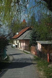
Cigeľ
| Cigeľ | ||
|---|---|---|
| coat of arms | map | |

|
|
|
| Basic data | ||
| State : | Slovakia | |
| Kraj : | Trenčiansky kraj | |
| Okres : | Prievidza | |
| Region : | Horná Nitra | |
| Area : | 17.350 km² | |
| Residents : | 1,258 (Dec. 31, 2019) | |
| Population density : | 73 inhabitants per km² | |
| Height : | 460 m nm | |
| Postal code : | 972 01 ( Prievidza post office ) | |
| Telephone code : | 0 46 | |
| Geographic location : | 48 ° 43 ' N , 18 ° 39' E | |
| License plate : | PD | |
| Kód obce : | 513920 | |
| structure | ||
| Community type : | local community | |
| Administration (as of November 2018) | ||
| Mayor : | Štefan Mjartan | |
| Address: | Obecný úrad Cigeľ č. 192 972 01 Prievidza |
|
| Website: | www.cigel.sk | |
| Statistics information on statistics.sk | ||
Cigeľ (until 1927 Slovak "Cigľa"; German brick , Hungarian Cégely - until 1907 Cigel ) is a municipality in the west-center of Slovakia with 1258 inhabitants (as of December 31, 2019), which belongs to Okres Prievidza , part of Trenčiansky kraj , heard.
geography
The community is located at the transition from the valley Hornonitrianska kotlina in the bird Mountains in the valley of the creek Ciglianka . The 17.35 km² large municipal area is hilly to mountainous and covered by illimerized and brown forest soils. The center of the village lies at an altitude of 460 m nm and is nine kilometers from Prievidza .
history
Cigeľ was first mentioned in writing in 1362 as Luchka and was first built on the Priwitz Castle estate. Later the village belonged to the estate of the Sivý Kameň Castle and the Weinitz Castle . In 1362 a certain Peter von Šútovce received the place from the Weinitz castellan. After the family died out, the Rescényi family came into possession. In 1461 the name Cyglen is mentioned. In 1553 nine porta are recorded in a tax register, then in 1675 33 subject and 15 house families. In the 17th century the Pálffys bought the local bailiwick.
In 1787 there were 42 inhabitants and 310 inhabitants, in 1828 52 houses and 369 inhabitants. The inhabitants were farmers and commuted for seasonal work. In the 19th century there was a mill, a saw and a cloth mill.
Until 1918, the place in Neutra County belonged to the Kingdom of Hungary and then came to Czechoslovakia or now Slovakia. Local residents took part in the Slovak National Uprising in 1944 ; In retaliation, an SS troop arrested 130 residents on January 13, 1945 and killed seven of them by torture.
population
According to the 2011 census, 1190 inhabitants lived in Cigeľ, of which 1176 were Slovaks and one each from Moravia, Russian, Serbian and Czech. Ten residents made no statement. 879 residents supported the Roman Catholic Church, 13 residents the Evangelical Church, nine residents the Evangelical Church A. B and two residents each for the Evangelical Methodist Church and the Orthodox Church; four residents were of other denominations. 209 inhabitants were without religious denomination and the denomination of 72 inhabitants has not been determined.
Results after the 2001 census (1003 inhabitants):
|
By ethnicity:
|
By denomination:
|
Buildings
- Roman Catholic Church from 1762
Individual evidence
Web links
- Entry on e-obce.sk (Slovak)


