Stará Bašta: Difference between revisions
Content deleted Content added
m robot Adding: eo:Stará Bašta |
m unapproved bot, blanking sections |
||
| (8 intermediate revisions by 8 users not shown) | |||
| Line 7: | Line 7: | ||
{{Rimavska Sobota District}} |
{{Rimavska Sobota District}} |
||
| ⚫ | |||
{{coord|48|11|N|19|57|E|region:SK_type:city|display=title}} |
{{coord|48|11|N|19|57|E|region:SK_type:city|display=title}} |
||
| ⚫ | |||
{{authority control}} |
|||
[[eo:Stará Bašta]] |
|||
[[hu:Óbást]] |
|||
{{DEFAULTSORT:Stara Basta}} |
|||
[[sk:Stará Bašta]] |
|||
| ⚫ | |||
| ⚫ | |||
Latest revision as of 10:22, 29 September 2022

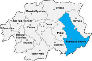
Stará Bašta (Hungarian: Óbást) is a village and municipality in the Rimavská Sobota District of the Banská Bystrica Region of southern Slovakia.
External links[edit]
48°11′N 19°57′E / 48.183°N 19.950°E
