Albany (Georgia)
| Albany | |
|---|---|
| Nickname : The Good Life City, The Artesian City | |
 Albany Government Center, 2006 |
|
| County and state location | |
| Basic data | |
| Foundation : | December 27, 1838 (City) |
| State : | United States |
| State : | Georgia |
| County : | Dougherty County |
| Coordinates : | 31 ° 35 ′ N , 84 ° 10 ′ W |
| Time zone : | Eastern ( UTC − 5 / −4 ) |
|
Inhabitants : - Metropolitan Area : |
77,434 (status: 2010) 157,308 (status: 2010) |
| Population density : | 538.9 inhabitants per km 2 |
| Area : | 144.7 km 2 (approx. 56 mi 2 ) of which 143.7 km 2 (approx. 55 mi 2 ) is land |
| Height : | 62 m |
| Area code : | +1 229 |
| FIPS : | 13-01052 |
| GNIS ID : | 0310424 |
| Website : | www.albanyga.gov |
| Mayor : | Dorothy Hubbard |
Albany is a city and also the county seat of Dougherty County in the US state of Georgia with 77,434 inhabitants (as of 2010).
geography
Albany's geographic coordinates are 31 ° 35 ' N , 84 ° 10' W (31.582273, −84.165557).
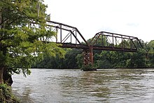
The city has an area of 144.7 km 2 , of which 143.7 km 2 is land and 0.9 km 2 (= 0.59%) is water. Albany lies in a belt of farmland on the banks of the Flint River .
Albany is the center of the Albany metropolitan area with around 157,000 inhabitants.
climate
The climate is characterized by hot, humid summers and mild to slightly cool winters. According to the Köppen and Geiger climate classification , the region around Albany is in the east side climate , which is abbreviated to "Cfa". In Albany there is significantly more precipitation than the national average. Among other things, there are an average of 86 thunderstorm days per year, this is more than twice as many as seen nationwide.
history
The civil rights movement against segregation also flashed in Albany in the 1960s , but remained rather unsuccessful due to the counter-strategy of the police under the leadership of Laurie Pritchett .
Today more than two-thirds of the population are African American .
Demographic data
According to the 2010 census, the then 77,434 inhabitants were distributed over 29,781 inhabited households, which gives an average of 2.46 people per household. There are a total of 33,436 households.
62.2% of the households were family households (consisting of married couples with or without offspring or one parent with offspring) with an average size of 3.11 persons. There were children under the age of 18 in 34.9% of all households and persons aged 65 and over in 22.1% of all households.
30.9% of the population were younger than 20 years old, 29.3% were 20 to 39 years old, 23.6% were 40 to 59 years old, and 16.1% were at least 60 years old. The mean age was 31 years. 46.1% of the population were male and 53.9% were female.
25.2% of the population identified themselves as whites , 71.6% as African American , 0.2% as Indians and 0.8% as Asian Americans . 1.0% said they belonged to another ethnic group and 1.1% to several ethnic groups. 2.1% of the population was made up of Hispanics or Latinos .
The average annual income per household was 31,263 USD , while 33.2% of the population lived below the poverty line.
politics
The mayor and six city councilors are elected for four years. In addition, there is an appointed city director who heads the administration. The city has been administered in this way since January 14, 1924.
Culture and sights
The city has a number of properties listed on the National Register of Historic Places . This includes:
- Albany District Pecan Growers' Exchange
- Albany Housefurnishing Company
- Albany Municipal Auditorium
- Albany Railroad Depot Historic District
- Bridge House (Albany, Georgia)
- Carnegie Library of Albany
- Davis-Exchange Bank Building
- John A. Davis House
- Lustron House at 1200 Fifth Avenue
- Lustron House at 711 Ninth Avenue
- Mount Zion Baptist Church
- New Albany Hotel
- Old St. Teresa's Catholic Church
- Rosenberg Brothers Department Store
- Samuel Farkas House
- St. Nicholas Hotel
- Tift Park
- US Post Office and Courthouse
- Union Depot (Albany, Georgia)
- WE Smith House
Sports
Albany was the hometown of the former baseball teams Albany Polecats and South Georgia Peanuts, and the football teams Albany Panthers and South Georgia Wildcats .
Economy and Infrastructure
Albany is home to a MillerCoors brewery and a Miller Brewing Company .
traffic
On December 25, 1847, the Savannah and Albany Railroad was founded , which was originally supposed to connect Savannah with Albany. The company was renamed Savannah, Albany and Gulf Railroad (SA&G) in 1853 and opened a railway line from Savannah to Screven in 1858 , but plans to continue to Albany were not carried out. The city finally got its first railway connection in 1869 by the Atlantic and Gulf Railroad , which was part of the Plant System . Today rail freight is handled by the Georgia Southwestern Railroad , Georgia and Florida Railway and Norfolk Southern Railway . Albany does not currently have a connection to rail passenger transport .
Albany is crossed by US Highways 19 and 82 and Georgia State Routes 3 , 62 , 91 , 133 , 234 , 300 and 520 .
Albanys Airport is the Southwest Georgia Regional Airport in the southwest of the city.
media
There is a Georgia Public Broadcasting radio station in Albany .
education
sons and daughters of the town
- Robert Wyche Davis (1849–1929), politician
- Wallingford Riegger (1885–1961), composer
- William L. Dawson (1886–1970), politician
- Clarence I. Lubin (1900-1989), mathematician
- Harry James (1916–1983), jazz trumpeter and band leader
- Alice Coachman (1923-2014), track and field athlete
- Jeanne L. Noble (1926–2002), Roman Catholic theologian
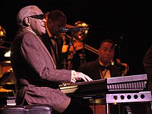
- Ray Charles (1930-2004), singer
- Paul Preuss (* 1942), science fiction author
- Bobby L. Rush (born 1946), politician
- Jo Marie Payton-Noble (born 1950), actress
- Thomas J. Hennen (* 1952), astronaut
- Mark F. Taylor (* 1957), politician
- Amelia Marshall (born 1958), actress
- Russell Malone (* 1963), jazz guitarist
- Gerald Brom (* 1965), Gothic and fantasy artist and illustrator
- Chann McRae (* 1971), racing cyclist
- Angelo Taylor (* 1978), athlete
- Deion Branch (born 1979), American football player
- Iris Smith (born 1979), wrestler
- Ricardo Lockette (born 1986), American football player
Web links
- Website of the city (Engl.)
Individual evidence
- ^ Albany, Georgia Köppen Climate Classification (Weatherbase) . Retrieved October 29, 2018.
- ^ Profile of General Population and Housing Characteristics: 2010 . United States Census Bureau . Retrieved October 29, 2018.
- ^ Board of City Commissioners ( English ) City of Albany. Archived from the original on October 8, 2011. Retrieved on February 24, 2015.


