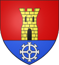
Bonsmoulins
| Bonsmoulins | ||
|---|---|---|

|
|
|
| region | Normandy | |
| Department | Orne | |
| Arrondissement | Mortagne-au-Perche | |
| Canton | Tourouvre | |
| Community association | Communauté de communes des Pays de L'Aigle | |
| Coordinates | 48 ° 39 ' N , 0 ° 32' E | |
| height | 223-291 m | |
| surface | 7.57 km 2 | |
| Residents | 240 (January 1, 2017) | |
| Population density | 32 inhabitants / km 2 | |
| Post Code | 61380 | |
| INSEE code | 61053 | |
 Bonsmoulins |
||
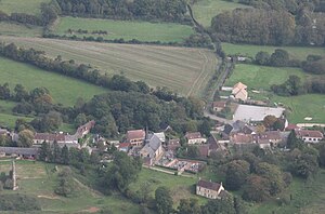
Bonsmoulins is a French municipality with 240 inhabitants (as of January 1 2017) in the department of Orne in the region of Normandy . It belongs to the canton of Tourouvre and the Arrondissement of Mortagne-au-Perche .
Neighboring municipalities are Bonnefoi in the northeast, Les Genettes in the east, Soligny-la-Trappe in the southeast, Saint-Aquilin-de-Corbion in the southwest, Moulins-la-Marche in the west and La Ferrière-au-Doyen in the northwest.
Population development
| year | 1962 | 1968 | 1975 | 1982 | 1990 | 1999 | 2008 | 2016 |
|---|---|---|---|---|---|---|---|---|
| Residents | 211 | 204 | 176 | 144 | 156 | 213 | 218 | 255 |
Web links
Commons : Bonsmoulins - collection of images, videos and audio files


