
Igé (Orne)
| Igé | ||
|---|---|---|
|
||
| region | Normandy | |
| Department | Orne | |
| Arrondissement | Mortagne-au-Perche | |
| Canton | Cetone | |
| Community association | Collines du Perche Normand | |
| Coordinates | 48 ° 19 ′ N , 0 ° 31 ′ E | |
| height | 90-180 m | |
| surface | 27.86 km 2 | |
| Residents | 630 (January 1, 2017) | |
| Population density | 23 inhabitants / km 2 | |
| Post Code | 61130 | |
| INSEE code | 61207 | |
 Tower of the Church of St. Martin |
||

Cluny is a French municipality with 630 inhabitants (at January 1, 2017) in Orne in the region Normandy (2015 Basse-Normandie ). It belongs to the Arrondissement of Mortagne-au-Perche and to the Collines du Perche Normand , a community of municipalities founded in 2016 . The inhabitants are called Igéens .
geography
The municipality is located in the Perche countryside , 33 kilometers southeast of the departmental capital Alençon and about 50 kilometers northeast of Le Mans on the Même River . Igé borders on the Sarthe department in the southwest . Igé includes several hamlets and individual farms as well as the village of Marcilly , which was incorporated into Igé in 1817. The neighboring municipalities are Vaunoise and Belforêt-en-Perche in the north, Saint-Martin-du-Vieux-Bellême and Appenai-sous-Bellême in the northeast, La Chapelle-Souëf in the east, Saint-Germain-de-la-Coudre and Bellou -le-Trichard in the southeast, Pouvrai in the south, Saint-Cosme-en-Vairais in the southwest and Saint-Fulgent-des-Ormes in the west.
Population development
| 1962 | 1968 | 1975 | 1982 | 1990 | 1999 | 2006 | 2016 | |
|---|---|---|---|---|---|---|---|---|
| 894 | 890 | 885 | 804 | 685 | 702 | 690 | 647 | |
| Sources: Cassini and INSEE | ||||||||
Attractions
- Château de Lonné from the 17th, 19th and 20th centuries, Monument historique
- Saint-Martin church with Romanesque tower
- Notre-Dame church in the Marcilly district from the 12th century, Monument historique
- Manoir de Bray, mansion with chapel from the 17th century, Monument historique
- Remains of a moth in the forest, one kilometer west of the village of Igé, Monument historique
- "Pyramid" (boundary stone) from 1735
- Lavoir
- Water tower

Château de Lonné

Former Igé train station, three kilometers north of Igé in the municipality of Belforêt-en-Perche

Notre-Dame church

Landmark pyramid

Manoir de Bray
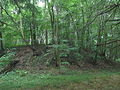
Reate the moth


Economy and Infrastructure
There are 35 farms in the municipality of Igé (cereal and feed cultivation, cattle and horse breeding)
The D938 road runs through Igé from Le Mans to Mortagne-au-Perche . In Alençon , 33 kilometers away, there are connections to the A 28 and the RN 12 .
supporting documents
- ↑ Marcilly on cassini.ehess.fr
- ↑ Igé on cassini.ehess.fr
- ↑ Igé on insee.fr
- ^ Entry in the Base Mérimée of the Ministry of Culture. Retrieved December 25, 2018 (French).
- ^ Entry in the Base Mérimée of the Ministry of Culture. Retrieved December 25, 2018 (French).
- ^ Entry in the Base Mérimée of the Ministry of Culture. Retrieved December 25, 2018 (French).
- ^ Entry in the Base Mérimée of the Ministry of Culture
- ↑ Farms on annuaire-mairie.fr