Saint-Martin-d'Écublei
| Saint-Martin-d'Écublei | ||
|---|---|---|
|
|
||
| region | Normandy | |
| Department | Orne | |
| Arrondissement | Mortagne-au-Perche | |
| Canton | L'Aigle | |
| Community association | Pays de L'Aigle | |
| Coordinates | 48 ° 47 ' N , 0 ° 41' E | |
| height | 182-248 m | |
| surface | 11.94 km 2 | |
| Residents | 651 (January 1, 2017) | |
| Population density | 55 inhabitants / km 2 | |
| Post Code | 61300 | |
| INSEE code | 61423 | |
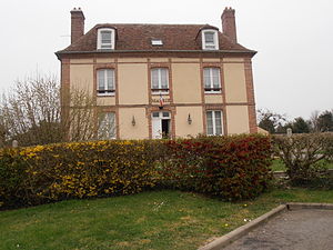
 Town hall (Mairie) of Saint-Martin-d'Écublei |
||
Saint-Martin-d'Écublei is a French municipality with 651 inhabitants (as of January 1 2017) in the department of Orne in the region of Normandy . It belongs administratively to the Arrondissement of Mortagne-au-Perche and is part of the canton of L'Aigle (until 2015 part of the canton of L'Aigle-Est ). The inhabitants are called Écubleins .
geography
Saint-Martin-d'Écublei is located about 55 kilometers northeast of Alençon . Saint-Martin-d'Écublei is surrounded by the neighboring communities of Saint-Antonin-de-Sommaire in the north, Rugles in the northeast, Chéronvilliers in the east, Saint-Sulpice-sur-Risle in the south and west and Saint-Nicolas-de-Sommaire in the Southwest.
Population development
| 1962 | 1968 | 1975 | 1982 | 1990 | 1999 | 2006 | 2011 | 2016 |
|---|---|---|---|---|---|---|---|---|
| 349 | 328 | 322 | 405 | 505 | 499 | 550 | 616 | 642 |
| Source: Cassini and INSEE | ||||||||
Attractions
- Menhir of Écublai
- Remains of a tower hill castle (moth)
- Saint Martin Church
- Le Mesnil Castle, built in 1766
- Le Bois-Bertre castle with chapel, built in 1824
- Le Lentil mansion from the 16th century
- La Chaise Mill
Personalities
- Émile Picot (1844–1918), Romanist
Web links
Commons : Saint-Martin-d'Écublei - Collection of images, videos and audio files


