
Bracht (Rauschenberg)
|
Brings
City of Rauschenberg
Coordinates: 50 ° 55 ′ 18 ″ N , 8 ° 50 ′ 57 ″ E
|
|
|---|---|
| Height : | 240 (238-257) m above sea level NHN |
| Area : | 28.24 km² |
| Residents : | 950 (2006) |
| Population density : | 34 inhabitants / km² |
| Incorporation : | December 31, 1971 |
| Postal code : | 35282 |
| Area code : | 06427 |
Bracht is one of seven districts of the large community Rauschenberg in the central Hessian district of Marburg-Biedenkopf . Bracht has around 950 inhabitants.
geography
The place is on the Rote Wasser , a northern tributary of the Ohm , in the Burgwald and borders on Rosenthal , Schönstadt , Albshausen and Schwabendorf .
history
_1.jpg)
In the vicinity of today's village, the remains of a ceramic band settlement have been excavated.
On January 2, 1241, Bracht was first mentioned as Brachtfe in a document issued at the Amöneburg . With the “Treaty of Langsdorf” on September 10, 1263, Bracht and large parts of the castle forest became the property of the sovereign and was therefore no longer directly under the archbishopric influence of the Amöneburg. In 1349 the plague claimed the first victims in the village. In 1450 Bracht came to the Schönstadt court (previously the Buhlenstrut court) with the peculiarity that all fines had to be paid to the landgrave's office in Marburg .
In the Thirty Years' War Bracht was not spared despite its "hidden" location.
The inauguration of the newly built church took place on September 3, 1728 (harvest festival and church consecration day). The Seven Years' War (1756–1763) again brought Bracht into great distress, as the Burgwald was one of the most important deployment, marching and retreat areas for both opponents. From 1776 to 1783 14 Brachter soldiers took part in the American Revolutionary War. In 1826 Bracht had a total of 443 inhabitants.
From 1833 to 1852 the civil guards maintained public order. Apart from the cities, it was numerically the largest in the Marburg district with 69 men, but also the most patriotic. In 1873 the Bracht - Rosenthal road, one of the first roads in Hesse to be partially paved, was opened to traffic. In 1891 the first fire engine was purchased for 900 marks and an independent volunteer fire brigade was founded. In 1920 the first Brachter football club was founded.
In the summer of 1934, 80 hectares of an already cleared forest area were expropriated by the air force area command in Münster for the first order port of Bracht , which was planned in 1933 . Construction of the airfield began in autumn 1934 and was completed in May 1936. From 1935, a connecting line to the Bracht airfield branched off from the Wohratalbahn at the Halsdorf train station, six kilometers away . It was used exclusively for the transport of military equipment and airfield personnel. From May 10, 1940, the III. Group of the Kampfgeschwader 28 and flew missions against France . On July 20, 1944, Bracht was bombed by the Allies for the first time . The last German members of the Wehrmacht blew up the airfield facilities and aircraft on March 27, 1945. A day later, the US troops and tank units marched into Bracht. In 1946 the connecting line was finally shut down and dismantled.
From 1949 the district settlement was created . A trombone choir was founded in 1950. On December 31, 1971, Bracht was incorporated into the town of Rauschenberg as part of the regional reform in Hesse .
After almost 20 years of planning, the inauguration of the multi-purpose hall was celebrated in 2004.
Territorial history and administration
The following list gives an overview of the territories in which Bracht was located or the administrative units to which it was subordinate:
- before 1567: Holy Roman Empire , Landgraviate of Hesse , Schönstadt court (Schönstadt court consisted of the following locations: Kölbe, Bernsdorf, Bürgeln, Betziesdorf, Reddehausen, Schönstädt, Schwarzenborn and Bracht)
- from 1567: Holy Roman Empire, Landgraviate Hessen-Marburg , Schönstadt court
- 1604–1648: Holy Roman Empire, disputed between Landgraviate Hessen-Darmstadt and Landgraviate Hessen-Kassel ( Hessian War ), Schönstadt court
- from 1648: Holy Roman Empire, Landgraviate Hessen-Kassel, Marburg Office , Schönstadt Court
- from 1803: Holy Roman Empire, Electorate of Hesse , Marburg Office, Schönstadt Court
- from 1806: Electorate of Hesse, Marburg Office, Schönstadt Court
- 1807–1813: Kingdom of Westphalia , department of Werra , district of Marburg , canton of Rosenthal
- from 1815: German Confederation , Electorate of Hesse, Marburg Office, Schönstadt Court
- from 1821: German Confederation, Electorate of Hesse, Province of Upper Hesse , District of Marburg (separation of justice ( district court Marburg ) and administration)
- from 1848: German Confederation, Electorate of Hesse, Marburg district
- from 1851: German Confederation, Electorate of Hesse, Province of Upper Hesse, District of Marburg
- from 1866: North German Confederation , Kingdom of Prussia , Province of Hesse-Nassau , District of Kassel , District of Marburg
- from 1871: German Empire , Kingdom of Prussia, Province of Hessen-Nassau, District of Kassel, District of Marburg
- from 1918: German Empire, Free State of Prussia , Province of Hessen-Nassau, Administrative Region of Kassel, District of Marburg
- from 1944: German Empire, Free State of Prussia, Province of Kurhessen , District of Marburg
- from 1945: American zone of occupation , Greater Hesse , Kassel district, Marburg district
- from 1949: Federal Republic of Germany , State of Hesse , Kassel district, Marburg district
- On January 31, 1971, Bracht was incorporated as a district of the newly formed municipality Rauschenberg.
- 1974: Federal Republic of Germany, Land Hessen, Kassel , Marburg-Biedenkopf
- from 1981: Federal Republic of Germany, State of Hesse, Gießen district, Marburg-Biedenkopf district
Courts since 1821
With an edict of June 29, 1821, administration and justice were separated in Kurhessen. Now judicial offices were responsible for the first instance jurisdiction, the administration was taken over by the districts. In Marburg, the Marburg district was set up to handle the administration and the Marburg Regional Court was the court of first instance responsible for Bracht. In 1850 the regional court was renamed the Marburg Justice Office. The Supreme Court was the Higher Appeal Court in Kassel . The higher court of Marburg was subordinate to the province of Upper Hesse. It was the second instance for the judicial offices.
After the annexation of Kurhessen by Prussia, the Marburg district court became the royal Prussian district court of Marburg in 1867 . In June 1867, a royal ordinance was issued that reorganized the court system in the areas that belonged to the former Electorate of Hesse. The previous judicial authorities were to be repealed and replaced by local courts in the first, district courts in the second and an appeal court in the third instance. In the course of this, on September 1, 1867, the previous judicial office was renamed the Marburg District Court. The courts of the higher authorities were the Marburg District Court and the Kassel Court of Appeal .
With the entry into force of the Courts Constitution Act of 1879, the district court continued to exist under his name. In the Federal Republic of Germany, the superordinate instances are the Marburg Regional Court , the Frankfurt am Main Higher Regional Court and the Federal Court of Justice as the last instance.
population
Population development
Source: Historical local dictionary
| • 1577: | 38 house seats |
| • 1630: | 24 house seats (2 three-horse, 4 two-horse, 9 single-horse farm workers, 9 one- man walkers ) |
| • 1681: | 25 home-seated teams |
| • 1747: | 60 house seats |
| • 1838: | 484 inhabitants, of which 70 beneficial owner local citizens, 19 sojourners . |
| Bracht: Population figures from 1766 to 1967 | ||||
|---|---|---|---|---|
| year | Residents | |||
| 1766 | 314 | |||
| 1834 | 451 | |||
| 1840 | 503 | |||
| 1846 | 503 | |||
| 1852 | 511 | |||
| 1858 | 489 | |||
| 1864 | 491 | |||
| 1871 | 454 | |||
| 1875 | 459 | |||
| 1885 | 444 | |||
| 1895 | 447 | |||
| 1905 | 507 | |||
| 1910 | 502 | |||
| 1925 | 457 | |||
| 1939 | 546 | |||
| 1946 | 812 | |||
| 1950 | 845 | |||
| 1956 | 806 | |||
| 1961 | 812 | |||
| 1967 | 868 | |||
| Data source: Historical municipality register for Hesse: The population of the municipalities from 1834 to 1967. Wiesbaden: Hessisches Statistisches Landesamt, 1968. Other sources: | ||||
Religious affiliation
Source: Historical local dictionary
| • 1861: | 479 Evangelical Lutheran , 19 Evangelical Reformed and one Roman Catholic inhabitant. |
| • 1885: | 443 Protestant (= 99.77%), one Catholic (= 0.23%) residents |
| • 1961: | 692 Protestant (= 85.22%), 113 Catholic (= 13.92%) residents |
Gainful employment
Source: Historical local dictionary
| • 1766: | Labor force: 2 cobblers, 1 stocking weaver, 4 blacksmiths, 11 linen weavers, 5 wagons, 1 tailor, 2 millers, 2 landlords, 1 carpenter, 1 brickmaker, 5 day laborers. |
| • 1838: | Families: 52 agriculture, 10 businesses, 27 day laborers. |
| • 1961: | Labor force: 226 agriculture and forestry, 131 manufacturing, 40 trade and transport, 40 services and other. |
Attractions
- “Die Burg”, the former Landgrave's hunting lodge in Bracht instead of a building built around 1280
- Several oaks near the forester's lodge Hirschberg, the thickest of which has a chest height of 7.25 m (2014).
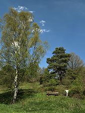
Natural monument at the Steinbornskopf
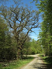
Hollow oak


Infrastructure
.jpg)
- A kindergarten
- A primary school
- A multipurpose hall
Web links
- Internet presence of the city of Rauschenberg
- Bracht, Marburg-Biedenkopf district. Historical local dictionary for Hessen. In: Landesgeschichtliches Informationssystem Hessen (LAGIS).
Individual evidence
- ↑ a b c d e f Bracht, Marburg-Biedenkopf district. Historical local dictionary for Hessen. (As of May 24, 2018). In: Landesgeschichtliches Informationssystem Hessen (LAGIS).
- ^ Federal Statistical Office (ed.): Historical municipality directory for the Federal Republic of Germany. Name, border and key number changes in municipalities, counties and administrative districts from May 27, 1970 to December 31, 1982 . W. Kohlhammer GmbH, Stuttgart and Mainz 1983, ISBN 3-17-003263-1 , p. 402 .
- ^ Michael Rademacher: German administrative history from the unification of the empire in 1871 to the reunification in 1990. State of Hesse. (Online material for the dissertation, Osnabrück 2006).
- ^ Georg Landau: Description of the Electorate of Hesse . T. Fischer, Kassel 1842, p. 370 ( online at HathiTrust's digital library ).
- ^ The affiliation of the Marburg office based on maps from the Historical Atlas of Hessen : Hessen-Marburg 1567–1604 . , Hessen-Kassel and Hessen-Darmstadt 1604–1638 . and Hessen-Darmstadt 1567–1866 .
- ^ Kur-Hessischer Staats- und Adress-Kalender: 1818 . Publishing house d. Orphanage, Kassel 1818, p. 100 ( limited preview in Google Book search).
- ↑ Ordinance of August 30th, 1821, concerning the new division of the area , Annex: Overview of the new division of the Electorate of Hesse according to provinces, districts and judicial districts. Collection of laws etc. for the Electoral Hesse states. Year 1821 - No. XV. - August., ( Kurhess GS 1821) pp. 223-224
- ↑ Latest news from Meklenburg / Kur-Hessen, Hessen-Darmstadt and the free cities, edited from the best sources. in the publishing house of the GHG privil. Landes-Industrie-Comptouts., Weimar 1823, p. 158 ff . ( online at HathiTrust's digital library ).
- ↑ Ordinance on the constitution of the courts in the former Electorate of Hesse and the formerly Royal Bavarian territories with the exclusion of the enclave Kaulsdorf from June 19, 1867. ( PrGS 1867, pp. 1085-1094 )
- ↑ Order of August 7, 1867, regarding the establishment of the according to the Most High Ordinance of June 19 of this year. J. in the former Electorate of Hesse and the formerly Royal Bavarian territorial parts with the exclusion of the enclave Kaulsdorf, courts to be formed ( Pr. JMBl. Pp. 221–224 )
- ^ Entry in the directory of monumental oaks . Retrieved January 10, 2017
.svg)
Albshausen | Bracht | Ernsthausen | Josbach | Rauschenberg | Schwabendorf | Wolf chews