
Budapest districts
The Budapest districts are municipalities within the capital and units of public administration . In Hungarian, the districts are numbered with Roman numerals and approximately clockwise. The reasons for some “irregularities” in the sequence are historical reorganizations of the districts and city extensions.


.JPG)


history
From 1873 to 1930
When the three cities Buda , Óbuda and Pest were united to form the unified capital Budapest in 1873, 10 districts were initially created.
In the area of Buda and Óbuda on the right side of the Danube were the districts 1 to 3:
- 1st district, consisting of the Castle District, Tabán and Krisztinaváros
- 2nd district, consisting of Országút and Víziváros
- 3rd district, consisting of Újlak and Óbuda
Districts 4 to 10 were located in the former Pest urban area:
- 4th district: Belváros
- 5th district: Lipótváros
- 6th district: Terézváros
- 7th district: Erzsébetváros
- 8th district: Józsefváros
- 9th district: Ferencváros
- 10th district: Kőbánya
From 1930 to 1950
In May 1930 the city administration divided with Law 1930: XVIII.tc. four new districts. These were only fully expanded in the following 10 years.
The 11th and 12th districts were separated from the 1st district. These are the areas of the former Buda on the right bank of the Danube. The 11th district was completed on March 1, 1934, the 12th district on July 1, 1940.
Districts 13 and 14 were created by the new division of the 5th, 6th, 7th and 10th district on the left bank of the Danube. The western 13th district was completed on June 15, 1938, the eastern 14th district 3 years earlier.
In addition, the state port area at Csepel and the forest area owned by the city between Budakeszi and Budapest were incorporated. The port area became part of the 9th district and the 12th district was expanded on the Budakeszier forest area.
As a result of the redesign, the earlier city structure was fundamentally changed. Previously, the districts were arranged radially around the very small 4th district, which, with the exception of the 8th district, extended to the city limits. The districts in the center (1st, 5th, 6th and 7th district) were small and very densely populated.
After 1950
Since the 1950s, the number of districts has grown to 22 and later to 23. On January 1, 1950, seven county towns and 16 large municipalities of Pest-Pilis-Solt-Kiskun county , which was partly in the area of today's Pest and Bács-Kiskun counties , were attached to the city.
These were the formerly independent towns of Budafok, Csepel, Kispest, Pestszenterzsébet, Pestszentlőrinc, Rákospalota, Újpest and the large municipalities of Albertfalva, Békásmegyer, Budatétény, Cinkota, Rákoskoskaba, Rátyásföld, Pestsidoszentécs, Rákosföld, Rákoskoskécs, Rátyásföld, Pestsidoszentécs, Rátyásfáhécs, Rátyásföld, Pestsidoszentécs, Rákoskoskaba, Rátyásföld, Pestsidoszentécs. Rákosszentmihály, Sashalom and Soroksár.
Three other areas were previously part of other locations:
- Szabadságtelep which until then Csömör part
- Adyliget, previously a part of Nagykovácsi was
- today the airport area , which used to be Vecsés belonged
Of the 14 old districts, the 4th and 5th district were combined. The newly connected place Újpest was given the vacant number 4. Furthermore, all district boundaries in Greater Budapest were more or less changed.
Of the 23 settlements that merged with the capital, three were connected to the old districts, plus one of those districts that previously belonged to another settlement. These are Albertfalva (11th district), Békásmegyer (3rd district), Pesthidegkút and Adyliget (both 2nd district).
Of the other 20 settlements and two districts, nine were assigned to the new districts. The eight new boroughs were numbered from 15 to 22 in circular order.
The new districts were formed from the following settlements, each of which has outgrown their old borders:
- 4th district: Újpest mv *
- 15th district: Rákospalota mv and Pestújhely nagyközség nk. *
- 16th district: Cinkota, Mátyásföld, Rákosszentmihály and Sashalom nk., Also Szabadságtelep
- 17th district: Rákoscsaba, Rákoshegy, Rákoskeresztúr and Rákosliget nk.
- 18th district: Pestszentlőrinc mv, Pestszentimre nk., Also the airport area around Vecse
- 19th district: Kispest mv
- 20th district: Pesterzsébet mv and Soroksár nk.
- 21st district: Csepel mv
- 22nd district: Budafok mv, Budatétény and Nagytétény nk.
- * 'mv' = county town ( megyei város )
- * 'nk' = large municipality ( nagyközség )
In 1994 the former Soroksár was spun off from the 20th district and has been the 23rd district ever since.
Districts and districts
In the table, the official name is given for each district number, provided that the respective district has a name. The second column is followed by the names of the districts that make up the district. The background colors indicate urban areas that are west of the Danube (pink) and east of the Danube (blue). Csepel is an island on the Danube.
| district | Districts |
| I. | Várkerület (castle district) - districts: Gellértberg (only partially), Krisztinaváros ("Christinestadt", only partially), Tabán ("Raitzenstadt", only partially), Castle District, Víziváros ("Wasserstadt", only partially) |
| II | Districts: Adyliget ("Hotterbergl"), Budakeszierdő ("Budakeszer Wald", partly), Budaliget ("Neuriss"), Csatárka , Erzsébetliget ("Elisabethwäldchen"), Erzsébettelek ("Elisabethgrund"), Felhévíz ("Aigen"), Gercse , Hársakalja , Hárshegy ("Lindenberg"), Hűvösvölgy ("Kühlestal"), Kővár ("Steinriegel"), Kurucles ("Kreutzenwinkel"), Lipótmező ("Leopoldfeld"), Máriaremete ("Maria-Einsiedl"), Nyék (" Huth pasture ") Országút , Pálvölgy (" Pauli valley "), Pasarét (" Sauwiesen ") Pesthidegkút-Ófalu , Petneházyrét , Remetekertváros , Rézmál , Rózsadomb , Szemlőhegy (" Joseph mountain "), Széphalom (" garden Bergel ") Szépilona (" Fine Helene "), Szépvölgy (" Schöntal "), Törökvész , Újlak (only partially), Vérhalom , Víziváros (only partially), Zöldmál |
| III | Óbuda-Békásmegyer - neighborhoods: Aquincum , Aranyhegy ( "Gold Mountain"), Békásmegyer ( "Frog village"), Csillaghegy ( "Star Mountain"), Csúcshegy ( "Spitzberg") Filatorigát ( "Filatoriried") Hármashatár-hegy ( "Dreihotterberg "), Kaszásdűlő (" Mahdried ") Mátyáshegy (" Matthias mountain "), Mocsárosdűlő (" Großmorast ") Óbuda (" Alt-furnace "), Óbudaisziget (" Großofenerinsel ") Remetehegy (" hermit mountain "), Rómaifürdő (" Roman Bath "), Solymárvölgy (" Schaumartal "), Táborhegy (" Lagerberg "), Testvérhegy (" Brüdersberg "), Törökkő (" Turk's Stone "), Újlak (only partially), Ürömhegy (" Erben-Berg ") |
| IV | Újpest - districts: Istvántelek ("Stephansgrund"), Káposztásmegyer , Megyer , Népsziget ("Pestherinsel", only partially), Székesdűlő , Újpest ("New Pest") |
| V | Belváros-Lipótváros - districts: Belváros ("inner city"), Lipótváros ("Leopoldstadt") |
| VI | Terézváros - Districts: Terézváros ("Theresienstadt") |
| VII | Erzsébetváros - districts: Erzsébetváros ("Elisabethstadt"), Istvánmező ("Stephansfeld", only partially) |
| VIII | Józsefváros - districts: Istvánmező (only partially), Józsefváros ("Joseph City "), Kerepesdűlő , Tisztviselőtelep |
| IX | Ferencváros - districts: Belső-Ferencváros , Középső-Ferencváros , Milleniumi Városközpont (" Millennium City "), Gubacsidűlő , József Attila-lakótelep (" Attila-József residential area") |
| X | Kőbánya - neighborhoods: Felsőrákos ( "Upper Rakoscher meadows"), Gyárdűlő , Keresztúridűlő , Kőbánya-Kertváros ( "Quarry Garden City"), Kúttó , Laposdűlő , Ligettelek , Népliget , Óhegy ( "Altgebirg") Téglagyárdűlő , Újhegy |
| XI | Újbuda - districts: Albertfalva ("Sachsenfeld"), Dobogó ("Galgenberg"), Gazdagrét ("Reicheried"), Gellérthegy (only partially), Hosszúrét ("Langeried"), Kamaraerdő ("Kammerwald"), Kelenföld ("Krenfeld") ), Kelenvölgy ("Scharfeseck"), Kőérberek , Lágymányos , Madárhegy ("Vogelberg"), Őrmező ("Field hat"), Örsöd , Péterhegy ("Petersberg"), Pösingermajor , Sasad (Burgerberg), Sashegy ("Adlerberg", only partially), Spanyolrét (Spanish meadow ), Tabán ("Raitzenstadt", only partially) |
| XII | Hegyvidék (“Bergland”) - districts: Budakeszierdő (“Budakeszer Wald”, only partially), Csillebérc (“Kukukberg”, also “Dreihotter”), Farkasrét (“Wolfswiese”), Farkasvölgy (“Wolfstal”), Istenhegy (“Gottesberg "), Jánoshegy (" Johannisberg "), Kissvábhegy (" Kleinschwabenberg "), Krisztinaváros (" Christinestadt ", only partially), Kútvölgy (" Brunntal "), Magasút (" Hochstraße "), Mártonhegy , Németvölgy (" Deutschenthal "), Orbánhegy ("Urbaniberg"), Sashegy ("Adlerberg", only partially), Svábhegy ("Schwabenberg"), Széchenyihegy ("Széchenyi-Berg"), Virányos , Zugliget ("Auhügel") |
| XIII | Angyalföld ("Engelsfeld"), Margitsziget , Népsziget ("Pestherinsel", only partially), Újlipótváros ("New Leopoldistadt"), Vizafogó |
| XIV | Zugló ( "Lerchenfeld") - neighborhoods: Alsórákos , Herminamező ( "Hermione field"), Istvánmező ( "Stephansfeld") Kiszugló ( "Little Lerchenfeld") Nagyzugló ( "Great Lerchenfeld") Rákosfalva , Törökőr , Városliget ( "City Park" ) |
| XV | Districts: Pestújhely ("Neustädtl"), Rákospalota ("Palota"), Újpalota ("Neupalota") |
| XVI | Districts: Árpádföld ("Arpadfeld"), Cinkota , Mátyásföld ("Matthiasfeld"), Rákosszentmihály , Sashalom ("Eagle Hill") |
| XVII | Rákosmente - districts: Akadémiaújtelep , Madárdomb ("Bird Hill"), Rákoscsaba , Rákoscsaba-Újtelep , Rákoshegy , Rákoskeresztúr , Rákoskert , Rákosliget , Régiakadémiatelep |
| XVIII | Pestszentlőrinc - neighborhoods Alacsakai úti lakótelep , Almáskert , Bélatelep ( "Béla settlement"), Belsőmajor , Bókaytelep , Erdőskert , Erzsébettelep ( "Elisabeth settlement"), Ferihegy , Ganzkertváros , Ganztelep , Gloriett-telep ( "Gloriette settlement"), Halmierdő , Havana-telep ( "Havana settlement"), Kossuth Ferenc-telep ( " Ferenc Kossuth -Siedlung") Lakatostelep , Liptáktelep , Lónyaytelep ( " Lónyay -Siedlung)" Miklóstelep ( "Nicholas settlement"), Rendessytelep , Szemeretelep ( " Szemere settlement"), Szent Imre-kertváros (" Emmerich settlement"), Szent Lőrinc-telep ("Saint Lawrence settlement"), Újpéteritelep |
| XIX | Kispest ("Little Pest") - Kispest , Wekerletelep districts |
| XX | Pesterzsébet - districts: Gubacsipuszta , Kossuthfalva , Pacsirtatelep , Pesterzsébet , Pesterzsébet-Szabótelep |
| XXI | Csepel - districts of Csepel-Belváros ("Tschepele-Innenstadt"), Csepel-Kertváros (" Tschepele -Garden City"), Csepel-Ófalu ("Tschepele-Altdorf"), Csepel-Rózsadomb (" Tschepele-Szabó Hill"), Csepel- , Csillagtelep ("star settlement"), Erdőalja , Erdősor , Gyártelep , Háros ("Harosch"), Királyerdő ("Imperial Forest"), Királymajor , Szigetcsúcs ("Inselspitz") |
| XXII | Budafok-Tétény - districts: Baross Gábor-telep (" Gábor Baross settlement"), Budafok ("Promontor"), Budatétény ("small meeting"), Nagytétény ("large meeting") |
| XXIII | Soroksár - districts: Millenniumtelep ("Millennium Settlement"), Soroksár ("Market"), Soroksár-Újtelep |
Population overview
The following information relates to January 1, 2007.
| district | population | Area (km 2 ) | Population density (per km 2 ) | Establishment date |
|---|---|---|---|---|
| 1st district | 24,707 | 3.41 | 7,245 | November 17, 1873 |
| 2nd district | 88.058 | 36.34 | 2,423 | November 17, 1873 |
| 03rd district | 124.256 | 39.70 | 3.130 | November 17, 1873 |
| 4th district | 98,518 | 18.82 | 5 235 | November 17, 1873 |
| 5th district | 27,055 | 2.59 | 10,446 | November 17, 1873 |
| 06th district | 41,839 | 2.38 | 17 579 | November 17, 1873 |
| 07th district | 62.001 | 2.09 | 29,666 | November 17, 1873 |
| 08th district | 80.166 | 6.85 | 11 703 | November 17, 1873 |
| 09th district | 59,992 | 12.53 | 4,788 | November 17, 1873 |
| 10th district | 77,822 | 32.49 | 2,395 | November 17, 1873 |
| 11th district | 136,557 | 33.47 | 4081 | March 1, 1934 |
| 12th district | 56,461 | 26.68 | 2.116 | July 1, 1940 |
| 13th district | 109,935 | 13.44 | 8,180 | June 15, 1938 |
| 14th district | 116,879 | 18.13 | 6,448 | June 15, 1935 |
| 15th district | 81,061 | 26.94 | 3,009 | January 1, 1950 |
| 16th district | 68,400 | 33.51 | 2,041 | January 1, 1950 |
| 17th district | 77,586 | 54.82 | 1,415 | January 1, 1950 |
| 18th district | 93,120 | 38.60 | 2,412 | January 1, 1950 |
| 19th district | 61,223 | 9.38 | 6,527 | January 1, 1950 |
| 20th district | 63.161 | 12.18 | 5,186 | January 1, 1950 |
| 21st district | 76,342 | 25.75 | 2,965 | January 1, 1950 |
| 22nd district | 50,449 | 34.25 | 1,473 | January 1, 1950 |
| 23rd district | 20,502 | 40.77 | 503 | December 11, 1994 |
| total | 1,696,128 | 525.12 | 3,230 | - |
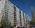
Prefabricated buildings in the 19th district
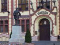
Town hall in the 20th district

Nagytétény Castle in the 22nd district


