Bukovany u Sokolova
| Bukovany | ||||
|---|---|---|---|---|
|
||||
| Basic data | ||||
| State : |
|
|||
| Region : | Karlovarský kraj | |||
| District : | Sokolov | |||
| Area : | 309.9169 ha | |||
| Geographic location : | 50 ° 10 ' N , 12 ° 44' E | |||
| Height: | 440 m nm | |||
| Residents : | 1,528 (Jan 1, 2019) | |||
| Postal code : | 357 55 | |||
| License plate : | K | |||
| traffic | ||||
| Street: | Sokolov - Kaceřov | |||
| Next international airport : | Karlovy Vary Airport | |||
| structure | ||||
| Status: | local community | |||
| Districts: | 1 | |||
| administration | ||||
| Mayor : | Miroslav Stropek (as of 2018) | |||
| Address: | Bukovany 47 357 55 Bukovany u Sokolova |
|||
| Municipality number: | 560316 | |||
| Website : | www.kr-karlovarsky.cz/obce/Bukovany | |||
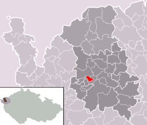
| Location of Bukovany in the Sokolov district | ||||

|
||||
Bukovany (German Bukwa , earlier Buckwa ) is a municipality in the Czech Republic . It is located five kilometers west of Sokolov and belongs to the Okres Sokolov .
geography
Geographical location
Bukovany is located in the Falkenau basin on a hill on the left side of the Harbartický creek . To the north are the open-cast mines of the Libík and Medard ( Medardi ) mines . A dump and opencast mining area also extends to the west.
Community structure
No districts are shown for the municipality of Bukovany.
Neighboring communities
Neighboring towns are Habartov (Habersbirk) in the north, Davidov and Svatava (Zwodau) in the northeast, Sokolov (Falkenau) and Citice (Zieditz) in the east, Hlavno (Kloben) in the southeast, Dasnice (Daßnitz) in the south, Chlum Svaté Maří (Maria Kulm) ) in the southwest and Lítov (Littengrün) and Úžlabí (Kahr colony) in the northwest.
The old village of Bukovany and the surrounding villages of Dvory ( Meierhöfen ), Kytlice ( Kitlitzdorf ), Lísková ( Haselbach ) and Rusov ( Reißengrün ) and, for the most part, Jehličná ( Grasset ) fell victim to lignite mining.
history
The first written mention of the place took place in 1304. It is assumed that the village belonged to the fiefdom of the Landgraves of Leuchtenberg around the Kinsberg Castle at that time . The Haselhof has been traceable since 1525.
The inhabitants of the place lived mainly from growing hops. At the beginning of the 19th century there was a vitriol factory near Kitlitzdorf. In 1846 the first school was opened in Buckwa. After the abolition of patrimonial Buckwa formed from 1850 a district of the community of Zwodau in the district of Falkenau . A lignite deposit of the best quality was found near Katzegiebl in 1850 and mining began shortly afterwards. In 1879 the municipality of Buckwa was established with the districts of Katzegiebl, Kitlitzdorf and Meierhöfen as well as the Haselhof settlement. With the increasing mining industry, the first Czech miners came to the village, which was previously inhabited by Germans, in 1888. Radical ideas spread among the lower class miners during the First World War. In 1917 there were hunger riots; 498 miners refused to work and ransacked the grocery stores. After the establishment of Czechoslovakia, the miners united in fighting organizations. In 1927 there was an improvement in the social situation of the miners at the Adolfschacht and Sophieschacht pits of the Dux-Bodenbacher Railway .
In 1930 the community had 1612 inhabitants, in 1939 there were 1337. In 1937 a chapel was built. After the Munich Agreement , the community of Lanz was incorporated into the German Empire and the name Buckwa was changed to Bukwa. Until 1945 Bukwa belonged to the Falkenau district . After 1938 the resettlement of the Czechs began, 30 families had to leave the place. With the enlargement of the Gustav Pit, a partial demolition of Buckwa began in 1939, with 300 residents being relocated to other places. During the Second World War, a prisoner of war camp was established in Bukwa; the Russians, French and Romanians were called in to work in the coal mines. After the end of the Second World War, the place came back to Czechoslovakia; the expulsion of the Germans began. In the 1960s, Bukovany, Dvory and Kytlice were completely cleared and dredged as the Libík-Medard mine enlarged. The new settlement of Bukovany was built at Katzenhübel one and a half kilometers southwest of the old village.
After the recultivation of the former Libík-Medard mine, a 500-hectare lake is to be created.
coat of arms
Description: In green a golden deciduous tree that has been torn up over a golden crossed hammer and mallet .
Sons and daughters of the church
- Walter Preißler (1915–2005), German politician

