
Krásno nad Teplou
| Krasno | |||||
|---|---|---|---|---|---|
|
|||||
| Basic data | |||||
| State : |
|
||||
| Region : | Karlovarský kraj | ||||
| District : | Sokolov | ||||
| Area : | 2535.9689 ha | ||||
| Geographic location : | 50 ° 6 ′ N , 12 ° 48 ′ E | ||||
| Height: | 688 m nm | ||||
| Residents : | 709 (Jan. 1, 2019) | ||||
| Postal code : | 357 31 - 357 47 | ||||
| License plate : | K | ||||
| structure | |||||
| Status: | city | ||||
| Districts: | 1 | ||||
| administration | |||||
| Mayor : | Josef Havel (as of 2018) | ||||
| Address: | Radniční 1 357 47 Krásno |
||||
| Municipality number: | 538337 | ||||
| Website : | www.mesto-krasno.cz | ||||
| Location of Krásno in the Sokolov district | |||||

|
|||||


Krásno (German Schönfeld , formerly Czech. Synfelt , too ) is a town in Okres Sokolov in the Czech Republic . It has 660 inhabitants.
geography
Geographical location
The city is located in northwestern Bohemia in the Imperial Forest ( Slavkovský les ) near Horní Slavkov ( Schlaggenwald ). The place was once known for its tin and tungsten ore mining; the last shaft closed in the early 1990s.
Community structure
No districts are shown for the city of Krásno. Basic settlement units are Dolní Hluboká ( Untertiefenbach ), Háje ( Rabensgrün ), Krásno ( Schönfeld ) and Milešov ( Müllersgrün ).
The municipality is divided into the cadastral districts of Dolní Hluboká, Háje nad Teplou, Krásno nad Teplou and Milešov.
history

.jpg)
The town grew from a mining settlement and received in 1355 by the brothers Slauko and Boreš of Riesenburg 1355 the law of the jurisdiction and administration of the tin mining in the region of Bečov . In 1380 the town charter followed, granted by Boresch von Riesenburg. In 1547 Schönfeld was elevated to the status of a royal mountain town .
After the First World War , Schönfeld was added to the newly created Czechoslovakia . Due to the Munich Agreement , the place came to the German Reich and until 1945 belonged to the district of Elbogen , administrative district of Eger , in the Reichsgau Sudetenland . After the war, Schönfeld was renamed Krásno (krásno = beautiful).
Since April 12, 2007, Krasno has been a city again after temporarily losing its city rights.
Population development
Until 1945 Schönfeld was mostly populated by German Bohemia , which were expelled.
| year | Residents | Remarks |
|---|---|---|
| 1785 | k. A. | 315 houses |
| 1830 | 2518 | in 396 houses |
| 1847 | 2894 | in 403 houses |
| 1900 | 3084 | German residents |
| 1921 | 2318 | including 2272 Germans |
| 1930 | 2132 | |
| 1939 | 1995 |
| year | 1970 | 1980 | 1991 | 2001 | 2003 |
|---|---|---|---|---|---|
| Residents | 1 250 | 1 138 | 1 086 | 1 002 | 976 |
Culture and sights
The Krásno Mining Museum is located on the site of the historic Wilhelmschacht ( Vilém ) tin mine , which was founded on the Gellnau corridor system and was in operation with a few interruptions until the 1990s.

Mining Museum

Decommissioned mine
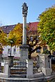
monument


sons and daughters of the town
- Johann Josef Stark (around 1700–1748), painter from the Baroque period
- Joseph Labitzky (1802–1881), composer
- Johann Caspar Ferdinand Fischer (1656–1746), composer of the Baroque period
- Karl Wilfert (1847–1916), sculptor
- Wilhelm Gerstner (1864–1927), painter
- August Roth (1864–1952), Austrian painter
- Franz Floth (* 1868), poet and local historian
- Willibald Ruß (1887–1974), sculptor, created the statue of Goethe in Marienbad (Mariánské Lázně) as well as tile mosaics depicting life in the village and the four seasons. The works are now exhibited in the Cheb Museum
Individual evidence
- ↑ http://www.uir.cz/obec/538337/Krasno
- ↑ Český statistický úřad - The population of the Czech municipalities as of January 1, 2019 (PDF; 7.4 MiB)
- ↑ http://www.uir.cz/zsj-obec/538337/Obec-Krasno
- ↑ http://www.uir.cz/katastralni-uzemi-obec/538337/Obec-Krasno
- ^ Johann Thaddäus Anton Peithner von Lichtenfels : Attempt on the natural and political history of the Bohemian and Moravian mines . Vienna 1780, pp. 69-71, § 74.
- ↑ Jaroslaus Schaller : Topography of the Kingdom of Bohemia . Volume 2: Ellbogner Kreis , Prague 1785, p. 159, item 3) .
- ↑ Yearbooks of the Bohemian Museum of Natural and Regional Studies, History, Art and Literature. Volume 2, Prague 1831, p. 199, item 6).
- ↑ Johann Gottfried Sommer : The Kingdom of Bohemia . Volume 15: Elbogner Kreis , Prague 1847, pp. 265–268, especially p. 267.
- ^ Meyer's Large Conversational Lexicon . 6th edition, Volume 18, Leipzig and Vienna 1909, pp. 2–3.
- ^ Sudetenland Genealogy Network
- ^ A b Michael Rademacher: German administrative history from the unification of the empire in 1871 to the reunification in 1990. Elbogen district (Czech: Loket). (Online material for the dissertation, Osnabrück 2006).
- ↑ Czech population statistics