Libavské Údolí
| Libavské Údolí | ||||
|---|---|---|---|---|
|
||||
| Basic data | ||||
| State : |
|
|||
| Region : | Karlovarský kraj | |||
| District : | Sokolov | |||
| Area : | 228.8814 ha | |||
| Geographic location : | 50 ° 7 ' N , 12 ° 33' E | |||
| Height: | 442 m nm | |||
| Residents : | 543 (Jan. 1, 2019) | |||
| Postal code : | 357 53 | |||
| License plate : | K | |||
| traffic | ||||
| Street: | Kynšperk nad Ohří - Citice | |||
| Railway connection: | Chomutov – Cheb | |||
| Next international airport : | Karlovy Vary Airport | |||
| structure | ||||
| Status: | local community | |||
| Districts: | 1 | |||
| administration | ||||
| Mayor : | Petra Gajičová (as of 2018) | |||
| Address: | Libavské Údolí 110 357 51 Kynšperk nad Ohří |
|||
| Municipality number: | 560502 | |||
| Website : | libavskeudoli.obec.cz | |||
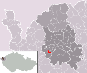
| Location of Libavské Údolí in the Sokolov district | ||||

|
||||
Libavské Údolí (German Liebauthal ) is a municipality in the Czech Republic . It is located nine kilometers southwest of Sokolov and belongs to the Okres Sokolov .
geography
Geographical location
Libavské Údolí is located at the northwestern foot of the Imperial Forest on the edge of the Egergraben in the valley of the Libava ( Liebaubach ), which arises above the village from the confluence of Velká Libava ( Großer Liebaubach ) and Malá Libava ( Kleiner Liebaubach ). The Chomutov – Cheb railway runs to the west ; the nearest train station “Kynšperk nad Ohří” is in Dolní Pochlovice. To the north rises the Drsný vrch ( Mariahilf-Berg , 570 m) with a lookout tower.
Community structure
No districts are shown for the municipality of Libavské Údolí. Basic settlement units are Kolová ( Kogerau ) and Libavské Údolí ( Liebauthal ).
Neighboring communities
Neighboring towns are Chlum Svaté Maří in the north, Dasnice in the northeast, Chlumek and Šabina in the east, Silnice and Arnoltov in the southeast, Kolová in the south, Kynšperk nad Ohří in the southwest, Dolní Pochlovice in the west and Horní Pochlovice in the northwest.
history
Settlement of the area can be traced back to the 9th century. A Slavic castle was located north of Kolová on the mountain spur above the confluence of the Big and Small Liebaubach.
The origin of the village of Liebauthal lies in the spinning mill founded in 1824 by Baron von Lenk von Lengenfeld in the valley of the Liebaubach. Five years later, a small Lenkenthal colony had emerged around the factory . The brothers Franz and Ferdinand Lenk first introduced contract weaving. From 1858 mechanical looms were used. Two years later the company was converted to a stock corporation. At that time there were 563 mechanical looms in operation.
After the abolition of patrimonial Liebauthal / Libavské Údolí formed from 1850 a district of the town of Königsberg / Kinšperk in the Falkenau / Falknov district . The Vienna stock market crash after the world exhibition in 1873 ruined the company. In 1876 the Lenk brothers started production again. From 1880 the construction of rental houses for the workforce began. With the construction of 19 rental houses with 208 apartments and 34 single-family houses in Liebauthal, the number of residents grew to 600. Stroß had another twelve single-family houses built in the municipality of Kogerau. In 1885 the company went bankrupt again. In 1892 it was sold to Ginsberg & Stroß.
In 1907 the name was changed to “Noe Stroß AG”, and the company became part of the United Textile Factory Liebauthal and Weißwasser .
In addition to the textile factory, Noe Stroß AG in Liebauthal also operated a small brown coal mine in civil engineering with the Ernst-Ludmilla-Zeche, which in 1938 had 48 employees. After the Munich Agreement in 1938, Liebauthal was added to the German Reich together with Königsberg and belonged to the Falkenau an der Eger district until 1945 . During the Nazi era , the Noe Stroß Jewish group of companies was expropriated. After the Aryanization , the factory operated as Liebauthaler Textilwerke Fischer & Co. In 1942, part of the production of the Schweinfurt ball bearing factory was outsourced to Liebauthal and housed in the weaving mill as the "rolling company of the Liebauthaler Textilwerke". Forced laborers from the occupied territories in the east were used for the work. After the war ended, the village returned to Czechoslovakia and the Germans were expelled.
Around 1950 Libavské Údolí was incorporated into an independent municipality and Kogerava. The district was later named Kolová. In the 1950s, a barracks for the Czechoslovak Army was built on parts of the town hall in Kolová. After its abandonment by the army, the property is now used as a penal institution . The largest company in the municipality is Libatex sro. The village of Libavské Údolí is surrounded by dense forests of the Imperial Forest.
Culture and sights
- Starý zámek, the remains of a Slavic castle near Kolová

