Dolná Ves
| Dolná Ves | ||
|---|---|---|
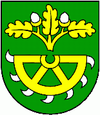
| coat of arms | map | |

|
|
|
| Basic data | ||
| State : | Slovakia | |
| Kraj : | Banskobystrický kraj | |
| Okres : | Žiar nad Hronom | |
| Region : | Pohrony | |
| Area : | 2.37 km² | |
| Residents : | 226 (Dec. 31, 2019) | |
| Population density : | 95 inhabitants per km² | |
| Height : | 443 m nm | |
| Postal code : | 966 31 | |
| Telephone code : | 0 45 | |
| Geographic location : | 48 ° 40 ' N , 18 ° 55' E | |
| License plate : | ZH | |
| Kód obce : | 516732 | |
| structure | ||
| Community type : | local community | |
| Administration (as of November 2018) | ||
| Mayor : | Milan Pračko | |
| Address: | Obecný úrad Dolná Ves 966 31 Dolná Ves |
|
| Statistics information on statistics.sk | ||
Dolná Ves (until 1948 Slovak "Šváb"; German Schwabendorf , Hungarian Sváb ) is a municipality in central Slovakia .
The place was mentioned in writing for the first time in 1429 and belonged to the city of Kremnica from 1948–1982 .
Web links
Commons : Dolná Ves - collection of images, videos and audio files

