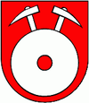
Hliník nad Hronom
| Hliník nad Hronom | ||
|---|---|---|
| coat of arms | map | |

|
|
|
| Basic data | ||
| State : | Slovakia | |
| Kraj : | Banskobystrický kraj | |
| Okres : | Žiar nad Hronom | |
| Region : | Pohrony | |
| Area : | 11.322 km² | |
| Residents : | 2,812 (Dec. 31, 2019) | |
| Population density : | 248 inhabitants per km² | |
| Height : | 239 m nm | |
| Postal code : | 966 01 | |
| Telephone code : | 0 45 | |
| Geographic location : | 48 ° 33 ' N , 18 ° 47' E | |
| License plate : | ZH | |
| Kód obce : | 516767 | |
| structure | ||
| Community type : | local community | |
| Administration (as of November 2018) | ||
| Mayor : | Vladimír Mikuláš | |
| Address: | Obecný úrad Hliník nad Hronom Železničná 320 96601 Hliník nad Hronom |
|
| Website: | www.hliniknadhronom.sk | |
| Statistics information on statistics.sk | ||
Hliník nad Hronom (until 1927 Slovak only "Hliník"; German rarely Hlinick , Hungarian Geletnek ) is a municipality in central Slovakia .
location
It is located in the Grantal at the foot of the Schemnitz Mountains . The main road I / 65 runs through the municipality between Žarnovica (8 km in a south-westerly direction) and Žiar nad Hronom / Zvolen (9 km / 30 km in an easterly direction). It has a train station on the Nové Zámky – Zvolen railway line .
history
The place was first mentioned in 1075 as Gelednuk .
population
Results after the 2001 census (2958 inhabitants):
|
By ethnicity:
|
By religion:
|
Attractions
- Roman Catholic Church of St. Martin (1408)
- Castle (16th century)
- Statues of St. Vendel (1778, baroque) and St. Florian (1818, classicism)
Web links
Commons : Hliník nad Hronom - collection of pictures, videos and audio files
