Grunewald (Marienheide)
|
Grunewald
Municipality Marienheide
Coordinates: 51 ° 4 ′ 31 ″ N , 7 ° 29 ′ 2 ″ E
|
||
|---|---|---|
| Height : | 378 m above sea level NN | |
| Residents : | 0 (Apr. 26, 2020) | |
| Postal code : | 51709 | |
| Area code : | 02264 | |
|
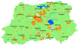
Location of Grunewald in Marienheide |
||
Grunewald is a village in the municipality of Marienheide in the Oberbergisches Kreis , North Rhine-Westphalia .
Location and description
The place is located 3.8 km southwest of Marienheide. Neighboring towns are Boinghausen , Siemerkusen and Dürhölzen . The river Sülz flows past in the northwest .
history
The place Grunewald belonged to the imperial rule Gimborn-Neustadt until 1806 . After belonging to the Grand Duchy of Berg (1806-1813) and a provisional transitional administration , the region came to the Kingdom of Prussia in 1815 on the basis of the agreements made at the Congress of Vienna . Under the Prussian administration, the place first belonged to the Gimborn district (1816–1825) and then to the Gummersbach district in the Rhine Province . In 1843 Grunewald had one house and eight residents.
In 1840, the historical topographic map of Prussian first recording shows a delimited courtyard. The place name refers to the name Grunewald, which is in use today.
leisure
- TuS Grunewald 06
- Hiking and biking trails
The following circular hiking trails lead through Grunewald.
| Circular / hiking trail | Waymarks | Distance | Path length |
| Circular hiking trail | A2 | Gimborn - Forester's House Kümmel - Grunewald - Gimborn | 5.4 km |
| Circular hiking trail | A3 | Gimborn - Grunewald - Dürhölzen - north of Jedinghagen - Gimborn | 6.1 km |
| Circular hiking trail | A4 | Gimborn - Grunewald - south of Siemerkusen - Winkel - Hütte - Dürhölzen - Jedinghagen - north of Erlinghagen - Gimborn | 9.5 km |
Bus and train connections
There is a daily connection to local public transport via the Obersiemeringhausen and Dürhölzen stops on line 399 (VRS / OVAG).
Individual evidence
- ↑ Topographical Information Management TIM-online, provided by the Cologne District Government
- ↑ a b Royal Government of Cologne (Ed.): Overview of the constituent parts and list of all localities and individually named properties of the government district of Cologne, according to districts, mayor's offices and parishes, with details of the number of people and the residential buildings, as well as the confession, Jurisdictions, military and former state relationships. Made on the basis of the officially requested messages. sn, Cologne 1845, p. 25 ( online edition at the Landesbibliothek Düsseldorf )
- ↑ Historika25, State Surveying Office NRW, sheet 4911, Gummersbach
- ↑ Timetable book 2018, Oberbergischer Kreis (PDF) published by Verkehrsverbund Rhein-Sieg GmbH, p. 279

