Hahlener Moor
|
Hahlener Moor
|
||
|
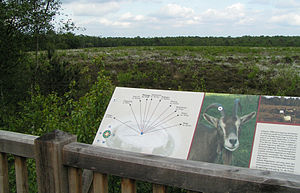
Moor nature trail in Hahlener Moor |
||
| location | Southeast of Herzlake | |
| surface | 294 ha | |
| Identifier | NSG EW 158 | |
| WDPA ID | 163477 | |
| Geographical location | 52 ° 40 ′ N , 7 ° 43 ′ E | |
|
|
||
| Sea level | from 22 m to 31 m | |
| Setup date | January 16, 2011 | |
| administration | NLWKN | |
The Hahlener Moor is a nature reserve in the Lower Saxony municipalities of Menslage in the joint municipality of Artland and Berge in the joint municipality of Fürstenau in the district of Osnabrück .
The nature reserve with the sign NSG WE 158 is 294 hectares in size. It is almost completely part of the FFH area "Hahnenmoor, Hahlener Moor, Suddenmoor". In the east it borders directly on the nature reserve " Suddenmoor / Anten ", in the west on the nature reserve " Hahnenmoor ". The area has been under nature protection since January 16, 2011. It replaces the somewhat smaller nature reserve of the same name from March 30, 1985. The responsible lower nature conservation authority is the district of Osnabrück.
The nature reserve is located southeast of Herzlake and northwest of Berge on the northern edge of the Börsteler Forest . It provides a high moor rest as part of the former Hahn Moores under protection, which drains in the past and by peat was changed in part.
The bog is now mainly of peat forests of birch trees - and pine vegetation and birch swamp forests dominated. In the east of the protected area, parts of the moor , which has not changed much here , have been rewetted. Here there is a large, open raised moor area created by dekusselung , in which the moor can regenerate. This area is characterized by bog heather , cotton grass and pipe grass . Parts of the area are grazed in order to limit woody growth. Existing still waters that are partially emerged as Torfstichgewässer during the rewetting, have Verlandungs stages on.
In the west, the “horse bush” adjoins the wooded moor, which was included in the protected area at the beginning of 2011 and connects to the “Hahnenmoor” nature reserve to the west. The "horse bush" is an agricultural area that is mainly used as grassland on low and high moorland, and sometimes also as arable land. The state road 102 runs through it between Herzlake and Berge.
In the south of the nature reserve is the "Achterbusch", which rises slightly to the Börsteler Wald. Several springs emerge here in the south-eastern area , including the “eye spring ” designed as a pool-like spring pot . Dense reeds grow in the area of the spring water, which trickles over the surface .
The nature reserve drains via ditches to the Hahnenmoorkanal to the north .
The “Hahlener Moor” is accessible to visitors through a moor nature trail , at the southern end of which there is a refuge.
Web links
- Nature reserve "Hahlener Moor" in the database of the Lower Saxony State Office for Water Management, Coastal and Nature Conservation (NLWKN)
Individual evidence
- ↑ The Hahlener Moor , joint municipality Artland. Retrieved on
- ↑ Hahlener Moor nature reserve , Geolife.de Navigator. Retrieved April 29, 2019.


