Hoppeckequelle
| Hoppeckequelle | |||
|---|---|---|---|
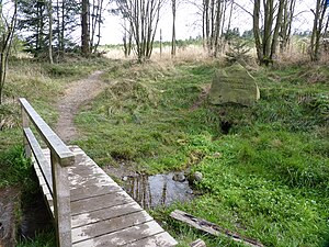
 The Hoppecke spring on the edge of the Niedersfelder Hochheide |
|||
| location | |||
| Country or region | Clemensberg , Rothaar Mountains , Hochsauerlandkreis , North Rhine-Westphalia ( Germany ) | ||
| Coordinates | 51 ° 15 ′ 28 " N , 8 ° 34 ′ 52" E | ||
| height | 780 m above sea level NHN | ||
|
|||
| geology | |||
| Mountains | Rothaar Mountains | ||
| Source type | Seepage source | ||
| Exit type | Hill debris source | ||
| Hydrology | |||
| River system | Weser | ||
| Receiving waters | Hoppecke → Diemel → Weser → North Sea | ||
Coordinates: 51 ° 15 ′ 28 " N , 8 ° 34 ′ 52" E
The Hoppeckequelle in the Rothaargebirge is the source of the 34.7 km long Hoppecke river , which flows into the Diemel between Bredelar and Marsberg, near Niedersfeld in the North Rhine-Westphalian Hochsauerlandkreis ( Germany ) .
geography
location
The Hoppeckequelle is located in the northern part of the Rothaargebirge near the border between the middle east of North Rhine-Westphalia and the northwestern part of North Hesse and thus near the border from the Hochsauerlandkreis to the Waldeck-Frankenberg district . At the junction of the smoothly merging mountain regions Sauerland and Upland , it is located in Westphalian territory 2 km (as the crow flies ) north-northeast of Hildfeld and 3.6 km east of Niedersfeld and 4.5 km south-southwest of Willingen in Hesse .
The source, located at around 780 m , is framed by the peaks of these mountains: Hegekopf ( 842.9 m ; 1.4 km north-northeast), Hopperkopf (approx. 832.3 m ; 1.7 km southeast), Clemensberg (approx. 837 m ; 580 m southwest) and Langenberg ( 843.2 m ; 2.6 km northwest). To the east of the source is the Diemelsee Nature Park in Hesse and the Sauerland-Rothaargebirge Nature Park a few kilometers south in Westphalia .
The Rothaarsteig long-distance hiking trail runs south past the source .
Natural allocation
The Hoppeckequelle belongs to the natural spatial main unit group Süderbergland (No. 33) in the main unit Rothaargebirge (with Hochsauerland ) (333) and in the subunit Winterberger Hochland (333.5) to the natural area Langenberg (333.58).
Rhine-Weser watershed
The Rhine-Weser watershed runs over the ridge between Clemensberg and Hopperkopf . While the water from the Hoppecke spring north of this ridge flows through the Hoppecke and Diemel towards the northeast of the Weser , that of the Schweimecke, which rises south of the ridge, runs west through the Hillebach and the Ruhr into the Rhine .
Protected areas
The Hoppecke spring is located in the high heath landscape of the nature reserve (NSG) Neuer Hagen ( Niedersfelder Hochheide ; CDDA No. 82238; designated 1955; 73.84 hectares ) and the fauna-flora-habitat area Neuer Hagen (FFH No. 4717 -302; 74.35 ha), to the north of which is connected to the NSG Hoppecke-Quellbach (CDDA no. 389788; 2006; 17.02 ha) through which the Hoppecke flows . The protected landscape area Winterberg (type A; CDDA no. 378617; 2005; 87.7991 km² ) joins these protected areas .
Source and water supply
The Hoppeckequelle is a hillside debris spring, which in the Rothaargebirge pours an average of around 1.2 liters per second. From a geological point of view, the Upper Fredeburg Strata lie below the source area , on which plateau clay has been deposited. In the source area, a fen with a peat thickness of up to 2.50 m has formed.
The spring water emerges from a small hole in the ground below a natural stone block with the stone inscription HOPPECKEQUELLE . Due to its small catchment area , which only extends as far as the nearby Clemensberg, the spring has a low discharge and it can even fall dry in hot summer months (intermittent spring).
Just below the Hoppecke spring, water can be taken from a small wooden bridge. The area around them is simply designed with a few benches. A few meters below the source, the Hoppecke is crossed by a wooden forest path bridge, and a little below it it joins several small tributaries that arise from secondary sources.
Web links
Individual evidence
- ↑ a b Topographical Information Management, Cologne District Government, Department GEObasis NRW ( Notes )
- ↑ Martin Bürgener: Geographical Land Survey: The natural spatial units on sheet 111 Arolsen. Federal Institute for Regional Studies, Bad Godesberg 1963. → Online map (PDF; 4.1 MB)
- ↑ Map services of the Federal Agency for Nature Conservation ( information )
- ↑ Flyer: GeoWanderführer Rothaarsteig ( memento of the original from September 24, 2015 in the Internet Archive ) Info: The archive link has been inserted automatically and has not yet been checked. Please check the original and archive link according to the instructions and then remove this notice. , Geological Service NRW, 216 S., Krefeld, 2008, ISBN 978-3-86029-973-9 (PDF; 2.5 MB)


