Jay (maine)
| Jay | ||
|---|---|---|
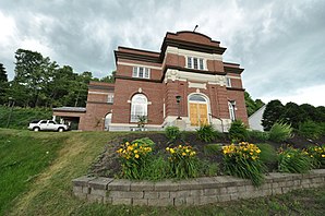
 Jay Niles Memorial Library |
||
| Location in Maine | ||
|
|
||
| Basic data | ||
| Foundation : | February 26, 1795 | |
| State : | United States | |
| State : | Maine | |
| County : | Franklin County | |
| Coordinates : | 44 ° 31 ′ N , 70 ° 12 ′ W | |
| Time zone : | Eastern ( UTC − 5 / −4 ) | |
| Residents : | 4,851 (as of 2010) | |
| Population density : | 38.7 inhabitants per km 2 | |
| Area : | 127.43 km 2 (approx. 49 mi 2 ) of which 125.3 km 2 (approx. 48 mi 2 ) are land |
|
| Postcodes : | 04239, 04262 | |
| Area code : | +1 207 | |
| FIPS : | 23-35625 | |
| GNIS ID : | 0582534 | |
| Website : | Town of Jay | |
Jay is a town in Franklin County in the state of Maine in the United States . In 2010 there lived 4851 inhabitants in 2032 households on an area of 127.43 km².
geography
According to the United States Census Bureau , Jay has a total area of 127.4 km², of which 125.3 km² is land and 2.1 km² consists of water .
Geographical location
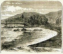
Jay is in the south of Franklin County. The Androscoggin River flows through the southwest corner of the town's area. Parker Pond lies to the southeast and Wilson Lake borders the area of the town to the north . The surface of the town is hilly. The highest point is the 374 m high Nebo Mountain in the west of Jay.
Neighboring communities
All distances are given as straight lines between the official coordinates of the places from the 2010 census.
- North: Wilton , 4.2 miles
- East: Chesterville , 6.6 mi / 10.6 km
- Southeast: Livermore Falls , Androscoggin County , 4.8 mi
- South: Livermore , 5.5 mi
- West: Canton , Oxford County , 6.4 mi
- Northwest: Dixfield , Oxford County, 13.2 mi
City structure
There are several settlement areas in Jay: Beans Corner (Bean's Corner, Beans Corners), Chisholm (formerly Otis Falls), Jay , Jay Bridge (former railroad station), Kennedys Corners , North Jay , Riley (formerly Peterson's Rips) and Stones Corner .
climate
The mean mean temperature in Jay is between −8.3 ° C (17 ° Fahrenheit ) in January and 20.6 ° C (69 ° Fahrenheit) in July. This means that the place is around 9 degrees cooler than the long-term average in the USA. The snowfalls between October and May are up to two and a half meters, more than twice as high as the average snow depth in the USA; the daily sunshine duration is at the lower end of the range in the USA.
history
Town Jay was founded on February 26th, 1795. In the 18th and 19th centuries, farmers grew hay, corn, wheat, potatoes, oats and apples on the loamy and productive soils. In 1793 a tavern was built. Jay had a population of 1,490 in 1870. In the years that followed, Jay became largely an industrial town . In 1888, entrepreneur Hugh J. Chisholm built the Otis Falls Pulp & Paper Company mill in southern Jay , which at the time was the third largest paper mill in the country. In 1905 International Paper built a mill on the opposite side of the river, which became known as the Otis Mill . In March 2009, Wausau Paper announced the closure of the Otis mill. The mill's business was then terminated.
Population development
| Census Results - Town of Jay, Maine | ||||||||||
|---|---|---|---|---|---|---|---|---|---|---|
| year | 1800 | 1810 | 1820 | 1830 | 1840 | 1850 | 1860 | 1870 | 1880 | 1890 |
| Residents | 430 | 1107 | 1614 | 1276 | 1750 | 1733 | 1680 | 1490 | 1291 | 1541 |
| year | 1900 | 1910 | 1920 | 1930 | 1940 | 1950 | 1960 | 1970 | 1980 | 1990 |
| Residents | 2758 | 2987 | 3152 | 3106 | 2858 | 3102 | 3247 | 3954 | 5080 | 5080 |
| year | 2000 | 2010 | 2020 | 2030 | 2040 | 2050 | 2060 | 2070 | 2080 | 2090 |
| Residents | 4985 | 4851 | ||||||||
Culture and sights
Buildings
Three structures are listed buildings and have been added to the National Register of Historic Places .
- Holmes-Crafts Homestead , recorded 1973, register no. 73000105
- Jay-Niles Memorial Library , incorporated in 1987, register no. 87000414
- North Jay Grange Store , registered 1974, register no. 74000150
Economy and Infrastructure
In Jay, Verso Paper Androscoggin operates a hydropower plant (power 3.1 MW) , which is located on the course of the Androscoggin River . Verso Paper operates a paper mill in Jay with an annual production capacity of around 450,000 tons of paper per year.
traffic
To the north, US Highway 2 touches the area of Town Jay. Several Main State Routes run in the area, the 133, 17 and 4 mainly in a north-south direction and the 156 in a west-east direction.
The Brunswick – Farmington railway runs through the town with a stop in North Jay.
Public facilities
There are no medical facilities in Jay. Hospitals can be found in Canton, Farmington and Dixfield.
Jay has his own library with the Jay-Niles Memorial Library . It was donated to the town on February 21, 1918 by the children of Varanas and Mehitable Harris Niles in memory.
education
Together with Livermore Falls and Livermore, Jay belongs to the Spruce Mountain School District or Regional School Unit # 73 .
The following schools are offered in the school district:
- Spruce Mountain Primary School in Livermore
- Spruce Mountain Elementary School in Jay
- Spruce Mountain Middle School in Jay
- Spruce Mountain High School in Jay
Personalities
Personalities who have worked on site
- Hugh J. Chisholm (1847-1912), entrepreneur
Web links
Individual evidence
- ↑ Jay in the Geographic Names Information System of the United States Geological Survey , accessed March 30, 2018
- ↑ Maine 2010 Census Results ; official publication of the Census Authority, (English; PDF; 32.5 MB)
- ^ Nebo Mountain. In: peakery.com. Retrieved March 30, 2018 .
- ↑ Coordinates of the locations of the Census Authority 2010
- ↑ Jay, Franklin County | Maine Genealogy. In: mainegenealogy.net. Retrieved March 30, 2018 .
- ↑ a b c Jay, Maine (ME 04239) profile: population, maps, real estate, averages, homes, statistics, relocation, travel, jobs, hospitals, schools, crime, moving, houses, news, sex offenders. In: city-data.com. www.city-data.com, accessed on March 30, 2018 (English).
- ^ A Brief History of Papermaking in Maine ( Memento of February 20, 2008 in the Internet Archive )
- ↑ Population 1800–2010 according to census results
- ↑ Verso: Androscoggin Mill , accessed September 11, 2019
- ↑ Jay-Niles Memorial Library. In: jaynileslibrary.com. Retrieved March 30, 2018 .
- ^ Spruce Mountain School District - RSU # 73 - Jay, Livermore & Livermore Falls. In: rsu73.org. Retrieved March 30, 2018 (American English).


