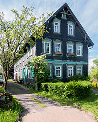
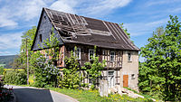
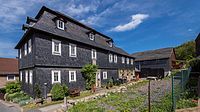
List of cultural monuments in Saalfeld / Saale
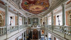
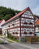
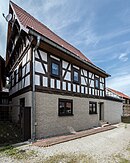
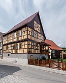
In the list of cultural monuments in Saalfeld / Saale , all cultural monuments of the Thuringian district town Saalfeld / Saale (district Saalfeld-Rudolstadt) and its districts are listed (status: February 12, 2013).
Saalfeld
Monument ensemble
| image | Street and house number | Monument designation | comment |
|---|---|---|---|

|
50 ° 38 '48 "N, 11 ° 21' 55" E |
Monument ensemble “Stadtkern Saalfeld / Saale” in the delimitation of the course of the former city fortifications | |

|
50 ° 39 ′ 4 "N, 11 ° 21 ′ 31" E |
Monument ensemble "Schloßstraße" with Schloßstraße 3 - 31, 4 - 14, Lange Gasse 37 and Lindenplatz 1 - 3 / development along the street (main building), at No. 31 also westward adjoining buildings |
Individual monuments
| image | Street and house number | Monument designation | comment |
|---|---|---|---|

|
50 ° 38 ′ 45 "N, 11 ° 21 ′ 46" E |
City fortifications Saalfeld / Saale | |

|
Albrecht-Dürer-Strasse 3/5, 7 50 ° 38 ′ 43 ″ N, 11 ° 21 ′ 31 ″ E |
Former Autohof (with Sonneberger Straße 8) and residential building | |

|
Alte Freiheit 1 50 ° 39 ′ 3 ″ N, 11 ° 21 ′ 15 ″ E |
Meininger Hof with theater hall | |

|
Alte Freiheit 2 50 ° 39 ′ 3 ″ N, 11 ° 21 ′ 18 ″ E |
Tenement house and outbuildings | |

|
Alte Freiheit 3 50 ° 39 ′ 4 ″ N, 11 ° 21 ′ 16 ″ E |
Former ducal official building with land and fencing | |

|
Alte Freiheit 5 50 ° 39 ′ 5 ″ N, 11 ° 21 ′ 20 ″ E |
Fronveste | |

|
Alte Freiheit 16 50 ° 39 ′ 5 ″ N, 11 ° 21 ′ 22 ″ E |
Residential building | |

|
Alte Freiheit 19 50 ° 39 ′ 7 ″ N, 11 ° 21 ′ 25 ″ E |
Residential building | |
|
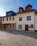
Alte Freiheit 21a and b 50 ° 39 ′ 7 ″ N, 11 ° 21 ′ 25 ″ E |
Residential building | |

|
Alte Marktgasse 1 50 ° 39 ′ 1 ″ N, 11 ° 21 ′ 41 ″ E |
Workers house | |

|
Alte Marktgasse 9 50 ° 39 ′ 2 ″ N, 11 ° 21 ′ 42 ″ E |
Residential building | |

|
Alte Marktgasse 11 50 ° 39 ′ 3 ″ N, 11 ° 21 ′ 43 ″ E |
Residential building | |

|
Alte Marktgasse 13 50 ° 39 ′ 3 ″ N, 11 ° 21 ′ 43 ″ E |
Residential building | |

|
Alter Markt 1 50 ° 39 ′ 6 ″ N, 11 ° 21 ′ 41 ″ E |
Residential building | |

|
Old Market 10 50 ° 39 ′ 4 ″ N, 11 ° 21 ′ 43 ″ E |
Cellar vault | Former location now parking lot |

|
Old Market 15 50 ° 39 ′ 4 ″ N, 11 ° 21 ′ 47 ″ E |
villa | |

|
Old Market 25 50 ° 39 ′ 2 ″ N, 11 ° 21 ′ 45 ″ E |
Renaissance portal of the residential building | |

|
Altsaalfelder Straße 24 50 ° 39 ′ 10 ″ N, 11 ° 21 ′ 58 ″ E |
Residential building | |

|
Altsaalfelder Straße 46 50 ° 39 ′ 21 ″ N, 11 ° 21 ′ 51 ″ E |
Residential building | |

|
On the high bank 50 ° 39 ′ 4 ″ N, 11 ° 21 ′ 48 ″ E |
Baderberg stairs | |

|
Am Hohen Ufer 1 50 ° 39 ′ 3 ″ N, 11 ° 21 ′ 49 ″ E |
Residential house with garage, property and fencing | |

|
Am Hohen Ufer 7 50 ° 39 ′ 2 ″ N, 11 ° 21 ′ 52 ″ E |
Residential building | |

|
Am Schloßbrunnen 50 ° 39 ′ 9 ″ N, 11 ° 21 ′ 28 ″ E |
Castle fountain / part of the entity "Saalfeld Castle and Park" | |

|
At the Sparrowhawk Wood 5 50 ° 38 '8 "N, 11 ° 22' 17" E |
Residential building with property and enclosure / component of the aggregate "Four former civil servant residences of the Mauxion chocolate factory, Am Sperberhölzchen 5 - 8" | |

|
At the Sparrowhawk Wood 6 50 ° 38 ′ 7 ″ N, 11 ° 22 ′ 18 ″ E |
Residential building with property and enclosure / component of the aggregate "Four former civil servant residences of the Mauxion chocolate factory, Am Sperberhölzchen 5 - 8" | |

|
Am Sparrowhawk 7 50 ° 38 ′ 7 ″ N, 11 ° 22 ′ 19 ″ E |
Residential building with property and enclosure / component of the aggregate "Four former civil servant residences of the Mauxion chocolate factory, Am Sperberhölzchen 5 - 8" | |

|
At the Sparrowhawk Wood 8 50 ° 38 '5 "N, 11 ° 22' 21" E |
Residential building with property and enclosure / component of the aggregate "Four former civil servant residences of the Mauxion chocolate factory, Am Sperberhölzchen 5 - 8" | |

|
At the Tauschwitzer Bach 18 50 ° 37 ′ 39 ″ N, 11 ° 21 ′ 37 ″ E |
Residential building | |

|
At Halben Gasse 50 ° 39 ′ 6 ″ N, 11 ° 21 ′ 36 ″ E |
School garden / part of the whole "Schloss Saalfeld and Park" | |

|
Bahnhofstrasse 6a 50 ° 39 ′ 0 ″ N, 11 ° 22 ′ 15 ″ E |
Administration building | |
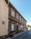
|
Barfüßergasse 1 50 ° 38 ′ 49 ″ N, 11 ° 21 ′ 31 ″ E |
Inn / part of the monument ensemble "Stadtkern Saalfeld / Saale" | |

|
Barfüßergasse 11 50 ° 38 ′ 51 ″ N, 11 ° 21 ′ 28 ″ E |
Residential building / part of the monument ensemble "Stadtkern Saalfeld / Saale" | |

|
Barfüßergasse 23 50 ° 38 ′ 53 ″ N, 11 ° 21 ′ 25 ″ E |
Portal (subject part) / part of the monument ensemble "Stadtkern Saalfeld / Saale" | |

|
Keep 1, 2 50 ° 38 ′ 5 ″ N, 11 ° 21 ′ 55 ″ E |
Bergfried house with furnishings and park with park architecture | |

|
Keep 3 50 ° 38 ′ 8 ″ N, 11 ° 21 ′ 48 ″ E |
Lower gatehouse and nursery / component of the "Bergfried House" | |

|
Blankenburger Strasse 50 ° 38 ′ 56 ″ N, 11 ° 21 ′ 29 ″ E |
Blankenburger Tor / part of the monument ensemble "Stadtkern Saalfeld / Saale" | |

|
Blankenburger Strasse 1/3 50 ° 38 ′ 52 ″ N, 11 ° 21 ′ 34 ″ E |
Residential and commercial building / part of the monument ensemble "Stadtkern Saalfeld / Saale" | |

|
Blankenburger Strasse 2 50 ° 38 ′ 54 ″ N, 11 ° 21 ′ 33 ″ E |
Residential and commercial building / part of the monument ensemble "Stadtkern Saalfeld / Saale" | |

|
Blankenburger Strasse 5/7 50 ° 38 ′ 52 ″ N, 11 ° 21 ′ 33 ″ E |
Cellar vault under residential and commercial building (new building) / part of the monument ensemble "Stadtkern Saalfeld / Saale" | |

|
Blankenburger Strasse 8 50 ° 38 ′ 55 ″ N, 11 ° 21 ′ 32 ″ E |
Restaurant "Das Loch" / part of the monument ensemble "Stadtkern Saalfeld / Saale" | |

|
Blankenburger Strasse 9 50 ° 38 ′ 53 ″ N, 11 ° 21 ′ 33 ″ E |
Restaurant "Alte Post" (residential and inn) / part of the monument ensemble "Stadtkern Saalfeld / Saale" | |

|
Blankenburger Strasse 18 50 ° 38 ′ 56 ″ N, 11 ° 21 ′ 30 ″ E |
Hiltmannsches Haus (residential and commercial building) / part of the monument ensemble "Stadtkern Saalfeld / Saale" | |

|
Blankenburger Strasse 21 50 ° 38 ′ 55 ″ N, 11 ° 21 ′ 30 ″ E |
Former Inn / part of the monument ensemble "Stadtkern Saalfeld / Saale" | |

|
Breitscheidstrasse 27 50 ° 38 ′ 46 ″ N, 11 ° 21 ′ 52 ″ E |
Garden house / part of the monument ensemble "Stadtkern Saalfeld / Saale" | |

|
Brudergasse 9 50 ° 38 ′ 49 ″ N, 11 ° 21 ′ 33 ″ E |
Former Trading house / part of the monument ensemble "Stadtkern Saalfeld / Saale" | |

|
Brudergasse 11 50 ° 38 ′ 49 ″ N, 11 ° 21 ′ 32 ″ E |
Patrician house / part of the monument ensemble "Stadtkern Saalfeld / Saale" | |

|
Brudergasse 14 50 ° 38 ′ 49 ″ N, 11 ° 21 ′ 32 ″ E |
City farmstead / part of the monument ensemble "Stadtkern Saalfeld / Saale" | |

|
Brudergasse 17 50 ° 38 ′ 47 ″ N, 11 ° 21 ′ 30 ″ E |
Apartment building / part of the monument ensemble "Stadtkern Saalfeld / Saale" | |

|
Brudergasse 19 50 ° 38 ′ 46 ″ N, 11 ° 21 ′ 30 ″ E |
Apartment building / part of the monument ensemble "Stadtkern Saalfeld / Saale" | |

|
Brudergasse 22 50 ° 38 ′ 47 ″ N, 11 ° 21 ′ 29 ″ E |
Residential house with memorial plaque for Otto Ludwig and Reinhard Richter / part of the monument ensemble "Stadtkern Saalfeld / Saale" | |

|
Carl-Zeiss-Strasse 50 ° 39 ′ 11 ″ N, 11 ° 21 ′ 51 ″ E |
Former Zeiss factory | |
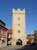
|
Darrtorstrasse 50 ° 38 ′ 58 ″ N, 11 ° 21 ′ 42 ″ E |
Darrtor / part of the monument ensemble "Stadtkern Saalfeld / Saale" | |

|
Darrtorstrasse 1 50 ° 38 ′ 55 ″ N, 11 ° 21 ′ 39 ″ E |
"Old coin" / part of the monument ensemble "Stadtkern Saalfeld / Saale" | |

|
Darrtorstrasse 2 50 ° 38 ′ 56 ″ N, 11 ° 21 ′ 41 ″ E |
Renaissance portal / part of the monument ensemble "Stadtkern Saalfeld / Saale" | |

|
Darrtorstrasse 3/5 50 ° 38 ′ 56 ″ N, 11 ° 21 ′ 40 ″ E |
Commercial building / part of the monument ensemble "Stadtkern Saalfeld / Saale" | |

|
Darrtorstrasse 13 50 ° 38 ′ 58 ″ N, 11 ° 21 ′ 42 ″ E |
Gatekeeper house / part of the monument ensemble "Stadtkern Saalfeld / Saale" | |

|
Dr.-Wilhelm-Külz-Strasse 5/7 50 ° 38 ′ 48 ″ N, 11 ° 21 ′ 22 ″ E |
Duplex house (apartment rental) | |

|
Dr.-Wilhelm-Külz-Strasse 12 50 ° 38 ′ 49 ″ N, 11 ° 21 ′ 22 ″ E |
Residential building / part of the monument ensemble "Stadtkern Saalfeld / Saale" | |

|
Fleischgasse 12 50 ° 38 ′ 58 ″ N, 11 ° 21 ′ 35 ″ E |
Living u. Commercial building / part of the monument ensemble "Stadtkern Saalfeld / Saale" | |

|
Friedensstrasse 4 50 ° 38 ′ 57 ″ N, 11 ° 21 ′ 29 ″ E |
Residential and commercial building / part of the monument ensemble "Stadtkern Saalfeld / Saale" | |

|
Friedensstrasse 4a 50 ° 38 ′ 57 ″ N, 11 ° 21 ′ 30 ″ E |
Half-timbered building / part of the monument ensemble "Stadtkern Saalfeld / Saale" | |

|
Friedensstrasse 6 50 ° 38 ′ 58 ″ N, 11 ° 21 ′ 29 ″ E |
Half-timbered building / part of the monument ensemble "Stadtkern Saalfeld / Saale" | |

|
Friedensstrasse 7 50 ° 38 ′ 58 ″ N, 11 ° 21 ′ 26 ″ E |
Residential and commercial building | |

|
Friedensstrasse 26 50 ° 39 ′ 0 ″ N, 11 ° 21 ′ 24 ″ E |
Basement | |

|
Friedensstrasse 33 50 ° 39 ′ 1 ″ N, 11 ° 21 ′ 18 ″ E |
Residential building | |

|
Friedensstrasse 42 50 ° 39 ′ 1 ″ N, 11 ° 21 ′ 21 ″ E |
Basement (material part) | |

|
Friedensstrasse 46 50 ° 39 ′ 1 ″ N, 11 ° 21 ′ 20 ″ E |
Residential building | |

|
Friedensstrasse 50 50 ° 39 ′ 1 ″ N, 11 ° 21 ′ 19 ″ E |
Basement | |

|
Friedensstrasse 56 50 ° 39 ′ 2 ″ N, 11 ° 21 ′ 17 ″ E |
Residential building | |

|
Friedensstrasse 62 50 ° 39 ′ 3 ″ N, 11 ° 21 ′ 12 ″ E |
Martinskapelle - also known as the Siechenkapelle | |

|
Friedhofstrasse 2 50 ° 39 ′ 4 ″ N, 11 ° 20 ′ 48 ″ E |
Cemetery: celebration hall including Auerbach crypt and crematorium | |

|
Friedhofstrasse 2 50 ° 39 ′ 1 ″ N, 11 ° 20 ′ 39 ″ E |
Cemetery: selected tombs, north-western historical cemetery wall including wall tombs and wrought iron grave fencing, separate burial ground for Soviet slave laborers and children including obelisk and enclosure | |

|
Gerbergasse 12 50 ° 38 ′ 53 ″ N, 11 ° 21 ′ 47 ″ E |
Residential building with gate drive / part of the monument ensemble "Stadtkern Saalfeld / Saale" | |

|
Gerbergasse 14 50 ° 38 ′ 52 ″ N, 11 ° 21 ′ 48 ″ E |
Barrel vaulted cellar / part of the monument ensemble "Stadtkern Saalfeld / Saale" | |

|
Green center 6 50 ° 38 ′ 40 ″ N, 11 ° 21 ′ 36 ″ E |
Factory building (so-called high-rise) of the former packaging plant | |

|
Grünhain 12 50 ° 39 ′ 3 ″ N, 11 ° 21 ′ 53 ″ E |
Residential building | |

|
Gutenbergstrasse 3 50 ° 38 ′ 41 ″ N, 11 ° 21 ′ 23 ″ E |
Villa with extension, outbuildings, land and fencing | |
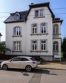
|
Haeckelstrasse 5 50 ° 39 ′ 16 ″ N, 11 ° 22 ′ 12 ″ E |
villa | |

|
Haeckelstrasse 7 50 ° 39 ′ 17 ″ N, 11 ° 22 ′ 12 ″ E |
villa | |

|
Half Alley 15 50 ° 39 ′ 5 ″ N, 11 ° 21 ′ 38 ″ E |
Craftsman House | |

|
Halbe Gasse 18 50 ° 39 ′ 6 ″ N, 11 ° 21 ′ 38 ″ E |
Former Castle gardening / part of the entity "Saalfeld Castle and Saalfeld Park" | |

|
Hirschengasse 11 50 ° 39 ′ 5 ″ N, 11 ° 21 ′ 26 ″ E |
urban residential building | |

|
Hirschengasse 19 50 ° 39 ′ 5 ″ N, 11 ° 21 ′ 29 ″ E |
Residential building | former location |

|
Industriestrasse 1 50 ° 39 ′ 32 ″ N, 11 ° 22 ′ 46 ″ E |
Former Central warehouse of the Saalfeld consumer cooperative association | |

|
Johannisgasse 5 50 ° 38 ′ 50 ″ N, 11 ° 21 ′ 43 ″ E |
Residential and commercial building with courtyard development / part of the monument ensemble "Stadtkern Saalfeld / Saale" | |

|
Johannisgasse 8 50 ° 38 ′ 49 ″ N, 11 ° 21 ′ 43 ″ E |
Residential building and cellar / part of the monument ensemble "Stadtkern Saalfeld / Saale" | |

|
Johannisgasse 10 50 ° 38 ′ 50 ″ N, 11 ° 21 ′ 44 ″ E |
Residential and guest house / part of the monument ensemble "Stadtkern Saalfeld / Saale" | |

|
Judengasse 1 50 ° 38 ′ 51 ″ N, 11 ° 21 ′ 45 ″ E |
Craftsman's house / part of the monument ensemble "Stadtkern Saalfeld / Saale" | |

|
Judengasse 2 50 ° 38 ′ 50 ″ N, 11 ° 21 ′ 45 ″ E |
Residential and commercial building / part of the monument ensemble "Stadtkern Saalfeld / Saale" | |

|
Judengasse 4 50 ° 38 ′ 51 ″ N, 11 ° 21 ′ 46 ″ E |
Craftsman's house / part of the monument ensemble "Stadtkern Saalfeld / Saale" | |

|
Judengasse 5 50 ° 38 ′ 51 ″ N, 11 ° 21 ′ 46 ″ E |
Residential and commercial building / part of the monument ensemble "Stadtkern Saalfeld / Saale" | |

|
Judengasse 7 50 ° 38 ′ 52 ″ N, 11 ° 21 ′ 46 ″ E |
Vaulted cellar (part) / part of the monument ensemble "Stadtkern Saalfeld / Saale" | |
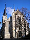
|
Kirchplatz 1 50 ° 38 ′ 54 ″ N, 11 ° 21 ′ 35 ″ E |
Johanneskirche / part of the monument ensemble "Stadtkern Saalfeld / Saale" | |

|
Kirchplatz 3 50 ° 38 ′ 55 ″ N, 11 ° 21 ′ 35 ″ E |
Superintendent / part of the monument ensemble "Stadtkern Saalfeld / Saale" | |
|
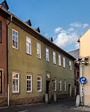
Kirchplatz 4 50 ° 38 ′ 56 ″ N, 11 ° 21 ′ 36 ″ E |
Rectory / part of the monument ensemble "Stadtkern Saalfeld / Saale" | |

|
Kirchplatz 6 50 ° 38 ′ 52 ″ N, 11 ° 21 ′ 35 ″ E |
Residential and commercial building / part of the monument ensemble "Stadtkern Saalfeld / Saale" | |

|
Kleine Gasse 1 50 ° 38 ′ 45 ″ N, 11 ° 21 ′ 44 ″ E |
Workers' house / part of the monument ensemble "Stadtkern Saalfeld / Saale" | |

|
Kleine Gasse 2 50 ° 38 ′ 45 ″ N, 11 ° 21 ′ 43 ″ E |
Residential building / part of the monument ensemble "Stadtkern Saalfeld / Saale" | |

|
Klostergasse 9 50 ° 38 ′ 54 ″ N, 11 ° 21 ′ 25 ″ E |
Bürgerhaus / part of the monument ensemble "Stadtkern Saalfeld / Saale" | |

|
Klostergasse 13 50 ° 38 ′ 52 ″ N, 11 ° 21 ′ 24 ″ E |
Residential building / part of the monument ensemble "Stadtkern Saalfeld / Saale" | |

|
Klostergasse 28 50 ° 38 ′ 51 ″ N, 11 ° 21 ′ 23 ″ E |
Residential building / part of the monument ensemble "Stadtkern Saalfeld / Saale" | |

|
Klostergasse 46 50 ° 38 ′ 47 ″ N, 11 ° 21 ′ 26 ″ E |
Residential building / part of the monument ensemble "Stadtkern Saalfeld / Saale" | |

|
Knochstrasse 31 50 ° 38 ′ 34 ″ N, 11 ° 21 ′ 44 ″ E |
Detached house with garage and pavilion | |

|
Köditzgasse 1 a 50 ° 38 ′ 52 ″ N, 11 ° 21 ′ 43 ″ E |
Residential building with ancillary building / part of the monument ensemble "Stadtkern Saalfeld / Saale" | |

|
Köditzgasse 2 50 ° 38 ′ 51 ″ N, 11 ° 21 ′ 42 ″ E |
Official prison / part of the monument ensemble "Stadtkern Saalfeld / Saale" | |

|
Köditzgasse 3 50 ° 38 ′ 51 ″ N, 11 ° 21 ′ 43 ″ E |
Residential and commercial building / part of the monument ensemble "Stadtkern Saalfeld / Saale" | |

|
Köditzgasse 5 50 ° 38 ′ 51 ″ N, 11 ° 21 ′ 44 ″ E |
Craftsman's house / part of the monument ensemble "Stadtkern Saalfeld / Saale" | |

|
Köditzgasse 7 50 ° 38 ′ 51 ″ N, 11 ° 21 ′ 44 ″ E |
Craftsman's house / part of the monument ensemble "Stadtkern Saalfeld / Saale" | |

|
Köditzgasse 27 50 ° 38 ′ 48 ″ N, 11 ° 21 ′ 48 ″ E |
Handelshof / part of the monument ensemble "Stadtkern Saalfeld / Saale" | |

|
Kulmbacher Strasse 21 50 ° 38 ′ 52 ″ N, 11 ° 22 ′ 26 ″ E |
two water towers (station area) | |

|
Kulmbacher Strasse 27 50 ° 39 ′ 2 ″ N, 11 ° 22 ′ 23 ″ E |
Post office building | |

|
Kulmstrasse 11a 50 ° 39 ′ 13 ″ N, 11 ° 22 ′ 16 ″ E |
Facade of residential building (material part) | |

|
Kulmstrasse 33 50 ° 39 ′ 23 ″ N, 11 ° 22 ′ 23 ″ E |
Former Factory building (Viktoria sewing machine factory) | |
|
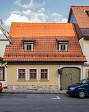
Lange Gasse 8 50 ° 39 ′ 0 ″ N, 11 ° 21 ′ 42 ″ E |
Residential building | |

|
Lange Gasse 9 50 ° 39 ′ 0 ″ N, 11 ° 21 ′ 41 ″ E |
Residential building | |

|
Lange Gasse 18 50 ° 39 ′ 1 ″ N, 11 ° 21 ′ 39 ″ E |
Former Craftsman House | |

|
Lange Gasse 25 50 ° 39 ′ 2 ″ N, 11 ° 21 ′ 37 ″ E |
Residential building | |

|
Lange Gasse 26 50 ° 39 ′ 2 ″ N, 11 ° 21 ′ 37 ″ E |
Residential building | |
|
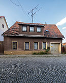
Lange Gasse 34 50 ° 39 ′ 2 ″ N, 11 ° 21 ′ 35 ″ E |
barn | |

|
Lange Gasse 36 50 ° 39 ′ 3 ″ N, 11 ° 21 ′ 34 ″ E |
Residential building | |

|
Lange Gasse 46 50 ° 39 ′ 3 ″ N, 11 ° 21 ′ 29 ″ E |
Courtyard | |

|
Lange Gasse 50/52 50 ° 39 ′ 3 ″ N, 11 ° 21 ′ 27 ″ E |
Courtyard | |
|
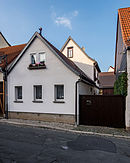
Lange Gasse 54 50 ° 39 ′ 3 ″ N, 11 ° 21 ′ 26 ″ E |
Workers' house and outbuildings | |

|
Lindenplatz 1 50 ° 39 ′ 4 ″ N, 11 ° 21 ′ 32 ″ E |
Residential building / part of the "Schloßstraße" monument ensemble | |

|
Markt 1 50 ° 38 ′ 52 ″ N, 11 ° 21 ′ 41 ″ E |
Town hall / part of the monument ensemble "Stadtkern Saalfeld / Saale" | |

|
Market 2 50 ° 38 ′ 51 ″ N, 11 ° 21 ′ 40 ″ E |
Residential and commercial building / part of the monument ensemble "Stadtkern Saalfeld / Saale" | |

|
Markt 6 50 ° 38 ′ 50 ″ N, 11 ° 21 ′ 36 ″ E |
Former Gasthof "Roter Hirsch" / part of the monument ensemble "Stadtkern Saalfeld / Saale" | |

|
Markt 12 50 ° 38 ′ 52 ″ N, 11 ° 21 ′ 37 ″ E |
Residential and commercial building / part of the monument ensemble "Stadtkern Saalfeld / Saale" | |

|
Markt 13 50 ° 38 ′ 52 ″ N, 11 ° 21 ′ 37 ″ E |
Residential and commercial building / part of the monument ensemble "Stadtkern Saalfeld / Saale" | |

|
Market 21 50 ° 38 ′ 54 ″ N, 11 ° 21 ′ 39 ″ E |
Romanesque house (pharmacy) / part of the monument ensemble "Stadtkern Saalfeld / Saale" | |

|
Market 24 50 ° 38 ′ 54 ″ N, 11 ° 21 ′ 41 ″ E |
Residential and commercial building / part of the monument ensemble "Stadtkern Saalfeld / Saale" | |

|
Market 25 50 ° 38 ′ 53 ″ N, 11 ° 21 ′ 41 ″ E |
Gasthaus (Hotel Anker) / part of the monument ensemble "Stadtkern Saalfeld / Saale" | |

|
Market 26 50 ° 38 ′ 53 ″ N, 11 ° 21 ′ 42 ″ E |
Former Gasthof "Güldene Gans" / part of the monument ensemble "Stadtkern Saalfeld / Saale" | |

|
Münzplatz 3 50 ° 38 ′ 45 ″ N, 11 ° 21 ′ 28 ″ E |
Former City wall tower / part of the monument ensemble "Stadtkern Saalfeld / Saale" | |

|
Münzplatz 5 50 ° 38 ′ 47 ″ N, 11 ° 21 ′ 28 ″ E |
Former Franciscan monastery / part of the monument ensemble "Stadtkern Saalfeld / Saale" | |

|
Neumühle 1 50 ° 38 ′ 0 ″ N, 11 ° 22 ′ 37 ″ E |
Chocolate factory | |

|
Neumühle 3 50 ° 37 ′ 57 ″ N, 11 ° 22 ′ 35 ″ E |
Former Werkmeister's residence with ancillary building, property and fencing | |
|
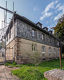
Neumühle 5 50 ° 37 ′ 54 ″ N, 11 ° 22 ′ 40 ″ E |
Nursery (former Mauxion Chocolate Factory Nursery) | |

|
Neumühlenweg 50 ° 38 ′ 11 ″ N, 11 ° 22 ′ 18 ″ E |
Arbor colony | |

|
Niedere Köditzgasse 1 50 ° 38 ′ 52 ″ N, 11 ° 21 ′ 49 ″ E |
Vaulted cellar / part of the monument ensemble "Stadtkern Saalfeld / Saale" | |

|
Niedere Köditzgasse 9 50 ° 38 ′ 51 ″ N, 11 ° 21 ′ 51 ″ E |
Vaulted cellar / part of the monument ensemble "Stadtkern Saalfeld / Saale" | |

|
Niedere Köditzgasse 17 50 ° 38 ′ 49 ″ N, 11 ° 21 ′ 52 ″ E |
Vaulted cellar / part of the monument ensemble "Stadtkern Saalfeld / Saale" | |

|
Niedere Köditzgasse 22 50 ° 38 ′ 48 ″ N, 11 ° 21 ′ 52 ″ E |
Former Farmhouse / part of the monument ensemble "Stadtkern Saalfeld / Saale" | |

|
Niedere Köditzgasse 29 50 ° 38 ′ 47 ″ N, 11 ° 21 ′ 55 ″ E |
Residential building / part of the monument ensemble "Stadtkern Saalfeld / Saale" | |

|
Obere Strasse 50 ° 38 ′ 44 ″ N, 11 ° 21 ′ 41 ″ E |
Upper gate / part of the monument ensemble "Stadtkern Saalfeld / Saale" | |

|
Obere Straße 1 50 ° 38 ′ 50 ″ N, 11 ° 21 ′ 38 ″ E |
Former Bürgerhaus / part of the monument ensemble "Stadtkern SaalfeldSaale" | |

|
Obere Strasse 2 50 ° 38 ′ 48 ″ N, 11 ° 21 ′ 35 ″ E |
Remise of the former Handelshof / part of the monument ensemble "Stadtkern Saalfeld / Saale" | |

|
Obere Straße 2 50 ° 38 ′ 50 ″ N, 11 ° 21 ′ 37 ″ E |
Former Handelshof / part of the monument ensemble "Stadtkern Saalfeld / Saale" | |

|
Obere Straße 4 50 ° 38 ′ 50 ″ N, 11 ° 21 ′ 37 ″ E |
Histor. Commercial building / part of the monument ensemble "Stadtkern Saalfeld / Saale" | |

|
Obere Straße 7 50 ° 38 ′ 48 ″ N, 11 ° 21 ′ 40 ″ E |
Residential and commercial building / part of the monument ensemble "Stadtkern Saalfeld / Saale" | |

|
Obere Straße 17 50 ° 38 ′ 45 ″ N, 11 ° 21 ′ 41 ″ E |
Residential and commercial building / part of the monument ensemble "Stadtkern Saalfeld / Saale" | |

|
Obere Torgasse 15 50 ° 38 ′ 44 ″ N, 11 ° 21 ′ 34 ″ E |
Residential building / part of the monument ensemble "Stadtkern Saalfeld / Saale" | |

|
Obere Torgasse 17 50 ° 38 ′ 44 ″ N, 11 ° 21 ′ 33 ″ E |
Craftsman's house / part of the monument ensemble "Stadtkern Saalfeld / Saale" | |
|
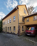
Obere Torgasse 29 50 ° 38 ′ 45 ″ N, 11 ° 21 ′ 30 ″ E |
Part of the city wall / part of the monument ensemble "Stadtkern Saalfeld / Saale" | |

|
Pfortenstrasse 3 50 ° 38 ′ 43 ″ N, 11 ° 21 ′ 23 ″ E |
Storey villa | |

|
Pfortenstrasse 4 50 ° 38 ′ 45 ″ N, 11 ° 21 ′ 24 ″ E |
villa | |
|
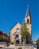
Pfortenstrasse 12 50 ° 38 ′ 43 ″ N, 11 ° 21 ′ 19 ″ E |
Catholic Church of St. Boniface | |

|
Pfortenstrasse 14 50 ° 38 ′ 43 ″ N, 11 ° 21 ′ 18 ″ E |
Rectory | |

|
Pfortenstrasse 38 50 ° 38 ′ 38 ″ N, 11 ° 21 ′ 3 ″ E |
Former Forest school | |

|
Pößnecker Strasse 50 ° 39 ′ 1 ″ N, 11 ° 22 ′ 3 ″ E |
Bridgehead Altsaalfeld of the previous bridge over the Saale | |

|
Pößnecker Strasse 50 50 ° 39 ′ 18 ″ N, 11 ° 22 ′ 46 ″ E |
villa | |

|
Rainweg 68 50 ° 38 ′ 40 ″ N, 11 ° 20 ′ 39 ″ E |
Thuringia Clinic | |

|
Saalstrasse 1 50 ° 38 ′ 55 ″ N, 11 ° 21 ′ 40 ″ E |
Residential and commercial building / part of the monument ensemble "Stadtkern Saalfeld / Saale" | |

|
Saalstrasse 2 50 ° 38 ′ 54 ″ N, 11 ° 21 ′ 41 ″ E |
Residential and commercial building (stucco ceiling) / part of the monument ensemble "Stadtkern Saalfeld / Saale" | |
|
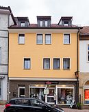
Saalstrasse 3 50 ° 38 ′ 55 ″ N, 11 ° 21 ′ 41 ″ E |
Residential and commercial building (former meat banks) / part of the monument ensemble "Stadtkern Saalfeld / Saale" | |

|
Saalstrasse 7 50 ° 38 ′ 55 ″ N, 11 ° 21 ′ 41 ″ E |
Commercial building / part of the monument ensemble "Stadtkern Saalfeld / Saale" | |
|
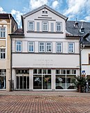
Saalstrasse 9 50 ° 38 ′ 55 ″ N, 11 ° 21 ′ 42 ″ E |
Commercial building (rear wall of the building with portal and window frames) / part of the monument ensemble "Stadtkern Saalfeld / Saale" | |

|
Saalstrasse 11 50 ° 38 ′ 56 ″ N, 11 ° 21 ′ 42 ″ E |
Patrician house / part of the monument ensemble "Stadtkern Saalfeld / Saale" | |

|
Saalstrasse 15 50 ° 38 ′ 56 ″ N, 11 ° 21 ′ 44 ″ E |
Residential and commercial building / part of the monument ensemble "Stadtkern Saalfeld / Saale" | |
|
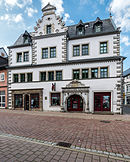
Saalstrasse 17 50 ° 38 ′ 56 ″ N, 11 ° 21 ′ 44 ″ E |
Residential and commercial building / part of the monument ensemble "Stadtkern Saalfeld / Saale" | |

|
Saalstrasse 28 50 ° 38 ′ 56 ″ N, 11 ° 21 ′ 48 ″ E |
Residential and commercial building / part of the monument ensemble "Stadtkern Saalfeld / Saale" | |

|
Saalstrasse 43 50 ° 38 ′ 58 ″ N, 11 ° 21 ′ 51 ″ E |
Residential and commercial building / part of the monument ensemble "Stadtkern Saalfeld / Saale" | |

|
Saalstrasse 48 50 ° 38 ′ 57 ″ N, 11 ° 21 ′ 53 ″ E |
Bank building / part of the monument ensemble "Stadtkern Saalfeld / Saale" | |

|
Saalstrasse 60 50 ° 38 ′ 59 ″ N, 11 ° 21 ′ 57 ″ E |
Hall gate / part of the monument ensemble "Stadtkern Saalfeld / Saale" | |

|
Saumarkt 1 50 ° 38 ′ 57 ″ N, 11 ° 21 ′ 44 ″ E |
Former Bank / part of the monument ensemble "Stadtkern Saalfeld / Saale" | |
|
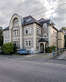
Schillerstrasse 3 50 ° 38 ′ 45 ″ N, 11 ° 21 ′ 17 ″ E |
Storey villa | |

|
Schloßberg 50 ° 39 ′ 15 ″ N, 11 ° 21 ′ 29 ″ E |
Castle slope / part of the entity "Castle and Park Saalfeld / Saale" | |

|
Schlossstrasse 50 ° 39 ′ 7 ″ N, 11 ° 21 ′ 36 ″ E |
Orangery / part of the collective "Schloss und Park Saalfeld / Saale" | |

|
Schlossstrasse 50 ° 39 ′ 0 ″ N, 11 ° 21 ′ 32 ″ E |
Memorial stone "Death March of the Buchenwald prisoners" | |

|
Schlossstrasse 50 ° 39 ′ 10 ″ N, 11 ° 21 ′ 34 ″ E |
Castle park / part of the whole "Castle and Park Saalfeld / Saale" | |

|
Schlossstrasse 4 50 ° 39 ′ 1 ″ N, 11 ° 21 ′ 33 ″ E |
Residential building with rear building / part of the "Schloßstraße" monument ensemble | |

|
Schlossstrasse 11 50 ° 39 ′ 3 ″ N, 11 ° 21 ′ 31 ″ E |
Residential building with side and rear buildings / part of the "Schloßstraße" monument ensemble | |

|
Schlossstrasse 17 50 ° 39 ′ 5 ″ N, 11 ° 21 ′ 30 ″ E |
Residential building with side buildings / part of the "Schloßstraße" monument ensemble | |

|
Schlossstrasse 21 50 ° 39 ′ 6 ″ N, 11 ° 21 ′ 30 ″ E |
Residential building / part of the "Schloßstraße" monument ensemble | |

|
Schlossstrasse 22 50 ° 39 ′ 10 ″ N, 11 ° 21 ′ 29 ″ E |
Former Marstall / part of the entity "Schloss and Park Saalfeld / Saale" | |

|
Schlossstrasse 22/24 50 ° 39 ′ 7 ″ N, 11 ° 21 ′ 35 ″ E |
The whole “ Schloss and Park Saalfeld / Saale” with enclosure, outbuildings, orangery, tea pavilion, stables, fountain, former castle gardening | |

|
Schlossstrasse 23 50 ° 39 ′ 6 ″ N, 11 ° 21 ′ 30 ″ E |
Histor. Basement of the residential and commercial building (new building) and exit Hirschengasse (sandstone pillars) / part of the “Schloßstraße” monument ensemble | |

|
Schlossstrasse 24 50 ° 39 ′ 13 ″ N, 11 ° 21 ′ 32 ″ E |
Castle / part of the entity "Castle and Park Saalfeld / Saale" | |

|
Schlossstrasse 25 50 ° 39 ′ 7 ″ N, 11 ° 21 ′ 29 ″ E |
Residential and commercial building / part of the "Schloßstraße" monument ensemble | |

|
Schlossstrasse 26 50 ° 39 ′ 10 ″ N, 11 ° 21 ′ 27 ″ E |
Residential building (formerly the castle guard) / part of the entity "Schloss und Park Saalfeld / Saale" | |

|
Schlossstrasse 27 50 ° 39 ′ 7 ″ N, 11 ° 21 ′ 29 ″ E |
Residential building / part of the "Schloßstraße" monument ensemble | |

|
Schlossstrasse 29 50 ° 39 ′ 7 ″ N, 11 ° 21 ′ 29 ″ E |
Residential building / part of the "Schloßstraße" monument ensemble | |

|
Schulplatz 5 50 ° 38 ′ 57 ″ N, 11 ° 21 ′ 30 ″ E |
Residential and commercial building / part of the monument ensemble "Stadtkern Saalfeld / Saale" | |

|
Schwarmgasse 50 ° 38 ′ 50 ″ N, 11 ° 21 ′ 59 ″ E |
Castle ruins "Hoher Schwarm" / part of the monument ensemble "Stadtkern Saalfeld / Saale" | |

|
Schwarmgasse 22 50 ° 38 ′ 53 ″ N, 11 ° 21 ′ 58 ″ E |
Former Nikolaikirche with enclosure wall / part of the monument ensemble "Stadtkern Saalfeld / Saale" | |

|
Schwarmgasse 24 50 ° 38 ′ 53 ″ N, 11 ° 22 ′ 0 ″ E |
Kitzerstein Castle with ancillary building and enclosure / part of the monument ensemble "Stadtkern Saalfeld / Saale" | Kitzerstein castle |

|
Schwarmgasse 26 50 ° 38 ′ 55 ″ N, 11 ° 21 ′ 59 ″ E |
Residential building with land and fence / part of the monument ensemble "Stadtkern Saalfeld / Saale" | |

|
Siechenbach 50 ° 39 ′ 0 ″ N, 11 ° 21 ′ 3 ″ E |
Entrance to the Fürstenhuther Stollen | |

|
Sonneberger Strasse 6 50 ° 38 ′ 41 ″ N, 11 ° 21 ′ 33 ″ E |
Residential house with fence and garden plot | |

|
Sonneberger Strasse 8 50 ° 38 ′ 41 ″ N, 11 ° 21 ′ 32 ″ E |
Commercial building / part of the former truck stop | |

|
Sonneberger Strasse 15/17 50 ° 38 ′ 37 ″ N, 11 ° 21 ′ 27 ″ E |
School building with gym and teachers' house | |

|
Sonneberger Strasse 46 50 ° 38 ′ 35 ″ N, 11 ° 21 ′ 14 ″ E |
Apartment building | |

|
Deeper Path 24 50 ° 38 ′ 9 ″ N, 11 ° 21 ′ 45 ″ E |
Residential building | |
|
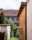
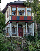
Töpfergasse 3 50 ° 38 ′ 45 ″ N, 11 ° 21 ′ 37 ″ E |
Residential building / part of the monument ensemble "Stadtkern Saalfeld / Saale" | |
|
Unterm Kitzerstein 50 ° 38 ′ 53 ″ N, 11 ° 22 ′ 1 ″ E |
Garden house / part of the monument ensemble "Stadtkern Saalfeld / Saale" | |

|
Wachserzweg 50 ° 38 ′ 45 ″ N, 11 ° 19 ′ 10 ″ E |
Old mining | |

|
Webergasse 35 50 ° 38 ′ 55 ″ N, 11 ° 21 ′ 56 ″ E |
Part of the vaulted cellar / part of the monument ensemble "Stadtkern Saalfeld / Saale" | |

|
Wetzelstein 1 50 ° 37 ′ 49 ″ N, 11 ° 22 ′ 44 ″ E |
Villa Wetzelstein with furnishings, park and park architecture, fountain basin, arched bridge (viewpoint) | |
| Wittmannsgereuther Strasse 50 ° 37 ′ 38 ″ N, 11 ° 19 ′ 3 ″ E |
Former Iron ore mine | ||

|
Desert Köditz 3 50 ° 38 ′ 27 ″ N, 11 ° 22 ′ 13 ″ E |
Business school |
Arnsgereuth
Individual monuments
| image | Street and house number | Monument designation | comment |
|---|---|---|---|

|
Local road 2 50 ° 36 ′ 30 ″ N, 11 ° 19 ′ 3 ″ E |
Homestead east of the church | |

|
Local road 7 50 ° 36 ′ 32 ″ N, 11 ° 19 ′ 2 ″ E |
Courtyard | |

|
Local road 8 50 ° 36 ′ 29 ″ N, 11 ° 19 ′ 6 ″ E |
Courtyard | |

|
Local road 22 50 ° 36 ′ 31 ″ N, 11 ° 19 ′ 1 ″ E |
Church with equipment |
Aue on the mountain
Individual monuments
| image | Street and house number | Monument designation | comment |
|---|---|---|---|

|
Local road 5 50 ° 39 ′ 49 ″ N, 11 ° 18 ′ 41 ″ E |
Church with equipment | Romanesque church from the 12th century |

|
Local road 34 50 ° 40 ′ 21 ″ N, 11 ° 19 ′ 24 ″ E |
Border house Kämmeritze with equipment, remains of the gate system and road |
Braunsdorf
Individual monuments
| image | address | Monument designation | comment |
|---|---|---|---|

|
Church with equipment | ||

|
Cemetery with historical tombstones | ||

|
Braunsdorf 12 | Rectory with stable building |
Burkersdorf
Individual monuments
| image | address | Monument designation | comment |
|---|---|---|---|

|
Burkersdorf 42 | Homestead |
Toast
Individual monuments
| image | Street and house number | Monument designation | comment |
|---|---|---|---|

|
Street of Friendship 17 50 ° 39 ′ 37 ″ N, 11 ° 20 ′ 8 ″ E |
Homestead |
Dittersdorf
Individual monuments
| image | address | Monument designation | comment |
|---|---|---|---|

|
Dittersdorf 7 | Residential building | |

|
Dittersdorf 27 | Farmstead, house and barn |
Dittrichshütte
Individual monuments
| image | address | Monument designation | comment |
|---|---|---|---|

|
At the windmill 2 | Windmill | |

|
Birch heather 12 | Former Bakehouse | |

|
Birch heather 25 | Homestead |
Eyba
Individual monuments
| image | address | Monument designation | comment |
|---|---|---|---|
|
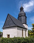
Eyba 1 | Church with equipment | |

|
Eyba 23 | lock | |

|
Eyba 25 | Homestead |
Garnsdorf
Individual monuments
| image | Street and house number | Monument designation | comment |
|---|---|---|---|

|
Feengrottenweg 2 50 ° 38 ′ 6 ″ N, 11 ° 20 ′ 30 ″ E |
Fairy grottoes , pits and tunnels of the historical alum slate mining, version of the mouth holes, well and spring house, grotto tavern and outdoor facilities | |

|
Garnsdorfer Strasse 20 50 ° 38 ′ 21 ″ N, 11 ° 20 ′ 45 ″ E |
Homestead | |

|
Garnsdorfer Strasse 33 50 ° 38 ′ 17 ″ N, 11 ° 20 ′ 46 ″ E |
Homestead | |
|
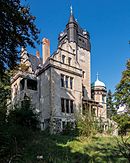
Garnsdorfer Strasse 52/54 50 ° 38 ′ 17 ″ N, 11 ° 20 ′ 28 ″ E |
Villa Auerbach with outbuildings, gates and landscaped gardens with fencing | |

|
Jacob-Grimm-Strasse 14 50 ° 38 ′ 16 ″ N, 11 ° 20 ′ 22 ″ E |
Teahouse at Villa Auerbach | |

|
Untere Dorfstrasse 13 50 ° 38 ′ 24 ″ N, 11 ° 20 ′ 56 ″ E |
Residential stable house | |

|
Lower Dorfstrasse 20 50 ° 38 ′ 22 ″ N, 11 ° 20 ′ 55 ″ E |
Residential house with half-timbered barn | |

|
Untere Dorfstrasse 21 50 ° 38 ′ 23 ″ N, 11 ° 21 ′ 0 ″ E |
Farmhouse |
Gorndorf
Monument ensemble
| image | Street and house number | Monument designation | comment |
|---|---|---|---|

|
Stauffenbergstrasse 50 ° 39 ′ 15 ″ N, 11 ° 23 ′ 30 ″ E |
Monument ensemble "Residential complex Stauffenbergstrasse 7 - 47, 146 - 168" |
Individual monuments
| image | Street and house number | Monument designation | comment |
|---|---|---|---|
|
50 ° 38 ′ 52 "N, 11 ° 24 ′ 7" E |
Former Silver mining, heaps and pinging in the wooded part of the Silberkammer passage train | ||

|
Albert-Schweitzer-Strasse 148 50 ° 39 ′ 17 ″ N, 11 ° 23 ′ 53 ″ E |
school | |

|
At Politz 10 50 ° 39 '16 "N, 11 ° 22' 54" O |
Villa in garden plot | |

|
Ratsgasse 50 ° 39 ′ 20 ″ N, 11 ° 24 ′ 7 ″ E |
Church with equipment | St. Mary's Church |

|
Weirastrasse 26 50 ° 39 ′ 24 ″ N, 11 ° 24 ′ 7 ″ E |
Farmstead |
Graba
Individual monuments
| image | Street and house number | Monument designation | comment |
|---|---|---|---|

|
At Gertrudiskirche 1 50 ° 39 ′ 19 ″ N, 11 ° 21 ′ 30 ″ E |
Church with furnishings, churchyard (former cemetery) and enclosure | Gertrudiskirche; late Gothic choir |

|
At Gertrudiskirche 2 50 ° 39 ′ 21 ″ N, 11 ° 21 ′ 31 ″ E |
Rectory | |

|
At Gertrudiskirche 3 50 ° 39 ′ 20 ″ N, 11 ° 21 ′ 30 ″ E |
Former Rectory | |

|
Fingersteinstrasse 4 50 ° 39 ′ 11 ″ N, 11 ° 21 ′ 8 ″ E |
villa | |

|
Fingersteinstrasse 34 50 ° 39 ′ 16 ″ N, 11 ° 21 ′ 23 ″ E |
Residential house with garden and enclosure | The house was built by the Jena architects Schreiter and Schlag in 1930 for the Saalfeld doctor Dr. Schöning built. In addition to the facade design with Bauhaus elements, the interior fittings with numerous built-in cupboards and an imposing staircase are particularly worth seeing. |

|
Grabaer Strasse 1 50 ° 39 ′ 19 ″ N, 11 ° 21 ′ 26 ″ E |
Former Screw factory |
Kleingeschwenda
Monument ensemble
| image | address | Monument designation | comment |
|---|---|---|---|

|
High oak 1/3 | Monument ensemble "Church and rectory" |
Individual monuments
Knobelsdorf
Individual monuments
| image | address | Monument designation | comment |
|---|---|---|---|

|
Knobelsdorf 17 | Church with equipment |
Köditz
Individual monuments
| image | Street and house number | Monument designation | comment |
|---|---|---|---|

|
At track 5, 50 ° 38 '23 "N, 11 ° 22' 26" E |
Homestead | |

|
Kapellenstrasse 12 50 ° 38 ′ 24 ″ N, 11 ° 22 ′ 28 ″ E |
Nikolauskapelle with equipment |
Lositz
Individual monuments
| image | address | Monument designation | comment |
|---|---|---|---|

|
Lositz 1 | Church with equipment |
Jehmichen
Individual monuments
| image | address | Monument designation | comment |
|---|---|---|---|

|
Jehmichen 1 | Homestead |
Obernitz
Individual monuments
| image | Street and house number | Monument designation | comment |
|---|---|---|---|

|
At the church 1 50 ° 37 ′ 40 ″ N, 11 ° 22 ′ 58 ″ E |
Church with equipment | |

|
Cemetery 50 ° 37 ′ 38 ″ N, 11 ° 23 ′ 4 ″ E |
Heyden grave site with tomb | |

|
Geschwister-Scholl-Strasse 10 50 ° 37 ′ 44 ″ N, 11 ° 22 ′ 49 ″ E |
Homestead | |

|
Geschwister-Scholl-Strasse 24 50 ° 37 ′ 39 ″ N, 11 ° 22 ′ 51 ″ E |
Homestead | |

|
Janusz-Korczak-Strasse 1/3 50 ° 37 ′ 41 ″ N, 11 ° 22 ′ 57 ″ E |
Castle (complete system) | |

|
Kronacher Strasse 3 50 ° 37 ′ 37 ″ N, 11 ° 22 ′ 55 ″ E |
Rectory |
Reichmannsdorf
- Individual monuments
| image | Street and house number | Monument designation | comment |
|---|---|---|---|

|
Goldberg 2 | So-called. Nurses station | former location |

|
Riesenbach 2 | Riesenbach 2 | |

|
Saalfelder Strasse 77 | Church with furnishings, churchyard with enclosure | Aquila Church |

|
Saalfelder Strasse 216 | Forester's house |
Remschütz
Monument ensemble
| image | Street and house number | Monument designation | comment |
|---|---|---|---|

|
Florian-Geyer-Strasse 50 ° 40 ′ 14 ″ N, 11 ° 21 ′ 19 ″ E |
Monument ensemble "Florian-Geyer-Straße 71 - 91" |
Individual monuments
| image | Street and house number | Monument designation | comment |
|---|---|---|---|

|
Village green 50 ° 40 ′ 14 ″ N, 11 ° 21 ′ 24 ″ E |
War memorial | |

|
Florian-Geyer-Strasse 73 50 ° 40 ′ 15 ″ N, 11 ° 21 ′ 17 ″ E |
Half-timbered house with arcade (part of the monument ensemble "Florian-Geyer-Straße 71-91") | |

|
Florian-Geyer-Strasse 83 50 ° 40 ′ 17 ″ N, 11 ° 21 ′ 14 ″ E |
Half-timbered house (part of the monument ensemble "Florian-Geyer-Straße 71 - 91") | |

|
Florian-Geyer-Strasse 85 50 ° 40 ′ 17 ″ N, 11 ° 21 ′ 13 ″ E |
Half-timbered house (part of the monument ensemble "Florian-Geyer-Straße 71 - 91") |
Reschwitz
Individual monuments
| image | address | Monument designation | comment |
|---|---|---|---|

|
Reschwitz 33 | Homestead | |

|
Reschwitz 53 | Edelhof | |

|
Reschwitz 55 | Former Servants' House | |

|
Reschwitz 67/68 | Former Hüthersches Mühlgut | |

|
Reschwitz 81 | Church with equipment |
Blacksmith field
Individual monuments
Unterwirbach
Monument ensemble
| image | address | Monument designation | comment |
|---|---|---|---|

|
Monument ensemble "Ortskern Unterwirbach" |
Individual monuments
Volkmannsdorf
Individual monuments
| image | address | Monument designation | comment |
|---|---|---|---|

|
Volkmannsdorf 22 | Residential building | |

|
Pikachu 46 | Church with equipment |
Wickersdorf
Monument ensemble
| image | address | Monument designation | comment |
|---|---|---|---|

|
Wickersdorf 1/22 | Monument ensemble "Entire site of the former Free School Community of Wickersdorf" | Free school community Wickersdorf |
Individual monuments
| image | address | Monument designation | comment |
|---|---|---|---|
 |
Wickersdorf 47 | Talmühle (sawmill) | |

|
Wickersdorf 56 a | Village bakery | New building 2013 |
Wittgendorf
Wittmannsgereuth
Individual monuments
| image | address | Monument designation | comment |
|---|---|---|---|

|
Wittmannsgereuth 1 | Church with equipment |
Witzendorf
Individual monuments
| image | address | Monument designation | comment |
|---|---|---|---|

|
Witzendorf 7 | Residential building |
Wöhlsdorf
Individual monuments
| image | Street and house number | Monument designation | comment |
|---|---|---|---|

|
B 85 50 ° 40 ′ 0 ″ N, 11 ° 20 ′ 30 ″ E |
Monument to Prince Louis Ferdinand of Prussia | |

|
B 85 50 ° 39 ′ 56 "N, 11 ° 20 ′ 35" E |
Memorial stone for the battle near Saalfeld on October 10, 1806 |
source
- Thuringian State Office for Monument Preservation: List of monuments of the district of Saalfeld-Rudolstadt (PDF; 632 kB)
literature
- Renate Reuther: Villas & Country Houses in Saalfeld. Culturcon-Medien, Berlin 2010, ISBN 978-3-941092-51-8 .
