
Mariental (Lower Saxony)
| coat of arms | Germany map | |
|---|---|---|

|
Coordinates: 52 ° 17 ' N , 10 ° 59' E |
|
| Basic data | ||
| State : | Lower Saxony | |
| County : | Helmstedt | |
| Joint municipality : | Grass life | |
| Height : | 130 m above sea level NHN | |
| Area : | 6.53 km 2 | |
| Residents: | 888 (Dec 31, 2019) | |
| Population density : | 136 inhabitants per km 2 | |
| Postal code : | 38368 | |
| Area code : | 05356 | |
| License plate : | HE | |
| Community key : | 03 1 54 015 | |
| Community structure: | 2 districts | |
| Association administration address: | Bahnhofstrasse 4 38368 Grasleben |
|
| Website : | ||
| Mayor : | Fred Worch ( CDU ) | |
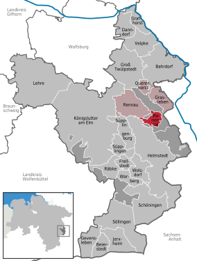
| Location of the municipality of Mariental in the Helmstedt district | ||
  |
||

Mariental is a municipality in the Helmstedt district in Lower Saxony (Germany). The municipality of Mariental is a member municipality of the integrated municipality of Grasleben .
geography
location
Mariental is about 7 kilometers north of the district town of Helmstedt in the Elm-Lappwald Nature Park . The community lies on the state border with Saxony-Anhalt .
Community structure
The municipality of Mariental consists of two districts:
history

Mariental-Dorf is the older district. It originated around the Mariental Monastery, founded in 1138 . The Mariental-Horst district has only existed since 1945 after the former air base was abandoned .
politics
The council of the municipality of Mariental consists of 9 councilors.
- 5 seats CDU parliamentary group Mariental
- 2 seats of the Mariental parliamentary group
- 2 seats Marientaler Bürgergemeinschaft
(As of: local election, September 11, 2016)
The council elected:
- to honorary mayor Fred Worch ( CDU )
- to the honorary community director Friedrich Rietz
(As of: constituent council meeting, November 17, 2016)
Honorary citizen
- Walter Naumann was made an honorary citizen on February 23, 2006 for his commitment to the community and the volunteer fire department.
- On May 18, 2008, Hans Hennig was made an honorary citizen for his commitment to the community, clubs and associations as well as the development of the village chronicle.
Culture and sights
- Mariental Monastery , this is where Duke Joachim Karl of Braunschweig-Wolfenbüttel was buried
- Lappwald
- Mariental-Horst , a former air base
economy
The largest employer is the Steinecke bread maker , with other bakeries in Bernburg (Saale) and Berlin as well as many small shops across Germany.
traffic
Mariental is located directly on the federal highway 244 , which meets the federal highway 2 from Hanover to Berlin 2 km away .
Individual evidence
- ↑ State Office for Statistics Lower Saxony, LSN-Online regional database, Table 12411: Update of the population, as of December 31, 2019 ( help ).
- ↑ a b Rudi Fischer: 800 years Calvörde - a chronicle up to 1991
- ↑ Generation change - Fred Worch is now mayor of Braunschweiger-Zeitung
Web links
Bahrdorf | Beierstedt | Danndorf | Frellstedt | Gevensleben | Grafhorst | Grass life | Groß Twülpstedt | Helmstedt | Jerxheim | Königslutter am Elm | Teaching | Mariental | Querenhorst | Räbke | Rennau | Schöningen | Söllingen | Süpplingen | Süpplingenburg | Velpke | Warberg | Wolsdorf
Municipality-free areas in the Helmstedt
Brunsleberfeld district |
Helmstedt |
Königslutter |
Mariental |
Schöningen