Fulufjellet National Park
| Fulufjellet National Park | ||
|---|---|---|
| Landscape of the Fulufjellet National Park. photographer: Gunn Oddny Olsen Haugen | ||
|
|
||
| Location: | Innlandet , Norway | |
| Next city: | Elverum | |
| Surface: | 86.4 km² | |
| Founding: | 2012 | |
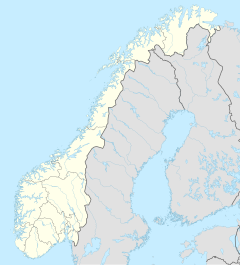
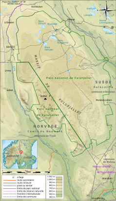
| Map showing the area of the Fulufjellet National Park | ||
The Fulufjellet National Park is a national park in the Norwegian province Innlandet in the field of community Trysil . The Fulufjell massif is a plateau mountain that belongs to Norway and Sweden . The park opened on April 27, 2012 as the 42nd national park in Norway. It covers an area of 86.4 square kilometers and borders on the east side of the national park of the same name in Sweden .
Geography, landscape and geology
The landscape is characterized by unmistakable geological occurrences from the Quaternary period and a primeval forest -like coniferous forest with a great diversity of nature. The area around Storgnollen-Steinknøsen-Furuknøsen is of scenic and Quaternary geological significance. The combination of the different topography with large differences in altitude, scree and rocky gorges makes this area particularly interesting.
Flora and fauna
The mountains are largely covered with heather vegetation, which is dominated by dwarf shrubs, grasses , sedges and rushes . There are many rare lichens and mushrooms in the national park. Spruce and pine forests , ravines and scree slopes of high natural value can be found along the mountain slopes and on the peaks . The vegetation in the high mountains is not very diverse and represents - both nationally and internationally - extremely low-species mountain vegetation. Bears are characteristic of the area, but wolves , wolverines and lynxes are also native here. The bird world is characterized by the capercaillie , black grouse , hazel grouse and ptarmigan .
Administration and use
The area is used for hunting , fishing and leisure, which is regulated in the protection regulations. The park is managed by the local national park administration.
Web links
- Fact sheet of the Directorate for naturforvaltning (PDF, Norwegian; 1.2 MB)
- Press release of the Ministry of Environment on the opening of the National Park (PDF)
Individual evidence
- ↑ a b Fact sheet of the Directorate for naturforvaltning (PDF; 1.2 MB)
- ↑ Protection plan of the Ministry of the Environment in Norwegian ( page no longer available , search in web archives ) Info: The link was automatically marked as defective. Please check the link according to the instructions and then remove this notice. (PDF; 195 kB)
- ↑ Information from the Directorate for naturforvaltning ( page no longer available , search in web archives ) Info: The link was automatically marked as defective. Please check the link according to the instructions and then remove this notice. (PDF)


