Lower Oerrelbach area
|
Lower Oerrelbach area
|
||
|
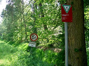
Reference to the NSG near the Lönsdenkmal, the NSG "Ise with tributaries" begins right next to the path |
||
| location | North of Wahrenholz , Gifhorn district , Lower Saxony | |
| surface | 134.3 ha | |
| Identifier | NSG BR 132 | |
| WDPA ID | 378135 | |
| Geographical location | 52 ° 39 ' N , 10 ° 34' E | |
|
|
||
| Sea level | from 60 m to 79 m | |
| Setup date | August 29, 2007 | |
| administration | NLWKN | |
The lowland area of Oerrelbach is a nature reserve in the Lower Saxony municipalities of Wahrenholz in the joint municipality of Wesendorf and Dedelstorf in the joint municipality of Hankensbüttel in the district of Gifhorn .
The nature reserve with the sign NSG BR 132 is 140 hectares in size. It is completely part of the FFH area "Rössenbergheide-Külsenmoor, Heiliger Hain". In the south it borders directly on the nature reserve " Heiliger Hain ", in the north on the nature reserve " Rössenbergheide-Külsenmoor " and in the south-east on the nature reserve " Ise with tributaries ". West and east it borders on the landscape protection area "Ostheide". The area has been under nature protection since September 13, 2007. The responsible lower nature conservation authority is the district of Gifhorn.
The nature reserve is located north of Wahrenholz on the eastern edge of an ice age ground moraine . It connects the nature reserves "Rössenbergheide-Külsenmoor" and "Heiliger Hain" to form an important heather and transitional moor complex.
The nature reserve includes Geest slopes falling to the lower part of the Oerrelbach in the northeast and part of the Oerrelbach lowland . The area is characterized by moor forest in the lower elevations and by pine forest on the dry Geest slopes . The geest slopes are preceded by spring moors that have been changed by peat digging. Part of the area is used as grassland . On unused land is in some regions moorland to find in dry locations and sandy heath .
The moor areas drain to the Oerrelbach, which is lined with alder bushes.


