
Pfaffenschlag near Waidhofen an der Thaya
|
Pfaffenschlag near Waidhofen adThaya
|
||
|---|---|---|
| coat of arms | Austria map | |
 |
|
|
| Basic data | ||
| Country: | Austria | |
| State : | Lower Austria | |
| Political District : | Waidhofen an der Thaya | |
| License plate : | WT | |
| Surface: | 29.74 km² | |
| Coordinates : | 48 ° 50 ′ N , 15 ° 11 ′ E | |
| Height : | 570 m above sea level A. | |
| Residents : | 923 (January 1, 2020) | |
| Postal code : | 3834 | |
| Area code : | 02848 | |
| Community code : | 3 22 14 | |
| NUTS region | AT124 | |
| Address of the municipal administration: |
Pfaffenschlag 110 3834 Pfaffenschlag near Waidhofen adThaya |
|
| Website: | ||
| politics | ||
| Mayor : | Willibald Pollak ( ÖVP ) | |
|
Municipal Council : ( 2020 ) (15 members) |
||
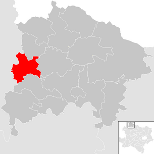
| Location of Pfaffenschlag near Waidhofen adThaya in the Waidhofen an der Thaya district | ||
  |
||
| Source: Municipal data from Statistics Austria | ||

Pfaffenschlag bei Waidhofen adThaya is a municipality with 923 inhabitants (as of January 1, 2020) in the district of Waidhofen an der Thaya in Lower Austria .
geography
Pfaffenschlag near Waidhofen an der Thaya is located in the northern Waldviertel in Lower Austria. The area of the municipality covers 29.74 km². About 36% of the area is forested.
Community structure
The municipality includes eight cadastral communities and towns of the same name (area 2016, population on January 1, 2020):
- Arnolz (263.99 ha, 76 Ew.)
- Artolz (390.84 ha, 57 Ew.)
- Eisenreichs (205.02 ha, 55 Ew.)
- Großeberharts (401.42 ha, 79 Ew.), The place bears the different name Groß-Eberharts
- Kleingöpfritz (547.13 ha, 114 Ew.)
- KG Pfaffenschlag (546.59 ha), OS Pfaffenschlag near Waidhofen an der Thaya (409 Ew.)
- Rohrbach (468.92 ha, 65 Ew.)
- Schwarzenberg (142.69 ha, 68 Ew.)
Neighboring communities
| Eggern | Gastern | |
| Heidenreichstein |
.svg)
|
Thaya |
| Waidhofen an der Thaya-Land | Waidhofen an der Thaya |
history
The district of Groß-Eberharts was first mentioned in 1112, Rohrbach in 1365, and Arnolz in 1230.
Since the addition of the name addition, Pfaffenschlag has Austria's longest community name (40 characters), also in the official version Pfaffenschlag bei Waidhofen adThaya (37), and also without spaces (35), followed by St. Georgen bei Obernberg am Inn and St. Marienkirchen at the Polsenz (32 each with spaces) - and also with the former the one with the most words.
Population development
According to the results of the 2001 census, there were 980 inhabitants. In 1991 the municipality had 970 inhabitants, 1071 in 1981 and 1193 in 1971.
Sports club
The Pfaffenschlag sports club was founded on July 25, 1953. The club colors are black and white. The main sponsor is WEB Windenergie AG. At the time of the provisional cessation of gaming due to the Covid 19 pandemic in spring 2020, the club was playing in 1st class Waldviertel.
politics
The municipal council has 15 members.
- With the municipal council elections in Lower Austria in 1990, the municipal council had the following distribution: 12 ÖVP , 2 FPÖ , and 1 SPÖ .
- With the municipal council elections in Lower Austria in 1995, the municipal council had the following distribution: 12 ÖVP, 2 FPÖ, and 1 SPÖ.
- With the municipal council elections in Lower Austria in 2000, the municipal council had the following distribution: 12 ÖVP, 2 FPÖ, and 1 SPÖ.
- With the municipal council elections in Lower Austria in 2005 , the municipal council had the following distribution: 13 ÖVP, 1 FPÖ, and 1 SPÖ.
- With the municipal council elections in Lower Austria in 2010 , the municipal council had the following distribution: 13 ÖVP, and 2 FPÖ.
- With the municipal council elections in Lower Austria in 2015 , the municipal council had the following distribution: 13 ÖVP and 2 FPÖ.
- With the municipal council elections in Lower Austria 2020 , the municipal council has the following distribution: 12 ÖVP, 2 FPÖ and 1 SPÖ.
- mayor
- until 2013 Johannes Semper (ÖVP)
- since 2014 Willibald Pollak (ÖVP)
Culture and sights

- Catholic parish church Pfaffenschlag hl. Martin: The core of the church is Romanesque and Gothic and was redesigned in the 19th century. The high altar dates from around 1720.
- In Kleingöpfritz there has been a local chapel since 1783, which was expanded in 1895. The local chapel in Rohrbach was built in the first half of the 19th century. In Groß-Eberharts the local chapel with its neo-baroque altar has existed at least since 1873. The local chapel in Artolz was built in 1874 and in 1904 was given a tower.
- To the east of Pfaffenschlag there is a stone statue of St. John of Nepomuk from the 18th century.
economy
In 2010 there were 89 agricultural and forestry holdings in the municipality . As of 2011, 38 non-agricultural workplaces were also identified. The number of people in employment at the place of residence was 460 in 2011, which corresponds to an employment rate of 51.31 percent. WEB Windenergie is the largest employer .
Web links
- 32214 - Pfaffenschlag near Waidhofen an der Thaya. Community data, Statistics Austria .
Individual evidence
- ↑ Federal Office for Metrology and Surveying, Regional Information, reference date December 31, 2016, accessed on February 19, 2017
- ↑ Statistics Austria: Population on January 1st, 2020 by locality (area status on January 1st, 2020) , ( CSV )
- ^ Website of the SC Pfaffenschlag. Retrieved August 25, 2020 .
- ^ Result of the municipal council election 1995 in Pfaffenschlag near Waidhofen an der Thaya. Office of the Lower Austrian State Government, March 30, 2000, accessed on May 11, 2019 .
- ^ Election result of the municipal council election 2000 in Pfaffenschlag near Waidhofen an der Thaya. Office of the Lower Austrian State Government, February 4, 2005, accessed on May 11, 2019 .
- ^ Election result of the municipal council election 2005 in Pfaffenschlag near Waidhofen an der Thaya. Office of the Lower Austrian State Government, March 4, 2005, accessed on May 11, 2019 .
- ^ Election result of the municipal council election 2010 in Pfaffenschlag near Waidhofen an der Thaya. Office of the Lower Austrian State Government, October 8, 2010, accessed on May 11, 2019 .
- ^ Election results for the 2015 municipal council election in Pfaffenschlag near Waidhofen an der Thaya. Office of the Lower Austrian State Government, December 1, 2015, accessed on May 11, 2019 .
- ↑ Results of the municipal council election 2020 in Pfaffenschlag near Waidhofen an der Thaya. Office of the Lower Austrian State Government, January 26, 2020, accessed on January 26, 2020 .
- ↑ a b c municipality data Pfaffenschlag near Waidhofen an der Thaya. In: noe.gv.at. November 28, 2018, accessed May 13, 2019 .
Cadastral communities: Arnolz | Artolz | Eisenreichs | Großeberharts | Kleingöpfritz | Pfaffenschlag | Rohrbach | Schwarzenberg
Locations: Arnolz | Artolz | Eisenreichs | Großeberharts | Johannessiedlung | Kleingöpfritz | Pfaffenschlag near Waidhofen an der Thaya | Rohrbach | Schwarzenberg
Villages: Pfaffenschlag near Waidhofen an der Thaya Villages: Arnolz | Artolz | Eisenreichs | Großeberharts | Kleingöpfritz | Pfaffenschlag near Waidhofen an der Thaya | Rohrbach Settlement: Johannessiedlung Weiler: Rotte Flea Mill : Drösiedl Scattered Houses: Schwarzenberg
Counting district: Pfaffenschlag b.Waidhfn. | Great Eberharts | Klein-Göpfritz | Rohrbach
