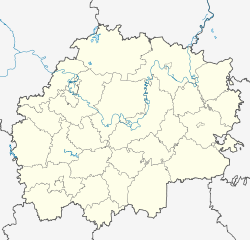
Putyatino (Ryazan)
| Village
Putjatino
Путятино
|
||||||||||||||||||||||||||||||||
|
||||||||||||||||||||||||||||||||
|
||||||||||||||||||||||||||||||||
Putjatino ( Russian Путя́тино ) is a village (selo) in the Ryazan Oblast in Russia with 3,047 inhabitants (as of October 14, 2010).
geography
The place is a good 100 km as the crow flies southeast of the Ryazan Oblast Administrative Center on the Worscha river, which flows into the right-hand Oka tributary Tyrnitsa just 10 km north .
Putjatino is the administrative center of the Putjatinsky Rajons as well as the seat of the rural community Putjatinskoje selskoje posselenije, which also includes the villages Glebowo (4 km southeast) and Klimowka (3 km north) and the settlements Dubki (7 km southwest), Krasnoye Shirino (11 km south-southwest, both of them without permanent residents) and Voropaevka (3 km south) belong.
history
The village, which was probably built as a fortified settlement at the beginning of the 16th century, belonged to the boyar family Godunow towards the end of the century , from which Tsar Boris Godunow also emerged . It was mentioned in a document for the first time in 1628. In the 17th century, Putjatino came into the possession of Prince Dmitri Poscharski's son and gained local economic importance. From 1778 the village belonged to the Ujesd Saposchok of the governorship, from 1796 to the Ryazan governorate . As the largest village in the Ujesd - only a little smaller than the administrative seat of Saposhok - it became the seat of a Volost .
After the introduction of the Rajon division, Putjatino belonged to the Schilowski rajon from July 12, 1929, with its seat in about 25 km northwest of Schilowo until it became the administrative seat of a new Rajon named after him on February 21, 1935. In 1963 the Rajon was temporarily disbanded and its territory was divided among the surrounding Rajons, but in March 1977 it was restored within the former borders.
Population development
| year | Residents |
|---|---|
| 1897 | 3866 |
| 1939 | 3880 |
| 1959 | 2426 |
| 1979 | 2042 |
| 1989 | 2389 |
| 2002 | 3122 |
| 2010 | 3047 |
Note: census data
traffic
Putjatino is on the M5 Ural federal highway , which connects Moscow with Chelyabinsk via Samara and Ufa . The nearest train station is Shilovo, about 25 km away on the Moscow - Rusajewka - Samara route.
Web links
Individual evidence
- ↑ a b Itogi Vserossijskoj perepisi naselenija 2010 goda. Tom 1. Čislennostʹ i razmeščenie naselenija (Results of the All-Russian Census 2010. Volume 1. Number and distribution of the population). Tables 5 , pp. 12-209; 11 , pp. 312–979 (download from the website of the Federal Service for State Statistics of the Russian Federation)


