Rammert (FFH area)
|
FFH area "Rammert"
|
||
|
Espenloch, view up to the rear heap |
||
| location | District of Tübingen and Zollernalbkreis , Baden-Württemberg , Germany | |
| WDPA ID | 555521949 | |
| Natura 2000 ID | DE-7519-342 | |
| FFH area | 28.59 km² | |
| Geographical location | 48 ° 26 ' N , 8 ° 58' E | |
|
|
||
| Setup date | January 1, 2005 | |
| administration | Regional Council Tübingen | |
The FFH area Rammert is located in the middle of Baden-Württemberg and is part of the European Natura 2000 network of protected areas . It was designated in 2005 by the Tübingen regional council.
location
The approximately 2859 hectare (hectare) protected area Rammert is located in the natural areas of the Southwestern Alb foreland , Central Alb foreland , Schönbuch and Glemswald and Obere Gäue . The six sub-areas are located in the municipalities of Dußlingen , Bodelshausen , Hirrlingen , Ofterdingen , Rottenburg am Neckar and Tübingen in the Tübingen district and Hechingen and Rangendingen in the Zollernalb district.
description
The nature of the landscape of the protected area is essentially determined by the largely wooded ridge of the Rammert, which is divided by partly deeply incised blades and valleys. There are many orchards on the edge of the slopes, which merge into grassland and arable land in the valley floodplains of Neckar , Steinlach and Katzenbach .
Protection purpose
Habitat types
The following habitat types according to Annex I of the Habitats Directive occur in the area:
| EU code |
* | Habitat type (official name) | Short name |
|---|---|---|---|
| 3150 | Natural eutrophic lakes with magnopotamion or hydrocharition vegetation | Natural nutrient-rich lakes | |
| 3260 | Rivers of the planar to montane level with vegetation of the Ranunculion fluitantis and the Callitricho-Batrachion | Running waters with flooding aquatic vegetation | |
| 6210 | * | Near-natural dry lime lawns and their stages of shrubbery (Festuco-Brometalia) (* special stands with remarkable orchids) | Lime grassland - orchid-rich stands * |
| 6430 | Moist tall herbaceous vegetation of the planar and montane to alpine level | Moist tall herbaceous vegetation | |
| 6510 | Lean lowland hay meadows ( Alopecurus pratensis, Sanguisorba officinalis ) | Lean, lowland hay meadows | |
| 7220 | * | Tufa springs (cratoneurion) | Tufa springs |
| 7230 | Lime-rich fens | Lime-rich fens | |
| 9110 | Grove beech forest (Luzulo-Fagetum) | Grove beech forest | |
| 9130 | Woodruff beech forest (Asperulo-Fagetum) | Woodruff beech forest | |
| 9160 | Subatlantic or Central European Pedunculate Oak Forest or Oak-Hornbeam Forest (Carpinion betuli) | Chickweed-oak-hornbeam forest | |
| 9170 | Bedstraw-oak-hornbeam forest Galio-Carpinetum | Bedstraw-oak-hornbeam forest | |
| 9180 | * | Mixed ravine and hillside forests (Tilio-Acerion) | Mixed ravine and hillside forests |
| 91E0 | * | Alluvial forests with Alnus glutinosa and Fraxinus excelsior (Alno-Padion, Alnion incanae, Salicion albae) | Alluvial forests with alder, ash, willow |
Species inventory
The following types of community interest exist in the area:
| image | EU code |
* | Art | scientific name | Species group |
|---|---|---|---|---|---|

|
1078 | * | Spanish flag | Callimorpha quadripunctaria | Butterflies |

|
1083 | * | Stag beetle | Lucanus cervus | Beetle |

|
1093 | * | Stone cancer | Austropotamobius torrentium | Crayfish |

|
1323 | Bechstein's bat | Myotis bechsteinii | Mammals | |

|
1324 | Great mouse ear | Myotis myotis | Mammals | |

|
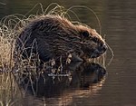
1337 | beaver | Castor fiber | Mammals | |

|
1381 | Green broom moss | Dicranum viride | Mosses |
Contiguous protected areas
The following nature reserves are part of the FFH area:
- Espenloch-Hintere Halde
- Leek heap
- Bühler Tal and Unterer Bürg
- Vollmershalde
- Rappenberg
- Katzenbach-Dünnbachtal
- Winter dump
The bird sanctuary in Mittlerer Rammert largely overlaps with the FFH area.
See also
Individual evidence
- ↑ a b c Tübingen regional council (ed.): Management plan for the FFH area 7519-342 Rammert and the bird sanctuary 7519-401 Mittlerer Rammert . edited by ILN Bühl. August 31, 2012 (190 pages, baden-wuerttemberg.de [PDF]).
Web links
- Standard data sheet for the FFH area "Rammert"
- Profile of the FFH area Rammert in the protected area directory of the LUBW
- Regional Council Tübingen (Ed.): Management plan for the FFH area 7519-342 Rammert and the bird sanctuary 7519-401 Mittlerer Rammert . edited by ILN Bühl. August 31, 2012 (190 pages, baden-wuerttemberg.de [PDF]).

