Ratměřice
| Ratměřice | ||||
|---|---|---|---|---|
|
||||
| Basic data | ||||
| State : |
|
|||
| Region : | Středočeský kraj | |||
| District : | Benešov | |||
| Area : | 954 ha | |||
| Geographic location : | 49 ° 39 ' N , 14 ° 45' E | |||
| Height: | 498 m nm | |||
| Residents : | 301 (Jan. 1, 2019) | |||
| Postal code : | 257 03 | |||
| traffic | ||||
| Street: | Votice - Louňovice pod Blaníkem | |||
| structure | ||||
| Status: | local community | |||
| Districts: | 3 | |||
| administration | ||||
| Mayor : | Viktor Liška (as of 2008) | |||
| Address: | Ratměřice 72 25703 Jankov |
|||
| Municipality number: | 532550 | |||
| Website : | www.ratmerice.cz | |||
Ratměřice (German Radmierschitz ) is a municipality in the Czech Republic . It is located twelve kilometers southwest of Vlašim and belongs to the Okres Benešov .
geography
Ratměřice is located in the Středočeská pahorkatina in an area called Česká Sibiř ( Bohemian Siberia ).
Neighboring towns are Skrýšov in the north, Hrzín and Ondřejovec in the northeast, Vlastišov and Vestec in the east, Zvěstov and Šlapánov in the southeast, Odlochovice and Nosákov in the south, Královna and Vlčkovice in the southwest, Habrovka in the west and Jankov in the northwest.
history
Ratmířici was first mentioned in 1220. The village was founded by a country gentleman named Ratmír . The church of St. Gallus has been a parish church since 1350. In the 14th century the Louňovice Monastery acquired the place. After its destruction by the Taborites , Ratměřice belonged to the property of the town of Tábor . Ferdinand I. confiscated all goods of the rebellious town of Tábor in 1547 and sold Louňovice including Ratměřice to Oldřich Skuhrovský von Skuhrov the following year. On March 6, 1645 Ratměřice was on the battlefield of Jankau , on that day the whole village fell to rubble. In 1665 Franz Wilhelm von Talmberg acquired Ratměřice and added the village to his estates in Vlašim .
1702 Rudolf von Talmberg sold Ratměřice together with Jankov to Johann Anton Kořenský von Terešov. Kořenský, who had been raised to the rank of count in 1705, had a castle built in Ratměřice and moved his seat from Jankov to Ratměřice. In 1719 his four sons sold the combined estate Ratměřice-Jankov with the castles Jankov and Ratměřice to Jiří Vojický from Nová Ves. In 1822 the Counts Chotek von Chotkow and Vojnín acquired the rule. In 1848 the cavalier Otto Chotek had a park with rare trees laid out around the castle.
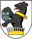
In 1890 the village had 373 inhabitants. After the abolition of patrimonial Ratměřice formed from 1848 a district of the market town Jankov in the Selchan district . In 1900 the village gained its independence and formed a municipality with the district of Skrýšov. After the Second World War the place came to the Okres Votice. On January 1, 1961, it was dissolved and reclassified to Okres Benešov . In 1980 Ratměřice was incorporated into Jankov. Ratměřice has existed again since November 24, 1990. The district of Hrzín has belonged to Ratměřice since 1990. The community has had a coat of arms since 1997. On March 1, 2008, hurricane Emma caused severe damage, mainly in the forests around the town.
Local division
The municipality Ratměřice consists of the districts Hrzín ( Hersin ), Ratměřice ( Radmierschitz ) and Skrýšov ( Skrejschow ).
Attractions
- St. Gallus Church, built around 1220
- Ratměřice Castle, built in 1750 as a baroque building. There are two giant sequoias in the English landscape garden, which was laid out in 1848
- Monument on the place of the surrender of the imperial troops in the battle of Jankau, northwest of the village near Habrovka
- Fountain on the village square, built in 1888
Sons and daughters of the church
- Josef Vlach (1923–1988), conductor

