Deggingen
| coat of arms | Germany map | |
|---|---|---|

|
Coordinates: 48 ° 36 ' N , 9 ° 43' E |
|
| Basic data | ||
| State : | Baden-Württemberg | |
| Administrative region : | Stuttgart | |
| County : | Goeppingen | |
| Height : | 492 m above sea level NHN | |
| Area : | 22.7 km 2 | |
| Residents: | 5331 (December 31, 2018) | |
| Population density : | 235 inhabitants per km 2 | |
| Postal code : | 73326 | |
| Area code : | 07334 | |
| License plate : | GP | |
| Community key : | 08 1 17 014 | |
| LOCODE : | DE 79E | |
| Address of the municipal administration: |
Bahnhofstrasse 9 73326 Deggingen |
|
| Website : | ||
| Mayor : | Karl Weber | |
| Location of the municipality of Deggingen in the district of Göppingen | ||


Deggingen is a municipality in Baden-Württemberg , which belongs to the district of Göppingen .
geography
Geographical location
Deggingen is located roughly in the middle of the Upper Filstal on the ascent to the Swabian Alb at an altitude of 470 to 520 meters.
Community structure
The formerly independent municipality of Reichenbach im Täle belongs to the municipality of Deggingen. The municipality of Deggingen within the borders of December 31, 1974 includes the village of Deggingen, the hamlet of Berneck, the church and monastery of Ave Maria (Tugstein) and the houses of Bierkeller and Nordalb as well as the lost village of Bogenweiler. The village Reichenbach im Täle and the homestead Gairen as well as the defunct Gerenberg Castle belong to the former municipality of Reichenbach im Täle .
Division of space

According to data from the State Statistical Office , as of 2014.
history
Incorporations
On January 1, 1975, Reichenbach was incorporated into Deggingen.
Population development
Source: Baden-Württemberg State Statistical Office for data from 1961
| date | Residents |
|---|---|
| 1837 | 2419 |
| 1907 | 2331 |
| May 17, 1939 | 2584 |
| September 13, 1950 | 3820 |
| June 6, 1961 | 4737 |
| May 27, 1970 | 5415 |
| December 31, 1983 | 5508 |
| May 25, 1987 | 5548 |
| December 31, 1991 | 5814 |
| December 31, 1995 | 5709 |
| December 31, 2000 | 5668 |
| December 31, 2005 | 5664 |
| December 31, 2010 | 5456 |
| December 31, 2015 | 5279 |
politics
Municipal council
In Deggingen, the municipal council is elected using the spurious selection of a part of town. The number of local councils can change due to overhang mandates . The municipal council in Deggingen has 15 members after the last election (unchanged). The local election on May 26, 2019 led to the following official final result. The municipal council consists of the elected voluntary councilors and the mayor as chairman. The mayor is entitled to vote in the municipal council.
| Parties and constituencies |
% 2019 |
Seats 2019 |
% 2014 |
Seats 2014 |
||
| CDU | Christian Democratic Union of Germany | 51.51 | 8th | 63.49 | 9 | |
| FW | Free voters Deggingen | 35.71 | 5 | 24.26 | 4th | |
| SPD | Social Democratic Party of Germany | 12.78 | 2 | 12.24 | 2 | |
| total | 100.0 | 15th | 100.0 | 15th | ||
| voter turnout | 64.85% | 54.03% | ||||
mayor
Karl Weber has been mayor since 2007; he was confirmed in office in March 2015 with 86.9 percent of the votes cast. Wolfgang Schweizer (8.5%) and Andreas Fischer (2.1%) had also applied for the office together with Weber.
coat of arms
The town's coat of arms shows a white elephant head with a yellow six-pointed star underneath on a red background. The elephant was the heraldic animal of the Counts of Helfenstein , who owned the place until it died out in 1627. The star is probably just a distinctive symbol. The elephant head and star are first documented as court seals of the Deggingen market in 1551. In 1954 a different-looking city relief was attached to the town hall, which connects the Helfenstein coat of arms with that of the local nobility. At the request of the municipality, the Ministry of the Interior awarded the original coat of arms with the Helfenstein colors of white and red on June 30, 1959.
Partnerships
The partner community of Deggingen is Kottmar in Upper Lusatia in Saxony . Other partnerships were also considered, but they were never realized.
Economy and Infrastructure
traffic
Street
Deggingen is divided in its north-south axis by the federal highway 466 . The federal road runs through the entire Upper Filstal and thus connects the federal highway 8 with Geislingen. This street is heavily frequented every day by commuters and goods traffic.
Public transportation
Deggingen was connected to the rail network from 1903 to 1983 by the Geislingen an der Steige-Wiesensteig ("Tälesbahn") branch line. The Royal Württemberg State Railways built the station building as a type IIb unit station . Today bus routes connect Deggingen u. a. with the cities of Göppingen , Geislingen an der Steige and Wiesensteig .
wheel
The area of the former railway embankment was converted into a bicycle path. As a result, the Upper Filstal has an excellently developed network of cycle paths and is part of the " Filstalroute ".
Air traffic
There is a glider flying site in the hamlet of Berneck .
Culture and sights
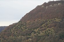
Deggingen is on the Schwäbische Albstraße , which leads past many sights. In the north of Deggingen is the "Nordalb", which offers an excellent view of the Upper Filstal.
societies
- The Deggingen shooting club was founded in 1674.
- The Liederkranz Concordia Deggingen was founded in 1867. With its eight sub-groups (mixed choir, young choir, youth choir, children's choir, Notahopser, mandolin, theater and binocular group), Concordia is one of the most structured associations in Deggingen.
- In 1958 the Deggingen Music Association was founded. The local brass music has a tradition going back more than 100 years.
- Pathfinder Deggingen: In 1962 the DPSG- Tribe Deggingen was founded.
- In 1985 the BSC Deggingen eV was founded
building
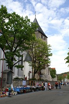
- Baroque parish church
- Sanctuary of Ave Maria
- In 1976, the remains of a Roman fortification were found near Deggingen ; see: Deggingen Castle
Sons and daughters of the church
- Marcel Atze (* 1967), German scholar, folklorist and librarian in Vienna
- Johann Georg Martin Dursch (1800–1881), Catholic professor of aesthetics and writer
- Ulrich von Kirchbach (* 1956), lawyer, since 2002 mayor for culture, youth and social affairs and integration of the city of Freiburg im Breisgau
- Monika Müller (* 1971), multiple German synchronized swimming champion
literature
- Fritz Darcis, Herbert Allmendinger: Deggingen and Reichenbach im Täle: a home book compiled by the work group Heimatbuch: Geislingen an der Steige: Maurer, [2010]. ISBN 978-3-00-033078-0
Web links
Individual evidence
- ↑ State Statistical Office Baden-Württemberg - Population by nationality and gender on December 31, 2018 (CSV file) ( help on this ).
- ^ The state of Baden-Württemberg. Official description by district and municipality. Volume III: Stuttgart District, Middle Neckar Regional Association. Kohlhammer, Stuttgart 1978, ISBN 3-17-004758-2 . Pp. 289-290
- ↑ State Statistical Office, area since 1988 according to actual use for Deggingen.
- ^ Federal Statistical Office (ed.): Historical municipality directory for the Federal Republic of Germany. Name, border and key number changes in municipalities, counties and administrative districts from May 27, 1970 to December 31, 1982 . W. Kohlhammer, Stuttgart / Mainz 1983, ISBN 3-17-003263-1 , p. 462 .
- ↑ Election information for the municipal data center
- ^ Rainer Stein: The Württemberg standard station on branch lines . In: Eisenbahn-Journal Württemberg-Report . tape 1 , no. V / 96 . Merker, Fürstenfeldbruck 1996, ISBN 3-922404-96-0 , p. 80-83 .


