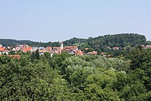
Rechberghausen
| coat of arms | Germany map | |
|---|---|---|

|
Coordinates: 48 ° 44 ' N , 9 ° 38' E |
|
| Basic data | ||
| State : | Baden-Württemberg | |
| Administrative region : | Stuttgart | |
| County : | Goeppingen | |
| Height : | 339 m above sea level NHN | |
| Area : | 6.4 km 2 | |
| Residents: | 5426 (Dec. 31, 2018) | |
| Population density : | 848 inhabitants per km 2 | |
| Postal code : | 73098 | |
| Area code : | 07161 | |
| License plate : | GP | |
| Community key : | 08 1 17 038 | |
| LOCODE : | DE 79G | |
| Address of the municipal administration: |
Amtsgasse 4 73098 Rechberghausen |
|
| Website : | ||
| Mayor : | Claudia Dörner | |
| Location of the municipality of Rechberghausen in the district of Göppingen | ||
Rechberghausen is a municipality in the north of the district of Göppingen in Baden-Württemberg . It belongs to the Stuttgart region (until 1992 the Middle Neckar region ) and the peripheral zone of the European metropolitan region of Stuttgart .
geography
Geographical location
The community is located in the foreland of the central Swabian Alb and on the edge of the eastern Schurwald at around 320 to 400 m above sea level. NN am Marbach , a right tributary of the Fils . At the entrance to the main town, lying on both banks and slopes of the stream, its large right upper reaches Herrenbach flows towards it.
Neighboring communities
The municipality of Börtlingen borders in the north-west and Birenbach in the north-east . The eastern and south-eastern neighbors are the district town of Göppingen , with whose district Bartenbach Rechberghausen has grown together, the western part is the municipality of Wangen . All are in the district of Göppingen.
structure
The community consists of the main town Rechberghausen and the much smaller hamlet of Oberhausen northeast of it.
Division of space

According to data from the State Statistical Office , as of 2014.
history
The place was first mentioned in a document in 1245. At that time it belonged to the Dukes of Teck , after the castle there had previously belonged to the Lords of Rechberg . In 1366 the place and castle came to Austria . In 1374 Austria sold both to the Lords of Rechberg zu Hohenrechberg . Count Alois Clemens von Rechberg had the New Palace (today's town hall) built in 1721. In 1733 the Upper Village fell back to Austria. Empress Maria Theresa enfeoffed Count Johann Joseph von Preysing with it in 1749 . His son sold the village to the Counts of Degenfeld-Schonburg in 1789 . As a result of mediatization , Rechberghausen came to Württemberg at the end of 1805 . In the course of the implementation of the new administrative structure in the Kingdom of Württemberg , Rechberghausen was assigned to the Oberamt Göppingen .
In a flood disaster in 1853, 37 residents died and 8 houses were destroyed.
The administrative reform of April 25, 1938 led to membership in the district of Göppingen . After the Second World War, the place became part of the American zone of occupation and since 1945 it has belonged to the newly founded state of Württemberg-Baden , which became part of the current state of Baden-Württemberg in 1952.
In the 1980s, the town center was redeveloped and the Lindach industrial estate developed.
Religions
Up until the Reformation , Rechberghausen was parish off to Göppingen , but since the Rechberg lords remained Roman Catholic , their own parish was set up there. Until the 1970s, Catholics were denominational in large numbers. The Catholic Church of the Assumption was consecrated in 1912.
Today there is a Protestant parish in Rechberghausen. Until 2017 it comprised the communities of Rechberghausen and Wäschenbeuren . Protestant residents moved in mainly after the Second World War. In the case of Rechberghausen these belonged initially to the parish of Bartenbach , in the case of Wäschenbeuren to the parish of Lorch. In 1955, the branch church community Rechberghausen was established as a subsidiary of the mother community Bartenbach and its own parish in Rechberghausen. In 1960/61 the Stuttgart architect Paul Heim jun. his own church, the Jesus Christ Church with community rooms on the slope floor below. The painter and graphic artist Albrecht Braun designed the church outside in the entrance area with concrete reliefs (crucifixion, resurrection, Emmaus, Pentecost) and on the east wall with a sgraffito (Michael's dragon fight). In 1974 the branch parish Rechberghausen was separated from the mother parish of Bartenbach and raised to an independent parish. At the same time, the Protestant residents from Wäschenbeuren were assigned to her. Wäschenbeuren was then detached from Rechberghausen on January 1, 2018 and connected with the Hohenstaufen parish to form the new parish on Hohenstaufen . The church community Rechberghausen also runs a kindergarten in Rechberghausen.
Population development
Source: Baden-Württemberg State Statistical Office for data from 1970
| date | Residents |
|---|---|
| 1837 | 737 |
| 1907 | 1335 |
| May 17, 1939 | 1726 |
| September 13, 1950 | 2514 |
| May 27, 1970 | 4629 |
| December 31, 1983 | 4916 |
| May 25, 1987 | 4991 |
| December 31, 1991 | 5305 |
| December 31, 1995 | 5245 |
| December 31, 2000 | 5490 |
| December 31, 2005 | 5532 |
| December 31, 2010 | 5366 |
| December 31, 2015 | 5424 |
politics
Administrative association
The community belongs with the neighboring communities Adelberg , Birenbach and Börtlingen to the community administration association "Eastern Schurwald" , which has its seat in Rechberghausen.
coat of arms
Blazon: In silver on a green three-mountain, an upright red roebuck .
Originally the community had an ibex on its mayor's office seal, but on October 16, 1932, it exchanged it for the "talking" coat of arms with the roebuck. This stands for the Rehberge, in connection with the Dreiberg, as well as for the von Rechberg family, to whose rule the place belonged until 1789.
The flag colors green and white were awarded by the Ministry of the Interior on February 18, 1959.
mayor
Mayor was Reiner Johannes Ruf from December 1, 1977 to June 30, 2015. Claudia Dörner was elected as the new mayor in April 2015. Ms. Dörner has been in office since July 1, 2015. Before the election, she worked for the municipal administration in Dettingen unter Teck .
Municipal council
The municipal council in Rechberghausen has 18 members. The local elections on May 26, 2019 led to the following final result. The municipal council consists of the elected voluntary councilors and the mayor as chairwoman. The mayor is entitled to vote in the municipal council.
| Parties and constituencies |
% 2019 |
Seats 2019 |
% 2014 |
Seats 2014 |
||
| UB | Independent citizens of Rechberghausen | 45.06 | 8th | 36.12 | 6th | |
| Green | The green | 21.39 | 4th | 15.99 | 3 | |
| CDU | Christian Democratic Union of Germany | 14.88 | 3 | 27.15 | 5 | |
| SPD | Social Democratic Party of Germany | 18.67 | 3 | 20.74 | 4th | |
| total | 100.0 | 18th | 100.0 | 18th | ||
| voter turnout | 62.08% | 50.26% | ||||
Twin cities
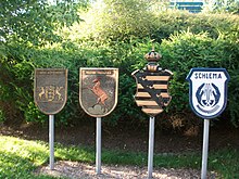
The partner community of Rechberghausen has been the community of Bad Schlema in Saxony since 1991 .
Economy and Infrastructure

traffic
The community is on the federal highway 297 ( Tübingen - Lorch ). From 1912 to 1984 it was also connected to the rail network by the Hohenstaufenbahn ( Schwäbisch Gmünd - Göppingen ).
education
The Schurwald secondary and secondary school is located in Rechberghausen . There is also a two-tier primary school , a communal, a Roman Catholic and a Protestant kindergarten . In addition, there is a branch of the Schurwald Adult Education Center and the Schurwald Music School in Rechberghausen.
Culture and sights
theatre
In the former station of the Hohenstaufenbahn there is an amateur theater, the Theater im Bahnhof , with a regular program.
In the summer, the children's theater week organized by the community takes place every year, during which 3 prizes are awarded to the best theater groups.
Green project 2009
The Rechberghausen green project , a small state horticultural show in Baden-Württemberg, was opened on May 29, 2009 . In addition, a landscape park with a lake and the 12.3 m high Luftikus observation tower were created .
The hoped-for number of visitors of 120,000 was far exceeded at the end of the four-month event with over 240,000 guests.
Personalities
Sons and daughters of the church
- Pankraz Stollenmayer (1889–1980), Benedictine, theologian and historian
- Paul Scheurle (1892–1952), sculptor
- Wolfgang Frey (* 1942), botanist and rainforest researcher
Personalities who have worked on site
- Konrad Plieninger (1928–2008), high school professor, historian, Romance studies and German studies
Web links
swell
- ↑ State Statistical Office Baden-Württemberg - Population by nationality and gender on December 31, 2018 (CSV file) ( help on this ).
- ↑ State Statistical Office, area since 1988 according to actual use for Rechberghausen.
- ↑ http://rechberghausen.de/index.php?id=299 History of Rechberghausen
- ^ Website of the Evangelical Church Community in Rechberghausen
- ↑ Eberhard Gönner and Heinz Baruda: "Wappenbuch des Landkreises Göppingen" , published by the Landkreis Göppingen and the Stuttgart Archive Directorate, Verlag W. Kohlhammer, Stuttgart 1966
- ↑ http://www.swp.de/goeppingen/lokales/landkreis_gp/neue-rathauschefin-claudia-doerner-freut-sich-trotz-niedriger-beteiligung-8316060.html
- ↑ Children's theater week. Rechberghausen municipality, accessed on May 12, 2019 .
- ↑ * Luftikus observation tower. In: Structurae
- ↑ Information from the community on the garden show


