Rifugio Mario Fraccaroli
| Rifugio Mario Fraccaroli CAI refuge category C |
||
|---|---|---|
|
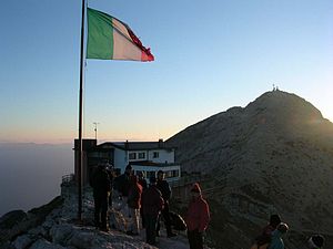
At sunrise with Cima Carega in the background |
||
| location | Cima Carega ; Trentino , Italy ; Valley location: Ala | |
| Mountain range | Caregagruppe , Vicentine Alps | |
| Geographical location: | 45 ° 43 '25.2 " N , 11 ° 7' 44.5" E | |
| Altitude | 2238 m slm | |
|
|
||
| builder | CAI | |
| owner | CAI section Verona | |
| Built | 1953 | |
| Construction type | Refuge | |
| Usual opening times | daily from June 15th to September 20th | |
| accommodation | 22 beds, 0 camps | |
| Winter room | 6 beds | |
| Web link | caregaweb.it | |
The Rifugio Mario Fraccaroli (also Rifugio Fraccaroli for short , German Fraccaroli hut ) is a refuge of the Verona section of the Club Alpino Italiano CAI.
Location and surroundings
The Rifugio Fraccaroli is located in the municipality of Ala in the province of Trento on the border with the province of Verona at 2238 m asl. The refuge is only a few minutes' walk from the Cima Carega , the main peak of the Carega group .
The European long-distance hiking trail E5 and the Sentiero della Pace (German peace trail ) pass by the hut .
history
The Rifugio Fraccaroli was built in the summer of 1953 and inaugurated on October 11th of the same year. It is named after Mario Fraccaroli, a member of the CAI Verona, who was shot dead by retreating German soldiers in April 1945 a few days before the end of World War II . The building has been expanded and modernized several times over the years.
Accesses
- From Rifugio Campogrosso , 1456 m ⊙ on path 157 (3 hours)
- From Rifugio Scalobri, 1767 m ⊙ on path 157, 192 (1 hour 15 minutes)
- From Ronchi di Ala, 705 m ⊙ on path 108 (5 hours)
Neighboring huts and crossings
- To Rifugio Monte Zugna, 1620 m ⊙ on path 108, 115 in 5 hours
- To Passo Pian delle Fugazze , 1162 m ⊙ on path 157, 170 in 4 hours
Mountaineering
- Cima Carega , 2259 m ⊙ 5 minutes
- Cima Cherlong or del Calieron, 2209 m ⊙ 30 minutes
- Cima Posta, 2210 m ⊙ 40 minutes
literature
- Luca Baldi, Gianni Pieropan: Guida alle Piccole Dolomiti , Panorama, Trento, 1986, ISBN 978-88-8711-819-3 .
- Achille Gadler, Mario Corradini: Rifugi e bivacchi nel Trentino , Panorama, Trento, 2003, ISBN 978-88-87118-40-7 .
- Claudio Gattera, Tiziano Berté, Marcello Maultauro: Le Piccole Dolomiti nella guerra 1915-1918. Dalla Vallarsa alla val Lagarina dal Carega ai Coni Zugna , Gino Rossato, Novale, 2000, ISBN 978-88-8130-074-7 .
- Società degli Alpinisti Tridentini - Sezione del CAI - Commissione Sentieri: … per sentieri e luoghi. Sui monti del Trentino. 1 Prealpi Trentine Orientali. Monte Lessini, Caréga, Pasubio-Colsanto, Finònchio-Monte Maggio, Altopiani Vézzena-Lavarone, Cima Dodici-Ortigara, Vigolana, Marzòla. Euroedit, Trento, 2012, ISBN 978-88-86147-95-8 .
Web links
References and comments
- ↑ The mule track that leads from Passo Pertica past the Rifugio Fraccaroli was laid out by Italian engineering troops as early as the First World War , when the Italians built a defense line with positions and logistical facilities in the Carega group.
- ^ Rifugio Mario Fraccaroli on the section page of the CAI Verona in Italian , accessed on February 20, 2017.


