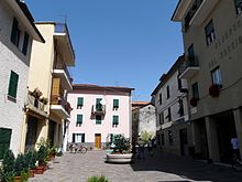
Rovegno
| Rovegno | ||
|---|---|---|

|
|
|
| Country | Italy | |
| region | Liguria | |
| Metropolitan city | Genoa (GE) | |
| Coordinates | 44 ° 35 ' N , 9 ° 17' E | |
| height | 658 m slm | |
| surface | 42.5 km² | |
| Residents | 506 (Dec. 31, 2019) | |
| Population density | 12 inhabitants / km² | |
| Post Code | 16028 | |
| prefix | 010 | |
| ISTAT number | 010052 | |
| Popular name | Rovegnesi | |
| Patron saint | John the Baptist | |
| Website | Rovegno | |
Rovegno ( Ligurian Roegno ) is an Italian municipality in the metropolitan city of Genoa with 506 inhabitants (as of December 31, 2019).
location
The municipality is located in the Trebbia valley in the Parco naturale regional dell'Antola (Antola Regional Nature Park). Together with seven other municipalities, Rovegno forms the mountain community of Alta Val Trebbia .
The territory of today's Rovegno consists of a large number of small towns and settlements, which in 1797, after the fall of the Republic of Genoa , were merged into a single municipality under the administration of Napoleon Bonaparte , with the administrative center of Rovegno.
According to the Italian classification for seismic activity , Rovegno was assigned to zone 3. This means that the community is in a seismically inactive zone.
swell
- ↑ Statistiche demografiche ISTAT. Monthly population statistics of the Istituto Nazionale di Statistica , as of December 31 of 2019.
- ↑ Ordinanza PCM n.3274 of 03/20/2003

