Ruhr shipping

The history of the Ruhr navigation reflects the history of navigation on the Ruhr resist dedicated to the north of the lower reaches of the river extending Ruhr gave his name. The timeframe ranges from the Middle Ages and later in particular from the end of the 18th century through the entire 19th century, in which cargo shipping reached its peak due to the Ruhr mining , to passenger shipping to the present day.
history
Simple shipping has been operated on the Ruhr since the Middle Ages . So, Emperor Conrad II. The Abbey are 1,033 customs legislation at the intermediate are operated and the mouth shipping. However, due to the fragmentation into numerous small states, it never got beyond local importance.
An old Ruhr estuary, the near Duisburg's Old Town before Stapeltor an oxbow lake of the Rhine met, was probably used in the Middle Ages as a port.
In the 16th century there was no more shipping on the Ruhr. After the Thirty Years' War , the Clevish-Brandenburg government decided to make the Ruhr navigable again. However, disputes between the territories prevented the decision to make the Ruhr navigable around 1542 and 1737.
At the behest of the Prussian King Friedrich II. , Who issued the "Royal Prussian Water and Bank Regulations for the Ruhr River, in Grafschaft Mark " on May 10, 1781, the Ruhr was made navigable to Holzwickede . During this time, the boatmen had to cross six political territories on a trip upriver: the Duchy of Kleve (Prussia), the Duchy of Broich ( Leiningen- Dagsburg) near Mülheim, the Duchy of Berg (Kurpfalz-Bavaria) near Kettwig , the Werden monastery , the monastery Eat at Steele and the County of Mark (Prussia).
The Ruhr was mainly used to transport hard coal , but also salt from the Königsborn saltworks , grain and other goods from the Ruhr valley and neighboring valleys. When expanding the Ruhr, numerous difficulties had to be overcome, such as cliffs, sand and gravel banks. In addition to the numerous flat and steep sections, which made the construction of locks necessary, plots along the Ruhr were necessary for the construction of the towpath. The Werden Abbey and the Essen Abbey in particular resisted the surrender of land, as the coal from the Mark was made navigable by being given an inexpensive transport route and thus became a competitor for coal from Essen.
Another problem with Ruhr shipping was reloading the cargo at the numerous weirs (also known as Schlagden). Wood and lime tolerated this. However, mainly hard coal should be transported. This was unsustainable for the quality of the coal, because the customers in the county of Kleve wanted lump coal. The construction of locks was therefore necessary. The coals were taken over at the coal defeats .
Between 1776 and 1780, 16 new locks were built between Duisburg and Langschede , through which up to 80 ships were later locked daily. The locks were mostly made of wood, later they were replaced with masonry. Previously, the weirs had only been used to generate energy for the mill operation. Today the weirs are primarily used for water management. The Duisburg ports were at the heart of Ruhr shipping. The making of the northern Emscher from Crange to the Rhine was negotiated with the Prussian government from 1767 to 1774, but remained unsuccessful. The Ruhr shipping, however, boomed and made the Ruhr one of the most traveled rivers in Europe at the time, although it was only navigated from Witten until 1801. Under the Prussian government, the Ruhr was regulated and numerous shallows removed. Groynes ensure that there is a fairway even at low tide.
Shipping reached its peak in 1860, when 867,734 tons of hard coal were shipped to Duisburg with the Ruhraaken. With the establishment of the Ruhr Valley Railway (1872 to 1876), Ruhr shipping lost its importance. In parallel with the construction of the railway from Styrum to Hagen , the transport performance fell to just over 100,000 tons in 1876. As a counter-reaction , the association for the canalization of the Ruhr was founded in Witten in 1886 with the active participation of the engineer Julius Greve , son of the former Bochum mayor Max Greve , which, however, was unable to assert itself. In 1889 the last coal ship passed the lock in Mülheim.
Historic ships
The Ruhraaken ( Sing .: the Ruhraak ) were flat-bottomed ships that were formerly used to transport coal on the Ruhr . Similar type variants of the Aaken were the Kölner Aak and the Dorstener Aak .
The Ruhraaken were adapted in size to the locks that were built on the Ruhr between 1776 and 1780. The ships had a length of 34 to 35 meters and a width of five meters. The draft was 0.8 meters.
Ruhr up the Ruhraaken were supported by sailing from running on the shore teams of horses with up to 400 meters long lines, on the so-called towpath (also Linnepad) towed . Down the Ruhr it was mostly only with the current. The boatmen were supported by local helmsmen. The crew consisted of the Aakesbaas or captain , the man in front, two helmsmen and the helmsman as pilot . Each Aak had a cabin as living space for the Aakesbaas.
In a qualification measure for unemployed young people in Mülheim an der Ruhr , a Ruhraak was faithfully recreated from 2000 onwards. Since the shipyards worked without drawings in the 19th century, the sources used included old contract documents with building specifications and the results of industrial espionage at the time. The Ruhraak replica is now in the industrial museum on the Nachtigall colliery in Witten .
Towpaths
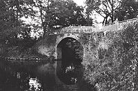
The former towpaths or towpaths of the Ruhr shipping industry, which are now mostly well developed and almost everywhere asphalt, are shared by pedestrians and cyclists. Today they are part of the Ruhr Valley Cycle Route . Authentic sections with original pavement exist, among other things, on the towpath below the Isenberg and on the bridge at the former Holteyer harbor .
Locks
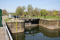
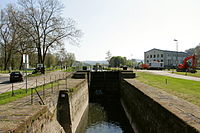
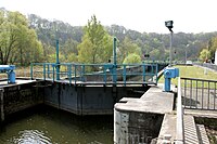
The historic locks had a standardized chamber length of around 44.5 meters and a width of around 5.4 meters. There were often houses for the lock keepers next to them. The modern locks have deviated from this.
The locks include (in brackets the river kilometers from the mouth):
| lock | km | Establishment | comment | image |
|---|---|---|---|---|
| Ruhr lock Duisburg | 2.5 | 1926 | Rebuilt 1942–1956 |

|
| Ruhr lock Raffelberg , Mülheim an der Ruhr | 7.8 | 1914-1928 | Rebuilt 1999–2006 |

|
| Ruhr lock Mülheim | 12.6 | 1779-1780 | Rebuilt between 1843 and 1845 at the current location. |

|
| Kettwig lock , Essen | 21.5 | 1779-1780 | Rebuilt in the 1940s on the right bank. |

|
| Paper mill sluice , food | 1777-1778 | Out of service |

|
|
| Neukirchen lock , Essen | 1777-1778 | fallen dry, out of order |

|
|
| Baldeney Lock , Essen | 29.3 | in operation, at the Baldeneysee |

|
|
| Rohmannsmühle lock | 38.4 | 1774 | Out of service |

|
| Spillenburg lock | 42.0 | Limit of navigability for motor ships | ||
| Horst lock , Essen | 47.4 | 1774-1775 |

|
|
| Dahlhausen lock | 49.9 |

|
||
| Lock Hattingen | 57.5 |

|
||
| Blankenstein lock , Hattingen | 61.8 |

|
||
| Kemnade lock , Bochum-Stiepel | 64.3 | |||
| Herbeder lock , Witten | 69.2 | 1776-1778 | Destroyed in 1943. Restored 1981–1983. |

|
| Steinhauser lock , Witten | 1780 | Disposed in 1856. | ||
| Witten lock | ||||
| Lock weather | 82.6 | |||
| Herdecke lock | ||||
| Lock Stiftsmühle | 1938 | Restored in 2017 | ||
| Hengsteysee lock | at the Hengsteysee |

|
Ports
Harbors were built for shipping on the Ruhr, in which the ships found protection from floods and ice.
| port | km | Establishment | comment | Illustration |
|---|---|---|---|---|
| Ruhrort harbor | from 1716 |

|
||
| Mülheim harbor | ||||
| Neukirch harbor | ||||
| Werdener port | ||||
| Copper turning port | ||||
| Holthausen harbor | ||||
| Spiek harbor | ||||
| Holteyer harbor | 1837/1838 | Closed in 1880 |

|
|
| Hamlet port | ||||
| Rauendahl | ||||
| Blankenstein |
Today's shipping
Freight transport
At the mouth of the Ruhr in Ruhrort , the Duisburg-Ruhrorter ports developed into the largest inland port in Europe. In 1927 the Ruhrschiffahrtskanal was built, on which ships of the format Large Rhine Ship can call at the Ruhr 12.21 kilometers up the Rhine-Ruhr port in Mülheim an der Ruhr . The expansion as a federal waterway ends at the castle bridge in Mülheim.
From Mülheim to Essen-Rellinghausen (river kilometer 41.40) the Ruhr can be used as a state waterway for machine-driven vehicles with a maximum draft of 1.7 meters, a maximum length of 38 meters and a maximum width of 5.2 meters.
Passenger shipping
On the five Ruhr reservoirs , as well as in Witten and from Baldeneysee to Mülheim also on the Ruhr itself, passenger ships operate today for local recreation. There is also a ferry connection between the Herbeder lock and the Hardenstein .
The operators between Mülheim and Kettwiger See are the MVG White Fleet with its "home port" at the water station in Mülheim an der Ruhr , and the White Fleet Baldeney between Kettwig and Kupferdreh , a subsidiary of the city of Essen , with its home port at Haus Scheppen , on Lake Kemnader ( MS Kemnade ) and the Harkortsee ( MS Friedrich Harkort ) the Meyer personal shipping company , between Kemnader See and Witten the Stadtwerke Witten ( MS Schwalbe II ) and on the Hengsteysee the Hengsteysee passenger shipping ( MS Freiherr vom Stein ).
The nature and environmental protection associations counter the wish of the initiative Das Ruhrtal for more landing stages with the reference to quiet relaxation and the protection of threatened animal and plant species.
water sports
Rowers and canoeists shape the scene on the river, while windsurfers and small sailing boats and ships on the lakes.
Touring rowers cannot use the locks. There are in Witten-Herbede (69.2 km), Kemnade (64.3 km), Bochum-Dahlhausen (49.9 km), Essen-Horst (47.4 km) and Essen-Spillenburg (42.0 km) Boat lanes available. Most of them are operated electro-hydraulically (except for Kemnade and Dahlhausen, as there are no locking devices) and are therefore out of order in winter. When the water level is high, there are strong cross currents behind the weirs in some places. When the water level is high, some parts of the Ruhr are closed to traffic. When the water level is low, stones in the river are critical in several places. A bird sanctuary must be observed in the area of Lake Baldeney.
literature
- Ludwig Benjamin Henz : The Ruhr current and its shipping conditions , Essen 1840
- A. Weiß: The Ruhr Shipping near Hattingen. In: Yearbook of the Association for Home Care in the Hattingen District, 1st year, 1922, pp. 129–132
- Wilhelm Behrenbeck: Making the Ruhr navigable , Hamburg, 1926
- Heinrich Blesken: Wittener Heimatbuch , Witten 1948, pp. 151–159.
- Karl Brinkmann: The history of the Ruhr shipping and its repercussions on Bochum. In: Bochumer Punkte , 6. Heimatbuch 1954 ( online )
- Gustav Adolf Wüstenfeld, Wilhelm Dege : Die Ruhrschiffahrt from 1780-1890 , 1978, ISBN 392201402X
- State Office for Water and Waste Management Düsseldorf, Duisburg branch (publisher): 200 years of Ruhr shipping , Duisburg 1980
- Wolfhard Weber: The Ruhr shipping in the 19th century. In: Yearbook of the Association for Local and Local Studies in the Grafschaft Mark zu Witten e. V. 78 (1980), pp. 57-65
- Olaf Schmidt-Rutsch: Coal ships on the Ruhr. Food 2000
- Olaf Schmidt-Rutsch: Salt shipping on the Ruhr. In memory of Dr. Jürgen Heinrich Gethmann, in: Märkisches Jahrbuch für Geschichte, ed. v. Heinrich Schoppmeyer , 102nd volume, 2002, pp. 125-143
- Olaf Schmidt-Rutsch: Shipping on the Ruhr, in: Märkisches Jahrbuch für Geschichte , ed. v. Heinrich Schoppmeyer,
- Olaf Schmidt-Rutsch: Coal shipping on the Ruhr, in: Zeche Nachtigall. Museum Guide, ed. v. Ingrid Telsemeyer, Klartext-Verlag . ISBN 3-89861-179-5 , pp. 100-139
- Walter Ollenik, Jürgen Uphues: About mills, locks and turbines. Klartext-Verlag . 2004, ISBN 3-89861-375-5
- Ralf Molkenthin, Hardy Priest: Ships on the Ruhr , in: Views of the Middle Ages, Aspects of the lifeworld, rule, religion and reception, Festschrift Hanna Vollrath for her 65th birthday, ed. v. Bodo Gundelach and Ralf Molkenthin, Herne 2004, pp. 217–235
- Ralf Molkenthin: ... 'We allow you to sail the Ruhr to the monastery by ship ...', medieval inland vessels on the Ruhr and elsewhere. In: Märkisches Jahrbuch für Geschichte, 105th Volume, 2005, pp. 7–32.
Web links
- Coal shipping on the Ruhr between 1780 and 1890 (excerpt from the association journal of the DMB "Linen Los" issue 1/2008), also as a PDF
- Michael Tiedt: The early mining on the Ruhr.
- The history of the Ruhr shipping and its repercussions on Bochum
- http://www.schifferverein-beuel.de/haas/02_fluesse/deutschland/schiffbar/12_ruhr/Treidelschiffahrt_Ruhr.pdf
- http://www.wsa-duisburg-meiderich.wsv.de/archiv/Broschueren/daten/huels.pdf
Individual evidence
- ^ Günter Krause: Duisburg as a trading and port location in the Middle Ages and the early modern period. March 26, 2007 ( PDF; 231 kB ( Memento of the original from May 26, 2015 in the Internet Archive ) Info: The archive link has been inserted automatically and has not yet been checked. Please check the original and archive link according to the instructions and then remove this note. ).
- ↑ http://www.wsa-duisburg-meiderich.wsv.de/Wasserstrassen/Westdeutsche-Kanaele/RUHR/index.html
- ↑ http://www.ruhrkohlenrevier.de/ob5101.html
- ↑ http://www.archive.nrw.de/LAV_NRW/jsp/findbuch.jsp?archivNr=1&klassId=18&tektId=599&id=0605
- ↑ http://www.archive.nrw.de/LAV_NRW/jsp/findbuch.jsp?archivNr=1&tektId=0&id=0342&klassId=32&verzId=7097&seite=4
- ↑ http://www.ruhrverband.de/presse/pressemitteilungen/detailansicht/news///ruhrverband-laesst-schleusentore-50-meter-uebers-wasser-schweben/
- ↑ http://www.ruhrkohlenrevier.de/hafen.html
- ↑ http://www.personenschifffahrt-hengsteysee.de/


