Rhine-Ruhr port
| Rhine-Ruhr port | |||
|---|---|---|---|
| Data | |||
| UN / LOCODE | DE MUH | ||
| owner | City of Mülheim | ||
| operator | Companies in the city of Mülheim an der Ruhr | ||
| opening | 1927 | ||
| Port type | Inland port and land | ||
| Throughput | 787,425 t (2015) | ||
| website | Mülheim harbor | ||
| Geographic information | |||
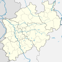
| place | Mülheim an der Ruhr | ||
| country | North Rhine-Westphalia | ||
| Country | Germany | ||
| Southern basin of the Rhine-Ruhr port | |||
| Coordinates | 51 ° 26 '24 " N , 6 ° 50' 11" E | ||
|
|||
The Rhine-Ruhr port is an inland port in Mülheim an der Ruhr on the lower reaches of the Ruhr .
location
The port is located above the mouth of the Rhine in the Speldorf district on the Ruhrschifffahrtskanal between Ruhr-km 8.5 to 9.5 on the left. It is connected to the Rhine-Herne Canal via the Ruhr lock Raffelberg , via the Meiderich lock with the Duisburg-Ruhrorter ports and via the Ruhr lock Duisburg with the Rhine.
The inland port , which is maintained by the companies of the city of Mülheim , consists of two parts: The north port is a land directly on the shipping canal, from which the south port branches off as a harbor basin . At normal water level, the water depth is at least 2.80 m and the length of the quay and handling facilities is 3.1 km. Another company site with a container bridge is located at Ruhr km 11.1 on the right. The port and the Ruhr navigation channel are up to the castle bridge (km 12.2) a waterway of class Va for the Great Rhine .
For passenger shipping, there is another pier near the city center at Ruhr-km 11.9 on the right. There is also a connection to local public transport
history
After the Ruhr shipping came to a complete standstill due to the arrival of the railways and especially the construction of the Ruhr Valley Railway at the end of the 19th century, the city of Mülheim an der Ruhr decided to build a port in 1913 to increase economic power and a direct connection to the Duisburg port to accomplish. To this end, the Ruhr Shipping Canal was built over a twelve-year construction period and the gradient of around ten meters between the cities was compensated for by two new locks. The Rhine-Ruhr port was officially inaugurated on October 8, 1927.
Since September 2004, the Rhine-Ruhr port has been the starting point of the EU project InterPorts , with which the cooperation between the inland ports is to be strengthened and the transfer of transport traffic to ship and rail is to be achieved. Today, the port belongs to the route of industrial culture under the name Rhein-Ruhr-Hafen (theme route 12 - past and present of the Ruhr and theme route 14 - canals and shipping ).
Function and meaning
The Rhine-Ruhr port has a total area of around 220 hectares and forms the largest industrial area in Mülheim. Around 500 companies with over 7,000 employees are located in the industrial park. Around 1.1 million t of various goods are handled and transported in the port every year , of which 787,425 t are actually handled by ships. (As of 2015) Freight transports within the port are carried out with a port railway that is operated on around 27 kilometers of track. Mainly scrap, iron, steel and mineral oil are handled.
For recreational shipping there is a spatially separate pier for small vehicles at Ruhr-km 8.4 on the left with its own supply and disposal facilities.
traffic
Two kilometers west of the port there are access routes to the federal motorway 3 and the A 40 . The port railway connects to the Witten / Dortmund – Oberhausen / Duisburg railway line via a pull-out track .
Yacht harbor, in the background the Ruhr lock Raffelberg
Web links
- Description of all locations on this themed route as part of the Route of Industrial Culture
- City of Mülheim adR to the port
Individual evidence
- ^ University of Duisburg; BinTrans project
- ↑ Rhein-Ruhr-Hafen industrial park. Mülheim & Business, March 8, 2018, accessed on May 16, 2018 .
- ^ Port of Mülheim, data and equipment
- ↑ Feeder for small vehicles


