Orsoy port
| Orsoy port | |||
|---|---|---|---|
| Data | |||
| UN / LOCODE | DE ORS | ||
| owner | City of Rheinberg | ||
| operator | Niederrheinischen Verkehrsbetriebe AG (NIAG) | ||
| opening | 1910 | ||
| Port type | Lands | ||
| Throughput | 622,000 t (2012) | ||
| website | Orsoy port | ||
| Geographic information | |||
| place | Orsoy | ||
| country | North Rhine-Westphalia | ||
| Country | Germany | ||
| Orsoy port from the north | |||
| Coordinates | 51 ° 31 '53 " N , 6 ° 40' 44" E | ||
|
|||
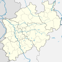
The port of Orsoy is a river port on the Lower Rhine . It is located at Rhine kilometers 793.8 to 794.5 to the left of the Rheinberg district of Orsoy .
history
Already started shortly after the turn of the century, it was not given a fortified quay wall until 1910 . Operation began soon after with three electric gantry cranes . The main cargo handled was and is still today coal and ores ; Building materials, forest and agricultural products were also implemented. Today the focus is on ship-to-rail handling of bulk and bulk goods .
Originally, it was planned to build a site there that would serve exclusively for the needs of the Friedrich-Heinrich colliery in Kamp-Lintfort . On the initiative of the Moers district administrator van Endert , however, it was realized as a public Rhine port. This enabled other businesses to use the transshipment point and the Moerser Kreisbahn established a rail connection.
After the First World War , other companies settled near the port. In 1936 the harbor basin was backfilled and, in order to improve flood protection, a dyke wall was built over it. Today there is a sports and children's playground with a small green area at the former location. The port facility, relocated 700 m to the north, was rebuilt as a power port. The warehouse on the former quay wall, which is still preserved today, was also used for temporary storage of various other goods. For a time, the raw tobacco processed in the Orsoyer cigar and tobacco factory was delivered there and customs cleared. Then the Underberg company used the warehouse for their bitter bitters , which were delivered to the USA.
In March 1945, Orsoy was occupied by Allied troops and, during the fighting of the Second World War, the German Wehrmacht shot at it from the opposite bank of the Rhine in order not to provide the occupiers with any usable infrastructure.
The site was returned to the Federal Republic of Germany in 1952 and operations resumed. In addition to coal, building materials, grain, flour and sugar were also handled and stored.
Infrastructure
The port is operated by Niederrheinische Verkehrsbetriebe AG (NIAG) , which belongs to the Rhenus Veniro Group . There are 2 gantry cranes, a crane bridge and conveyor systems for bulk goods. The siding leads directly to the pier in three trains, and a wagon scale is also available there. There are 65,000 m² of outdoor storage space.
In 2012, 622,000 tons of goods were handled in the port of Orsoy.
The port in Orsoy is not suitable for recreational boating; For small vehicles there is a small mooring point in the directly opposite Walsum harbor .
The passenger shipping uses the jetty at Nordwall as a dock.
traffic
The federal motorway 42 runs south of the port to which there are access possibilities seven kilometers to the west. The port railway connects to the Rheinhausen – Kleve railway line via a pull-out track .
One kilometer further south, the Rhine is crossed by the Walsum –Orsoy car ferry .
Port of Orsoy and Orsoy on the right, Duisburg-Walsum power plant on the left, view in southern direction
Web links
- Video of a shunting trip to the port of Orsoy (5:23, port from 3:05 in the picture)
- Description of this sight on the route of industrial culture
- Operator NIAG to the Rhine port Orsoy


