Municipal Rhine port of Wesel
| Municipal Rhine port of Wesel | |||
|---|---|---|---|
| Data | |||
| UN / LOCODE | DE WES | ||
| owner | City of Wesel | ||
| operator | DeltaPort GmbH & Co. KG | ||
| opening | 1896 | ||
| Port type | Inland port | ||
| Throughput | 646,000 t (2012) | ||
| website | City Rhine port of Wesel | ||
| Geographic information | |||
| place | Wesel | ||
| country | North Rhine-Westphalia | ||
| Country | Germany | ||
| Urban Rhine port, view from the Niederrhein Bridge | |||
| Coordinates | 51 ° 39 '2 " N , 6 ° 36' 28" E | ||
|
|||
The municipal Rhine port of Wesel is the commercial port of the city of Wesel on the Lower Rhine.
location
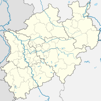
The port is located on the western edge of Wesel between the Rhine kilometers 814.50 - 815.90. Two kilometers further south - at the confluence of the Wesel-Datteln Canal with the Rhine - is the Rhine-Lippe port of Wesel . The Lippe flows into the Rhine parallel to the harbor basin.
history
As early as 1355 it is mentioned in a document that trade was carried out on the Lippe in Wesel with the help of a crane ship . In 1407 Wesel was elevated to the status of a Hanseatic city and a new crane ship was installed on the banks of the Rhine. The first port basin on the Rhine was completed in 1650, and a new security port was finally completed in 1896. The old harbor basin was filled in in 1927.
Initially used by towing and sailing ships, later also by steam and motor ships, the port experienced a steady increase in handling. A port railway was built around 1870, which established a connection to the Haltern – Venlo , Oberhausen – Arnhem and Wesel – Bocholt railway lines .
Towards the end of the Second World War , large parts of the port were destroyed. The port railway and the quay walls were rebuilt in 1950.
Infrastructure
Today the port is operated by DeltaPort GmbH & Co. KG. It has a pounded quay wall 805 meters long , contains 7.3 hectares of water and has 13.8 hectares of industrial land . Conversely hitting are bulk and packaged products , animal feed, fertilizers, grain, peat, glass, gravel and other construction materials and fuels (coal, gasoline, diesel, fuel oil). In 2006, the inland shipping volume of goods was 973,000 tons, but fell to 646,000 tons by 2012. For logistics, there are silos (46,000 tons for feed, building materials and fertilizers), tank farms (42,000 tons), bulk floors (3,000 m²) as well as four 6-tonne cranes, three 40-tonne floating cranes, handling, suction and other transport systems to disposal.
In addition, there is a pier for passenger shipping on the port area. These use their own landing stage with a floating pontoon at Rhine kilometer 817 on the right on the Rhine promenade . For the recreational boating has its own marina at Rhine kilometer 817.8 right. There are suitable docks and their own supply and disposal facilities for small vehicles .
traffic
The port company operates a port railway with its own diesel locomotives and a route length of 7.5 kilometers. There are direct connections to the rail network of Deutsche Bahn AG.
The federal highway 8 and the B 58 open up the port areas to the federal highway 3, which runs eight kilometers to the east .
Web links
- City of Wesel on the envelopes in their two ports
- Description of this sight on the route of industrial culture


