Schwarzberger Moor
Coordinates: 54 ° 52 ′ 40 ″ N , 8 ° 59 ′ 15 ″ E
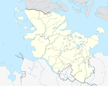
The Schwarzberger Moor (Danish: Sortbjerg Mose ) is a nature reserve in the Schleswig-Holstein municipality of Westre in the district of North Friesland .
The approximately 18 hectare nature reserve is registered under number 67 in the directory of nature reserves of the Ministry of Agriculture, Environment and Rural Areas. It was designated in 1994 (date of the ordinance: June 23, 1994) and replaces the previous nature reserve of the same name designated in February 1966. The responsible lower nature conservation authority is the district of North Friesland.
The nature reserve is located in the north of the district of North Friesland north of Westre. It is part of the 809 hectare FFH area "Süderlügumer Binnendünen". It represents a small bog area with larger bodies of water amidst inland dunes landscape under protection. Besides bog areas are low and transitional bog find, also wet pagans as well as dry sand heaths and forest. In the south and west, the nature reserve borders on forest areas. In the north and east it is bordered by roads, which in turn are mainly connected to agricultural areas . The moor drains through ditches to the Wiedau tributary Süderau (Sønderå). At the edge of the nature reserve, which is looked after by the Schleswig-Holstein State Forests , there is a refuge from which the reserve can be viewed.
Web links
- Schwarzberger Moor , leaflet from the State Office for Agriculture, Environment and Rural Areas of Schleswig-Holstein (PDF, 1.8 MB)
Individual evidence
- ↑ Anders Bjerrum: Sydslesvigs stednavne , Volume 4.1 Kær herred, 1979, p. 153.
- ↑ State ordinance on the "Schwarzberger Moor" nature reserve of June 23, 1994 , state regulations and state case law, state government Schleswig-Holstein. Retrieved April 2, 2013.
- ↑ Süderlügumer inland dunes , profiles of the Natura 2000 areas, Federal Agency for Nature Conservation . Retrieved September 25, 2019.
- ↑ Border route: Germany's northernmost cycle path, From Ladelund to Tønder (33 kilometers) ( Memento from May 12, 2014 in the Internet Archive ) , NRD, July 12, 2010.


