Amrum dunes
Coordinates: 54 ° 39 ′ 34 ″ N , 8 ° 19 ′ 19 ″ E

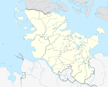
The nature reserve (NSG) Amrumer Dünen is located in the west of the North Sea island of Amrum in the district of North Friesland in Schleswig-Holstein . It includes almost all dune areas on the island and belongs to all three island communities.
geography
The 728 hectare area extends east of the Kniepsand in a north-south direction almost over the entire island. The Amrumer Odde in the north of the island forms its own nature reserve, which is also located in the dunes. The NSG Amrumer Dünen is around eight kilometers long and up to one kilometer wide. The highest point is the dune A Siatler (German: Setzerdüne) with 32 meters above sea level . It is located southwest of Norddorf and, like some other dunes, has a platform as a viewing dune. In Wittdün there are local dune areas that are not in the NSG Amrumer Dünen.
history
The dunes were formed after the last ice age. Under the dune sand lies an old moraine , which is occasionally blown free and shows traces of settlement such as the megalithic bed of fog , furrows and archaeological finds.
In 1971 the regulation for the NSG became legally binding. On December 6, 1989 the regulation was extended. The Öömrang Ferian , a local homeland association, took care of the area.
2014 was near the duck decoy Meeram the replica of an Iron Age house completed, reminiscent of earlier settlements in the area. Since the house is in the NSG, a special permit had to be granted.
Ecology, flora and fauna
The area of the NSG is one of the most extensive dune areas in Germany. All stages of dune formation can be observed, but primary dunes are mainly found on the Kniepsand. Accordingly, one finds a corresponding flora with silver grass , red fescue and sand sedge in the area of the white and gray dunes , crowberry and dune rose in the gray dunes. White ostrich and black-headed bulrush grow in damp dune valleys . There are also species such as blood-eye , bell heather and swamp bear moss . Herring gulls and other seagull species breed in the dunes .
Part of the NSG is the Norddorfer Vogelkoje, which was used to catch birds until 1936 and is now used for recreation. The Norddorf lighthouse is one of the few buildings in the nature reserve . Most of the time, entering the NSG is only permitted on boardwalks . A bridle path leads in an east-west direction. Three roads leading to Kniepsand or drivable paths divide the area at Nebel , Süddorf and Wittdün. One goal of nature conservation work is to inform tourists about the biotope. The coastal protection takes precedence over all other concerns, including the nature, according to regulation. The operation of the children's clinic “Satteldüne” in Süddorf is permitted in the nature reserve. The hunting tenant is allowed to collect seagull eggs and to hunt.
The NSG Amrumer Dünen is part of the FFH area "Coastal and Dune Landscapes Amrum" and the Ramsar area "Schleswig-Holstein Wadden Sea and adjacent coastal areas". It is one of two nature reserves on Amrum. Together with the Amrum nature reserve , over 80 percent of the island's area is under protection. The Schleswig-Holstein Wadden Sea National Park joins on the west side .
Web links
Individual evidence
- ↑ a b c d e Official description (PDF), accessed on February 29, 2012
- ↑ Topping- out ceremony at the Iron Age House. Inselbote from February 26, 2014, accessed May 30, 2014
- ^ Website of the Norddorf Nature Center , accessed on February 29, 2012


