
Selztal cycle path
| Selztal cycle path | |
|---|---|
|
|
|
| overall length | 65 km |
| location |
Rheinhessen / Rhineland-Palatinate |
| map | |

|
|
| Selz course in Rheinhessen | |
| Starting point | Orb |
| Target point | Ingelheim am Rhein |
| Places along the way | Mauchenheim , Alzey , Framersheim , Gau-Odernheim , Bechtolsheim , Friesenheim , Selzen , Hahnheim , Nieder-Olm , Stadecken-Elsheim , Schwabenheim an der Selz , Großwinternheim |
| Flooring | Asphalt or concrete paths (farm roads). |
| Height difference | +270 Hm up -355 Hm down |
| difficulty | light |
| Traffic volume | Almost completely off the road |
| Website URL | www.rheinhessen.info |
The Selztal cycle path is a 65 km long cycle path and leads from the source of the Selz in Orbis through Rheinhessen to the confluence with the Rhine at Ingelheim . It runs partly on or near the former railway lines "Amiche" and "Zuckerlottche" by the wine-growing embossed Rheinhessen hills . The entire route is signposted and is easy to drive in both directions. The farm roads used are not necessarily recommended for children because of their surface properties and the sometimes heavy pollution at harvest time.
Route
Selzquelle to Alzey
The source of the Selz is located in Orbis , which is part of the Kirchheimbolanden community . Kirchheimbolanden can be reached by train. From there you can get to Orbis via quiet but hilly country roads. Since 2009 this route has also had a cycle path. The source is at the eastern edge at 49 ° 41 '45.3 " N , 7 ° 59' 54.8" O to find. From here, the route runs largely flat for about ten kilometers via Mauchenheim to Alzey . There are not separate cycle paths everywhere within Alzey.
Alzey to Gau-Odernheim
The route leaves Alzey via a Nordschleife; there are a few meters to climb near the federal motorway 61 . Alternatively, a shorter route can be chosen, but signs warn of this for reasons of road safety, as a difficult road has to be crossed in the industrial area of Alzey. There is also a traffic obstruction on this alternative route where cyclists with trailers or recumbent cyclists have to get off. Then it's relatively flat near the Selz on farm roads past Framersheim to Gau-Odernheim . The cycle path ends before Gau-Odernheim. Here you can turn off on quiet country roads in the direction of Guntersblum and then on the Rhine cycle path to Oppenheim . The Selztal cycle path follows the road to the center of the village, where the route leads away from the main road towards Petersberg . The length of the section is about nine kilometers.
Gau-Odernheim to Nieder-Olm
Behind Gau-Odernheim the foothills of the Petersberg have to be overcome (approx. 40 meters in altitude). The mountain itself remains on the right. Those who climb the Petersberg can enjoy the most beautiful viewpoint on the route. The path then leads on a scenic route through Bechtolsheim and on to Friesenheim . At the end of Friesenheim there is the possibility of changing to the rail terrace paths Valtinche to Nierstein am Rhein or Amiche to Bodenheim . Here the vineyards end and it goes through agricultural areas. Near the Selz, it goes via Hahnheim to Sörgenloch , where another short climb (approx. 20 meters in altitude) has to be overcome. Shortly afterwards the industrial area of Nieder-Olm is reached. The section is about 20 kilometers long.
Nieder-Olm to the mouth of the Selz
The path now leads to Ingelheim without any major inclines. The vineyards that accompany the route to Ingelheim am Rhein begin again from Stadecken-Elsheim . After passing Schwabenheim an der Selz and Großwinternheim , the further route follows on the outskirts of Ingelheim der Selz. After the crossing of the Mainz – Bingen railway line , the path follows the tracks for a while before crossing under the federal motorway 60 . Shortly before it flows into the Rhine at 49 ° 59 ′ 45.4 ″ N , 8 ° 1 ′ 34 ″ E , the Selztal Cycle Path ends on the Rhine Cycle Path . The length of the section is approx. 16 kilometers.
landscape
The Selz rises in the North Palatinate uplands on the edge of the village of Orbis and flows through a landscape typical of Rheinhessen, before flowing into the Rhine after 61 kilometers at Ingelheim. The hilly landscape of Rheinhessen is largely shaped by viticulture. Coming from the mountains in the north of the Palatinate, the Selz reaches Alzey after just ten kilometers. From there to Gau-Odernheim it leads through hills full of vines. In the following section, agriculture dominates in the valley. There are still some working mills here. A flattened mountain range stretches from Nieder-Olm to Mainz, bypassing the Selz and thus also the cycle path in a north-westerly direction. Here the wine towns of Stadecken-Elsheim, Schwabenheim and Großwinternheim follow, before the Selz reaches the flat alluvial land of the Rhine after Ingelheim, into which it soon flows.
Attractions
- Alzey : The sixth largest wine-growing community in Rhineland-Palatinate has a beautiful old town with a pedestrian zone, where there are many places to stop for a break (see also the list of cultural monuments in Alzey ).
- Gau-Odernheim : There are also many winemakers in Gau-Odernheim who offer their wine. The simultaneous church , which consists of a Catholic and a Protestant part, is worth seeing . After Gau-Odernheim, the path leads past Petersberg , from which you have a good overview of the Rheinhessen hill country (see also the list of cultural monuments in Gau-Odernheim ).
- Bechtolsheim also offers a simultaneous church that is well worth seeing and a beautiful town passage with a group of agricultural figures (goose fountain) (see also the list of cultural monuments in Bechtolsheim ).
- In Köngernheim farmed Untermühle located (see list of cultural monuments in Köngernheim ).
- Other wine locations are Nieder-Olm , Stadecken-Elsheim , Schwabenheim an der Selz , Großwinternheim and Ingelheim am Rhein .
- In Ober-Ingelheim there is the evangelical castle church with fortifications and the old city wall with the Malakoff tower. To get to the district, you should take the right path of the Hiwwel route before the village . This route continues to the Kaiserpfalz in Nieder-Ingelheim . In the port of Ingelheim, which is located in the Frei-Weinheim district, the car ferry runs across the Rhine to Oestrich-Winkel (see also the list of cultural monuments in Ingelheim am Rhein ).
- Pictures on the way

Selzquelle in Orbis

Petersberg
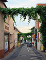
Backhausstrasse in Schwabenheim

Muzzle into the Rhine


Rail connection
The train station closest to the spring is in Kirchheimbolanden , approx. 5 km south of the Selz spring in Orbis . The Alzey train station , which is connected every half hour with the regional express from Mainz, is easier to reach . Other ways to get there are the Nieder-Olm train stations ( Mainz – Alzey line ) and Ingelheim.
Connection routes
- Rhine cycle path - connection in Ingelheim Nord.
- Fruit route - several points of contact, as well as the same route between Ingelheim and Schwabenheim.
- Amiche - connection in Friesenheim
- Hiwwel route - several points of contact: Ingelheim, Hahnheim, Alzey
- Mill cycle path - connection in Framersheim
See also:
literature
- Marliese Reitzel, Andreas Bitz, Peter Krings: Cycle guide through the Selztal / Rheinhessen region and discover, experience, experience. GMN, Verlag Mensch und Natur, Mainz, 2003. ISBN 3-00-011632-X
- Mainz and Rheinhessen: with hiking and cycling trails; Independent cities of Mainz and Worms, districts of Alzey-Worms, Bad Kreuznach, Mainz-Bingen and Donnersbergkreis. Publisher, Land Surveying Office Rhineland-Palatinate, Koblenz, 1999. ISBN 3-89637-301-3
Web links
- Selztal-Radweg at Rheinhessen.de
- Selztal - everything bike path or what? Private homepage with report and pictures ( Memento from February 11, 2013 in the web archive archive.today )
- Selztal-Radweg at Radwanderland.de
Coordinates: 49 ° 42 ' N , 8 ° 0' E