Sill
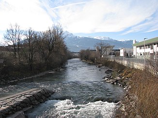
The Sill is a right tributary of the Inn in Tyrol , Austria , with a length of 42 km.
Run and landscape
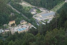
The Sill rises in the Zillertal Alps on the main Alpine ridge southeast of the Brenner Pass . The source is in the area of the Griesbergalm in the municipality of Gries am Brenner below the Wildseespitze at an altitude of over 2300 m. Below the Brenner, it flows through the Brennersee and then flows north through the North Tyrolean part of the Wipptal . Before entering the Inn Valley near Innsbruck, the Sill formed the Sill Gorge over the centuries, which extends from Gärberbach (district of Mutters ) to below the Bergisel . In the Inn Valley, the Sill has formed an alluvial cone and pushed the Inn to the foot of the Nordkette .
Other interesting places in the river are the weir Bretterkeller, named after a nearby inn, with a height of about five meters at the foot of the Paschberg in the city of Innsbruck and the Sillfall (height about 4 m), where the Sill water is taken. At the Sillzwickel, the name of the estuary, it flows into the Inn in the city of Innsbruck . The city has established a local recreation area there.
The most important feeder is the Ruetz coming from the Stubai Valley , which is around 32 km long and drains a catchment area of 321 km².
One of the three most important Alpine transit routes runs along the Sill, the Brenner Railway and the Brenner Motorway .
Construction work for rail tunnels from 2020
On August 3, 2020, construction work on the Sillschlucht construction lot of the Brenner Base Tunnel began. The north portal of the tunnel at the foot of the Viller Berg is to be built here by the end of 2024 . In addition, slope protection measures, a 200 m long retaining wall and 2 bridges each about 50 m long for the tracks over the Sill.
As a result, the construction site will be closed to pedestrians from August 10th, making the northern Sill Gorge inaccessible. The Sill Gorge above and south of the construction site and the panorama round remain accessible for hikers. An alternative hiking route to the lower northern area of the Sill Gorge is to be set up in autumn 2020.
Surname
The river is mentioned in the 12th century (1141 and 1187) in the (forged) documents of Wilten Abbey as "aqua Sulle" and "flumen Sülle", the confluence of the Sill and Inn as "Singelære" for the first time. At Patsch, Pfons and Steinach, the river is also referred to as “Sülle” or “Sill” in documents from the Middle Ages and modern times. The name is derived from the Latin root word silex with the meaning "pebble", "pebble-carrying brook", which is also associated with other river and place names (e.g. Sillian , Silz ).
The Sillalm in the Valser Valley and the Silesköpfl above it, mentioned in 1500 as "Sülkogl", suggest that the Valser Bach used to be seen as the upper reaches of the Sill.
Catchment area and water supply
The Sill has a natural catchment area of 854.8 km², of which (as of 2006) 28.1 km² (3.3%) are glaciated. The highest point in the catchment area is the Zuckerhütl at 3507 m . The half-height of the Sill catchment area is 1900 m , i. H. 50% of the catchment area is above this value.
The mean discharge at the Innsbruck-Reichenau gauge is 24.5 m³ / s, which corresponds to a discharge rate of 29.5 l / s · km². The runoff regime with the maximum in June and the minimum in February is typical for a mountain river without any significant glacial influence; it is dominated by the snowmelt in the higher areas of the catchment area. The highest monthly mean is 6.5 times higher than the lowest.
Average monthly discharge of the Sill (in m³ / s) at the Innsbruck-Reichenau gauge,
survey period 1951–2009, source:

The Sill repeatedly caused devastating floods in what is now the city of Innsbruck ( Wilten , Pradl , Dreiheiligen , Saggen ); in 1668, for example, 200 people died as a result. The bridges were regularly destroyed or damaged.
After two days of intense rainfall, on August 6, 1985, the largest flood event recorded to date occurred with a peak flow of 358 m³ / s at the Innsbruck-Reichenau gauge. The water accumulated on the Pradler bridge and flooded parts of Pradl and Dreiheiligen. Was affected greatly the armory , where parts of the stored in the basement of natural history collections were destroyed. Even worse was prevented by the fact that on August 6th the snow line fell to 1000 m and thus the precipitation in 95% of the catchment area was bound as snow. As a result, the Pradler Bridge was rebuilt with a modified road layout and flood protection structures were built along the Sill.
Economic use
The Sill Canal, which branches off from the Sill at the Sillfall in Wilten and flows back into the Sill at the Pradler Bridge, was created as early as the 12th century . It supplied Wilten and Innsbruck with water and served as an energy source for numerous businesses, including sawmills , grain mills, fig mills (for making fig coffee ) and hammer smiths . In 1926 there were still 20 businesses on the Sill Canal.
Today, water power is primarily used by electricity plants: a small power plant on the upper reaches in Gries am Brenner, the burner plant near Matrei am Brenner, the upper and lower Sillwerk .
Water quality
The water quality class in the Wipptal is I – II and in the urban area of Innsbruck II (as of 2005).
Web links
- Water level, flow rate and water temperature of the Sill at the Puig gauge (Matrei am Brenner) (Hydrographischer Dienst Tirol)
- Water level, flow and water temperature of the Sill at the Innsbruck-Reichenau gauge (Hydrographic Service Tyrol)
Individual evidence
- ↑ TIRIS - Tyrolean regional planning and information system
- ↑ a b c Office of the Tyrolean Provincial Government (Ed.): Fließgewässeratlas Tirol - Handbuch . Innsbruck 2002 ( PDF; 5.8 MB )
- ↑ a b c Federal Ministry of Agriculture, Forestry, Environment and Water Management (ed.): Hydrographisches Jahrbuch von Österreich 2009. 117th volume. Vienna 2011, p. OG 103, PDF (12.1 MB) on bmlrt.gv.at (yearbook 2009)
- ↑ BBT: Construction work in Sillschlucht started orf.at, August 4, 2020, accessed August 4, 2020.
- ↑ Martin Bitschnau - Hannes Obermair (edit.): Tiroler Urkundenbuch , II. Dept .: The documents on the history of the Inn, Eisack and Pustertal valleys , Vol. 2: 1140–1200 . Innsbruck: Wagner 2012, ISBN 978-3-7030-0485-8 , pp. 144ff. No. 392 and No. 328ff. No. 816 (each with a detailed discussion of the tradition forged in the 13th century).
- ↑ Otto Stolz : History of the waters of Tyrol . Schlern-Schriften, Volume 32, Innsbruck 1932, p. 27. ( digitized version )
- ↑ Ludwig Steinberger: Criss-cross through Tyrol's world of place names. In: Publications of the Museum Ferdinandeum, Volume 8 (1928) pp. 559–632 ( PDF; 4 MB )
- ^ Daniela Feistmantl, Gerhard Rampl: The oronyms of the Wipptal in the hunting book of Emperor Maximilian I. In: Gerhard Rampl, Katharina Zipser, Manfred Kienpointner (eds.): In Fontibus Veritas. Festschrift for Peter Anreiter on his 60th birthday. Innsbruck University Press, Innsbruck 2014, pp. 105–121 ( online )
- ↑ a b c Office of the Tyrolean Provincial Government, Dept. Water Management (Ed.): The Innsbruck / Sill gauge ( PDF; 1.9 MB ( page no longer available , search in web archives ) Info: The link was automatically marked as defective. Please check the link according to the instructions and then remove this notice. )
- ↑ Innsbruck Beautification Association: The Sill Canal, once a source of energy for the Innsbruck industry, received a monument. ( Memento from April 19, 2012 in the Internet Archive )
- ↑ Federal Ministry of Agriculture, Forestry, Environment and Water Management (ed.): Saprobiological water quality of the flowing waters of Austria. As of 2005. ( PDF; 1 MB ( Memento of the original from December 22, 2015 in the Internet Archive ) Info: The archive link has been inserted automatically and has not yet been checked. Please check the original and archive link according to the instructions and then remove this note. )


