
Stadelberg
| Sotinski breg / Stadelberg | ||
|---|---|---|
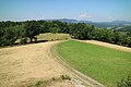
 Sotinski breg from the southeast |
||
| height | 418 m. i. J. | |
| location | Prekmurje , Slovenia and Burgenland , Austria | |
| Mountains | Goričko ( Southeastern Alpine Foreland ) | |
| Dominance | 5.1 km → Stradner Kogel | |
| Notch height | 91 m ↓ Bonisdorf | |
| Coordinates | 46 ° 50 '10 " N , 16 ° 1' 50" E | |
|
||
| rock | Phyllite schist | |
| Age of the rock | Paleozoic | |
| particularities | highest point in the Prekmurje region | |

The Stadelberg (also Stadlberg , Slovenian Sotinski breg or Kugla ) is a 418 m. i. J. high hill in Goričko on the border between Slovenia and Austria . It forms the highest elevation of the Prekmurje and Pomurska regions as well as the Jennersdorf district and is sometimes referred to by Slovenes as the “ Triglav des Prekmurje”.
Location and surroundings
The Stadelberg lies on both sides of the border in the municipalities of Rogašovci and Neuhaus am Klausenbach between the three-country corner of Styria / Burgenland / Slovenia in the southwest and the three-country corner of Austria / Hungary / Slovenia in the northeast. The highest point is on Slovenian soil, a triangulation point on the Austrian side is 417 m above sea level. A. In the southwest, the Ledava cut separates the elevation from Serdiški breg ( 416 m ). The largely forested north-west flank slopes down to the Leinergraben (Klausenbach), the populated and agriculturally used south-east slope to the Sotina valley. Around 1 km northeast of the elevation is Bonisdorf, the closest closed village. The hill is part of the Raab-Őrség-Goričko trilateral nature park .
Geology and geomorphology


The Stadelberg, located on the eastern edge of the Graz Bay , has a geological and morphological peculiarity, as, in contrast to its tertiary surroundings, it consists of much older Paleozoic slates that belong to the Sausal group. The geological window , referred to in Austrian literature as the “Neuhauser Schieferinsel”, also includes the neighboring Serdiški breg . In the Badenium and lower Sarmatian , the weather-resistant slate mountains protruded as islands from the Paratethys . In the Upper Pliocene , different levels formed in the area through phased denudation , of which the so-called Stadelberg level between 395 and 410 m is the highest. The mountain owes its typical plateau character to this leveled area. Because the levels in the Gleichenberg volcanic region are similar above sea level, Ivan Gams believed that volcanic formation was possible in 1959 .
In the Ledava Gorge, the slopes reach a steepness of up to 38 °, which is unusual for slate. Since the late 1980s there has been a quarry operated by SGP Pomgrad , which produces around 55,000 m³ of excavated material annually. The slates containing phyllith at the contact with the Miocene sediments , which are used, for example, in road construction , are extracted . Strongly metamorphic diabase , which are part of the geotectonic unit of the central alpine, dominate. In addition to quartz vessels up to 10 cm thick, there are albite and mica as well as pyrite and muscovite crystals . In the left (northern) part of the quarry, there are dolomite inclusions , which are covered with limonite and contain tiny goethite inclusions .
meteorology

In November 2006, at the request of Janko Halb, Director of the Landscape Protection Park (Krajinski park Goričko) , a fully automatic meteorological measuring station was built at Sotinski breg. The expansion of the monitoring network was intended to achieve a certain independence of the Prekmurje and especially Goričko from Austrian and Hungarian weather forecasts . The landscape protection park invested a total of 12 million tolar in the station, the location of which was made available by a landowner from Sotina without any claim for compensation. Since the end of December 2006, the weather hut and the wind mast have been recording meteorological data for the Slovenian Environment Agency (Agencija Republike Slovenije za okolje, ARSO) . There is a webcam on the wind mast .
The average wind speed between 2007 and 2016 was exactly 3 m / s, with the highest values measured between March and May. The main direction of current is south-southeast with almost 17% of all recorded winds. Around 12% come from a north-northwest direction.
tourism
The Sotinski breg is a popular destination and can be reached from both countries on hiking trails as well as on paved roads. Via Pomurje (Pomurska Planinska Pot) , a 300 km long long- distance hiking trail through the Pomurska region, runs over the summit . Next to the meteorological station there is a 17 m - according to other information - 14 m high observation and bell tower , which has been a checkpoint for long-distance hikers since 2013. The view extends in the south over the entire Goričko into the Mur plain (Mursko polje) and beyond to Croatia . In the west and north-west one overlooks the Styrian volcanic region with Stradner Kogel , Gleichenberger Kogel and Kapfenstein , to the east the view extends to western Hungary . A snack bar open on weekends is just a few minutes' walk from the observation tower.
According to a visitor survey using cognitive maps, the Sotinski breg is one of the most popular sights of the Goričko Landscape Park, along with the Grad Castle and the Ledavsko jezero and Bukovniško jezero lakes .
photos

Signpost in Sotina

Sotina quarry from the southeast

Summit plate

Lookout and bell tower

Plastic bull "Adam"
View to the Stradner Kogel

Signpost on the plateau


Web links
Individual evidence
- ^ Rogašovci. Krajinski park Goričko , accessed June 26, 2018 .
- ↑ Mojca Bedjanič: Geološki za varstvo narave zakladi Krajinskega parka Goricko. Zavod Republike Slovenije za varstvo narave, accessed on June 26, 2018 (Slovenian).
- ↑ Natural attraction - Sotinski breg. Krajinski park Goričko , accessed June 26, 2018 .
- ↑ a b Rudolf Berka: On the geology of the large basin areas of the Eastern Alps. In: Treatises of the Federal Geological Institute, Volume 64, Vienna 2015, pp. 71–141. Online PDF , accessed June 26, 2018.
- ↑ Renate Sampl: The Neuhauser Hügelland - Geological and morphological overview. In: 850 Years of Neuhaus am Klausenbach , Marktgemeinde Neuhaus am Klausenbach 2008, ISBN 978-3-200-01152-6 , pp. 68–70.
- ↑ Arthur Winkler-Hermaden : Geological interplay of forces and land formation - basic findings on the question of young mountain formation and land formation. Springer-Verlag, Vienna 1957, ISBN 978-3-7091-7881-2 , p. 363.
- ^ A b Ivan Gams : Geomorfologija in Izraba Tal v Pomurju. In: Geografski zbornik , Volume 5 (1959), pp. 205-251. Online PDF (Slovenian), accessed June 26, 2018.
- ↑ Anita Žalik, Rok Ciglič, Petra Gostinčar & Klemen Gostič: Prikaz pokrajine s pomočjo geografske panorame na primeru Serdiškega in Sotinskega brega. In: 20. Zborovanje Slovenskih Geografov - Pomurje Trajnostni regionalni razvoj ob reki Muri , Ljutomer - Murska Sobota 2009, pp. 341–353 (Slovenian). Online PDF , accessed June 26, 2018.
- ↑ Ludvik Penhofer & Miha Ješerk: Minerali iz kamnoloma Sotina. In: Zbornik minerali 2005, pp. 366–367. Online PDF , accessed June 26, 2018.
- ^ Bernarda B. Peček: Nova meteorološka postaja na Sotinskem bregu. In: Večer , December 2006, newspaper clipping at the meteorological station (Slovenian).
- ↑ Sotinski breg. Agencija Republike Slovenije za okolje (ARSO), March 15, 2017, accessed on June 26, 2018 (English).
- ^ Sotinski breg - first page. Sotinski breg, accessed June 26, 2018 .
- ↑ Stolp na Sotinskem bregu. Občina Rogašovci , accessed on June 26, 2018 (Slovenian).
- ^ Sotinski breg Hill. Mura-Raba, accessed June 26, 2018 .
- ^ Sotinski breg - gallery. Sotinski breg, accessed June 26, 2018 .
- ↑ Petra Gostinčar, Boštjan Jerebic, Jani Kozina, Barbara Lampič, Karmen Peternelj & Jernej Tiran: Krajinski Park Goričko: Omejitve in možnosti za razvoj zavarovanega območja. In: Tatjana Kikec (ed.): 20. Zborovanje Slovenskih Geografov - Pomurje Trajnostni regionalni razvoj ob reki Muri , Murska Sobota 2009, pp. 341–353 (Slovenian). Online PDF , accessed June 26, 2018.