Tanner (Washington)
| Tanner, Washington | ||
|---|---|---|
|
Location in Washington
|
||
| Basic data | ||
| State : | United States | |
| State : | Washington | |
| County : | King County | |
| Coordinates : | 47 ° 29 ′ N , 121 ° 45 ′ W | |
| Time zone : | Pacific ( UTC − 8 / −7 ) | |
| Residents : | 1,018 (as of: United States Census 2010 ) | |
| Population density : | 101.8 inhabitants per km 2 | |
| Area : | 10.5 km 2 (approx. 4 mi 2 ) of which 10.0 km 2 (approx. 4 mi 2 ) are land |
|
| Height : | 159 m | |
| FIPS : | 53-70315 | |
| GNIS ID : | 1526933 | |
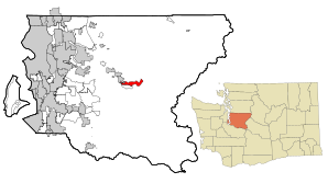
 Location of Tanner in King County |
||
Tanner is a census-designated place (CDP) in eastern King County , Washington state . The population was 1,018 at the 2010 United States Census .
In terms of per capita income , Tanner ranks 46th out of 522 among all municipalities classified in Washington state.
geography
Tanner is at 47 ° 28'43 "N / 121 ° 44'45" W. According to the United States Census Bureau , the place has a total area of 10.5 km², of which 0.5 km² or 4.51% is water.
Driving east on Interstate Highway I-90 , Tanner can be found east past North Bend at the base of Mount Si if you turn north at Exit 32 on I-90. Tanner is surrounded by miles of hiking trails that run through Washington State Forests. The most popular is the Mount Si Trail .; it is used by more than 100,000 hikers annually, which makes Tanner a popular destination for day hikes to the summit of Mount Si. There are other popular hiking trails in the Tanner area; these include the Little Si Trail , the Kamikaze / Teneriffe Falls and the Mailbox Peak Trail .
Demographics
As of the 2010 census , there were 2,966 residents, 1,055 households, and 835 families in Tanner. The population density was 188.7 per km ². There were 1,087 housing units at an average density of 69.1 per km².
The population was 94.1% White , 0.37% African American , 0.98% Native American , 1.21% Asian , 0.13% Pacific Islander , 0.84% from other "races" and 2.36% from two or more "races" . Hispanics or Latinos of "any race" made up 2.29% of the population.
Of the 1,055 households, 41.8% had children under the age of 18, 69.1% were run by married couples living together and 7.3% by single mothers; 20.8% were non-families. 14.8% of the households were singles and 2.2% were single persons over 65 years of age. The average household size was 2.81 and the average family size was 3.12.
The median age in the city was 36 years. 29.3% of the population were under 18, 5.9% between 18 and 24, 33.5% between 25 and 44, 25.7% between 45 and 64 and 5.6 65 years or older. There were 105.8 men for every 100 women, and 102.9 men for every 100 women over the age of 18.
All information on median income relates to the median. The median household income was US $ 73,105 and that of families was US $ 78,021. Men had a median income of US $ 52,140 compared to US $ 31,923 for women. The per capita income was US $ 28,604. About 1.5% of families and 4.5% of the total population lived below the poverty line ; this affected 1.1% of those under 18 years of age and 24.3% of those over 65 years of age.
Individual evidence
- ^ A b Geographic Identifiers: 2010 Demographic Profile Data (G001): Tanner CDP, Washington . US Census Bureau, American Factfinder. Retrieved April 2, 2013.
- ↑ US Gazetteer files: 2010, 2000, and 1990 . United States Census Bureau . February 12, 2011. Retrieved April 23, 2011.
- ^ Mount Si - Washington Trails Association . Retrieved October 6, 2015.
- ↑ Little Si Trail . Retrieved October 6, 2015.
- ↑ Kamikaze / Teneriffe Falls . Retrieved October 6, 2015.
- ↑ Mailbox Peak Trail . Retrieved October 6, 2015.
