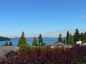
Mercer Island
| Mercer Island | |
|---|---|
 View across Lake Washington towards Seattle |
|
| County and state location | |
| Basic data | |
| State : | United States |
| State : | Washington |
| County : | King County |
| Coordinates : | 47 ° 34 ′ N , 122 ° 14 ′ W |
| Time zone : | Pacific ( UTC − 8 / −7 ) |
| Residents : | 22,036 (as of: 2000) |
| Population density : | 1,335.5 inhabitants per km 2 |
| Area : | 34.0 km 2 (approx. 13 mi 2 ) of which 16.5 km 2 (approx. 6 mi 2 ) is land |
| Height : | 103 m |
| Postal code : | 98040 |
| Area code : | +1 206 |
| FIPS : | 53-45005 |
| GNIS ID : | 1512455 |
| Website : | www.ci.mercer-island.wa.us |
| Mayor : | Jim Pearman |
Mercer Island is a city in King County in western Washington state . The city is located on the island of the same name in Lake Washington to the east of Seattle and belongs to its metropolitan area . To the north, Interstate 90 connects the city to the mainland . The population was 22,036 in 2000.
history
Mercer Island was first settled by whites in the 1870s. The island was named after the Mercer brothers, who rowed here from Seattle to fish, hunt or pick berries. The first settlement was formed on the northwest side of the island. This was initially called East Seattle . In 1889, CC Calkins built a hotel there, the Calkins Hotel. Because of this, a ferry pier was built there, Calkins Landing , which in turn contributed to a growth in the population. The hotel burned to the ground in 1908, but the ferry service was maintained and a small industrial area was created. During the 1930s, George Lightfoot campaigned for a bridge connection to Seattle. The Lake Washington Floating Bridge was completed in 1940, relocating the industrial park to its current location at the northern end of the island.
The City of Mercer Island was registered on July 5, 1960 and included the entire island with the exception of the approximately 28 hectare industrial park. This constituted itself on August 9, 1960 as the Town of Mercer Island and was completely surrounded by the city . The two communities merged on May 19, 1970.
geography
Mercer Island geographical coordinates are 47 ° 34 ' N , 122 ° 14' W .
According to the United States Census Bureau , the city has an area of 34.0 km² ; 16.5 km² of this is land and 17.4 km² is water.
Mercer Island is the most populous parish on an inland island in the United States.
bridges
Mercer Island is connected by Interstate 90 to Seattle to the west and Bellevue to the east. The Interstate to Seattle is led with the Mercer Island Bridge over Lake Washington. The structure consists of the two parallel floating bridges Homer M. Hadley Memorial Bridge and Lacey V. Murrow Memorial Bridge , which are among the longest floating bridges in the world. To the east, the interstate uses the East Channel Bridge to cross the water.
education
The Mercer Island School District includes six schools on the island, three elementary schools ( West Mercer Elementary , Island Park Elementary, and Lakeridge Elementary ), one middle school ( Islander Middle School ) and one high school ( Mercer Island High School ), and an alternative high school ( Crest Learning center ). The St. Monica School , the French American School of Puget Sound and the Northwest Yeshiva High School are also located on Mercer Island .
Demographics
At the time of the United States Census 2000, Mercer Island was inhabited by 22,036 people. The population density was 1,333.6 people per km ². There were 8806 housing units at an average of 532.9 per km². The Mercer Island population was 84.09% White , 1.14% Black or African American , 0.16% Native American , 11.87% Asian , 0.07% Pacific Islander , 0.52% said others Belonging to races and 2.16% named two or more races. 1.86% of the population declared to be Hispanic or Latinos of any race.
The residents of Mercer Islands distributed to 8437 households out of which 35.5% were living in children under 18 years of age. 65.6% of households were married, 6.7% had a female head of the household without a husband and 25.6% were not families. 22.1% of households were made up of individuals and someone lived in 11.2% of all households aged 65 years or older. The average household size was 2.58 and the average family size was 3.03.
The urban population was distributed among 26.0% minors, 4.2% 18–24 year olds, 21.2% 25–44 year olds, 29.9% 45–64 year olds and 18.7% aged 65 and over or more. The median age was 44 years. For every 100 women there were 92.7 men. For every 100 women over 18, there were 88.3 men.
The median household income in Mercer Island was 91,904 US dollars, and the median family income reached the level of 110,830 US dollars. The median income for men was $ 82,855 compared to $ 46,734 for women. The per capita income in Mercer Island was $ 53,799. 3.2% of the population and 1.9% of families had an income below the poverty line , including 3.4% of minors and 2.3% of those aged 65 and over.
sons and daughters of the town
- Mary Wayte (born 1965), swimmer
- Quin Snyder (born 1966), basketball coach
- Katie Hall (* 1987), racing cyclist
Twin town
Web links
- Mercer Island Reporter Local Newspaper
