
Theilenberg
|
Theilenberg
City gap
Coordinates: 49 ° 11 ′ 43 ″ N , 10 ° 52 ′ 24 ″ E
|
|
|---|---|
| Height : | 485 (473-496) m above sea level NHN |
| Residents : | 102 (Aug 1, 2015) |
| Postal code : | 91174 |
| Area code : | 09873 |
 Place view
|
|


Theilenberg is a district of the town of Spalt in the Central Franconian district of Roth .
geography
The parish village lies on the eastern flank of the Geiersberg, which slopes down in all other directions. In the west is the "Eichwald", in the southwest the "Dirnenholz". The Erlbach , a right tributary of the Franconian Rezat, flows south in the valley . Wernfels in the north is only a few hundred meters away. The place is in the Spalter hill country . A community road leads to the district road RH 10 (0.7 km north), which runs to Wernfels (0.6 km south-east) or the B 446 (1 km north-west).
history
The place was first mentioned by name on July 16, 1058 in a deed of donation in which Archdeacon Heysso, provost of Herrieden, bequeathed two vineyards in "Tilenburc" to his canon monastery in Herrieden. On this occasion you can learn that the place is in Sualafeldgau . At that time there was still the castle complex of the same name. The second mention was at 1158, when Count Rapoto of Abenberg the monastery Heilsbronn bequeathed the church of "Tilenburg". In 1284 Wernfels Castle and the two courtyards in Theilenberg came to Reinboto von Meilenhart , the then Prince-Bishop of Eichstätt. In the Eichstätter Salbuch of 1300 7 fiefs are recorded for the place, which resulted from the demolition of the two farms. In 1303, Bishop Konrad II von Pfeffenhausen acquired three further fiefs and two vineyards there. In 1348 the church patronage passed to the Nikolausstift zu Spalt. From 1475 St. Wenzelaus is Theilenberg's parish church, the pastors were mostly canons of Spalt.
Towards the end of the 18th century, Theilenberg formed a municipality with Wernfels. There were 15 properties in Theilenberg (1 whole courtyard, 4 three-quarter courtyards, 6 half courtyards, 4 small farms). The high court was exercised by the Wernfels-Spalt administration office in Eichstatt . All properties had the caste office Spalt as landlord . For a whole courtyard the dues went to the church in Teilberg, for a three-quarter courtyard the church in Theilenberg was loanable and interestable. In addition to the property, there was also the parish church and communal buildings (school, shepherd's house).
As part of the community edict, Theilenberg was assigned to the Wernfels tax district formed in 1808 . It also belonged to the rural community of Wernfels, founded in 1811 . On May 1, 1978, Theilenberg was incorporated into Spalt as part of the regional reform in Bavaria .
Architectural monuments
- House No. 20a: Catholic parish church of St. Wenceslas
- House No. 21: Former farmhouse with barn
- House No. 22: Former farmhouse with barn
- House No. 24: Adjoining barn
- House No. 33: Former parish barn
- 3 chapels
Population development
| year | 1818 | 1840 | 1861 | 1871 | 1885 | 1900 | 1925 | 1950 | 1961 | 1970 | 1987 | 2015 |
|---|---|---|---|---|---|---|---|---|---|---|---|---|
| Residents | 95 | 115 | 139 | 120 | 158 | 111 | 104 | 105 | 103 | 97 | 95 | 102 |
| Houses | 16 | 19th | 25th | 24 | 22nd | 22nd | 23 | 29 | ||||
| source |
religion
Even after the Reformation, the place remained predominantly Roman Catholic. The residents of the Roman Catholic denomination are parish to St. Wenzelaus (Theilenberg) , the residents of the Evangelical Lutheran denomination to St. Andreas (Wasserm inaccurate) .
photos
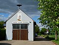
Theilenberg fire station

View fromeilenberg

Wernfels Castle as seen from Theilenberg
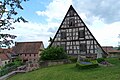
Cemetery and old Stodl in Theilenberg

Playground in Theilenberg


literature
- Johann Kaspar Bundschuh : Deulenberg . In: Geographical Statistical-Topographical Lexicon of Franconia . tape 1 : A-egg . Verlag der Stettinische Buchhandlung, Ulm 1799, DNB 790364298 , OCLC 833753073 , Sp. 588-590 ( digitized version ).
- Friedrich Eigler : Schwabach (= Historical Atlas of Bavaria, part of Franconia . I, 28). Michael Laßleben, Kallmünz 1990, ISBN 3-7696-9941-6 , p. 424, 488 .
- Karl Gröber, Felix Mader : City and district of Schwabach (= The art monuments of Bavaria . Middle Franconia 7). R. Oldenburg, Munich 1939, DNB 366496239 , p. 376-381 .
- Ernst von Kietzell: Werdenfels, Tilenburg: Burg- u. Local history of Wernfels-Theilenberg . In: From the Spalter home; Episode 12 . Heimatverein Spalter Land e. V., Spalt 1973, DNB 740689150 .
- Willi Ulsamer (Ed.): 100 Years of the Schwabach District (1862–1962). A home book . Schwabach 1964, DNB 984880232 , p. 640-641 .
Web links
- Theilenberg in the location database of the Bayerische Landesbibliothek Online . Bavarian State Library
- Theilenberg in the Topographia Franconiae of the University of Würzburg , accessed on September 22, 2019.
- Theilenberg in the historical directory of the association for computer genealogy
Individual evidence
- ↑ a b Population figures on the grossweingarten.de website
- ↑ Theilenberg in the Bavaria Atlas
- ↑ F. Eigler, p. 77.
- ↑ F. Eigler, p. 424.
- ↑ F. Eigler, p. 488.
- ↑ Only inhabited houses are given. In 1818 these were referred to as hearths , in 1840 as houses , and from 1871 to 1987 as residential buildings.
- ↑ Alphabetical index of all the localities contained in the Rezatkkreis according to its constitution by the newest organization: with indication of a. the tax districts, b. Judicial Districts, c. Rent offices in which they are located, then several other statistical notes . Ansbach 1818, p. 91 ( digitized version ).
- ↑ Eduard Vetter (Ed.): Statistical handbook and address book of Middle Franconia in the Kingdom of Bavaria . Self-published, Ansbach 1846, p. 220 ( digitized version ).
- ^ Joseph Heyberger, Chr. Schmitt, v. Wachter: Topographical-statistical manual of the Kingdom of Bavaria with an alphabetical local dictionary . In: K. Bayer. Statistical Bureau (Ed.): Bavaria. Regional and folklore of the Kingdom of Bavaria . tape 5 . Literary and artistic establishment of the JG Cotta'schen Buchhandlung, Munich 1867, Sp. 1090 , urn : nbn: de: bvb: 12-bsb10374496-4 ( digitized ).
- ↑ Kgl. Statistical Bureau (ed.): Complete list of localities of the Kingdom of Bavaria. According to districts, administrative districts, court districts and municipalities, including parish, school and post office affiliation ... with an alphabetical general register containing the population according to the results of the census of December 1, 1875 . Adolf Ackermann, Munich 1877, 2nd section (population figures from 1871, cattle figures from 1873), Sp. 1258 , urn : nbn: de: bvb: 12-bsb00052489-4 ( digitized version ).
- ↑ K. Bayer. Statistical Bureau (Ed.): Localities directory of the Kingdom of Bavaria. According to government districts, administrative districts, ... then with an alphabetical register of locations, including the property and the responsible administrative district for each location. LIV. Issue of the contributions to the statistics of the Kingdom of Bavaria. Munich 1888, Section III, Sp. 1192 ( digitized version ).
- ↑ K. Bayer. Statistical Bureau (Ed.): Directory of localities of the Kingdom of Bavaria, with alphabetical register of places . LXV. Issue of the contributions to the statistics of the Kingdom of Bavaria. Munich 1904, Section II, Sp. 1266 ( digitized version ).
- ↑ Bavarian State Statistical Office (ed.): Localities directory for the Free State of Bavaria according to the census of June 16, 1925 and the territorial status of January 1, 1928 . Issue 109 of the articles on Bavaria's statistics. Munich 1928, Section II, Sp. 1304 ( digitized version ).
- ↑ Bavarian State Statistical Office (ed.): Official place directory for Bavaria - edited on the basis of the census of September 13, 1950 . Issue 169 of the articles on Bavaria's statistics. Munich 1952, DNB 453660975 , Section II, Sp. 1128 ( digitized version ).
- ↑ Bavarian State Statistical Office (ed.): Official city directory for Bavaria, territorial status on October 1, 1964 with statistical information from the 1961 census . Issue 260 of the articles on Bavaria's statistics. Munich 1964, DNB 453660959 , Section II, Sp. 826 ( digitized version ).
- ^ Bavarian State Statistical Office (ed.): Official place directory for Bavaria . Issue 335 of the articles on Bavaria's statistics. Munich 1973, DNB 740801384 , p. 181 ( digitized version ).
- ↑ Bavarian State Office for Statistics and Data Processing (Ed.): Official local directory for Bavaria, territorial status: May 25, 1987 . Issue 450 of the articles on Bavaria's statistics. Munich November 1991, DNB 94240937X , p. 349 ( digitized version ).

Leech mill | Enderndorf am See | Engelhof | Funfbronn | Large vineyard | Güsseldorf | Hagsbronn | Heiligenblut | Höfstetten | Hohenrad | Hill mill | Kaltenbrunn | Wedge Mountain | Massendorf | Mosbach | Nagelhof | Ottmannsberg | Cutling | Steinfurt | Jar mill | Stockheim | Street house | Theilenberg | Trautenfurt | Untererlbach | Wasserzell | Wernfels