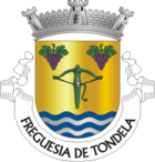
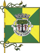
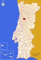
Tondela
| Tondela | ||||||
|---|---|---|---|---|---|---|
|
||||||
| Basic data | ||||||
| Region : | Centro | |||||
| Sub-region : | Dão-Lafoes | |||||
| District : | Viseu | |||||
| Concelho : | Tondela | |||||
| Coordinates : | 40 ° 31 ′ N , 8 ° 5 ′ W | |||||
| Residents: | 4509 (as of June 30, 2011) | |||||
| Surface: | 11.35 km² (as of January 1, 2010) | |||||
| Population density : | 397 inhabitants per km² | |||||
| politics | ||||||
| Address of the municipal administration: | Junta de Freguesia de Tondela R Pedro Figueiredo 3460-608 Tondela |
|||||
| Tondela district | ||||||
|
||||||
| Residents: | 28,946 (as of June 30, 2011) | |||||
| Surface: | 371.22 km² (as of January 1, 2010) | |||||
| Population density : | 78 inhabitants per km² | |||||
| Number of municipalities : | 19th | |||||
| administration | ||||||
| Administration address: | Câmara Municipal de Tondela Largo da República, n.º 16 3464-001 Tondela |
|||||
| President of the Câmara Municipal: | José António Jesus ( PSD ) | |||||
| Website: | www.cm-tondela.pt | |||||
Tondela is a Portuguese district ( Concelho ) and a city ( Cidade ) with 4509 inhabitants (as of June 30, 2011).
history

In the Anta Arquinha da Moura
|
Various excavations and finds of rock drawings, among other things, prove a prehistoric settlement of the district area. Since the Romans who lived here since the 2nd century BC Ruled, the most important local town was known as Ballistarii . Some sections of the Roman road running here have been preserved to this day. The district became independent as Besteiros before the independence of the Kingdom of Portugal from 1139, and Tondela belonged to the district of Besteiros.
King Manuel I gave Besteiros town rights in 1515. In 1836 the seat and name of the district changed to Tondela. In 1987 Tondela was promoted to city.
Culture and sights
The architectural monuments of the district include archaeological excavations and sites, historical public buildings, stone fountains, Roman and later bridges, mansions and a variety of sacred buildings . The historic town center as a whole is also a listed building.
The climatic health resort of Caramulo is located in the municipality of Guardão . Hiking trails run through the wooded mountains of the Serra do Caramulo . Further thematic hiking trails are laid out in the whole district.
The Caldas de Sangemil thermal baths , which opened in 1994 and whose warm mineral water springs have been known for their medicinal properties since the 18th century, is located in the municipality of Lajeosa .
The Caramulo Museum is both a well-known car museum and an important art museum.
Sports
The football club CD Tondela rose to the second Portuguese division for the first time in 2013 , and in 2015 to the first Portuguese division . on. He plays his home games at Estádio João Cardoso, which has a capacity of 2,586 .
There are a number of other sports clubs in the district, including the Clube Atlético de Molelos and the Sporting Clube de Nandufe , founded in 1925, both of which are particularly known for their football departments.
administration
The circle
Tondela is the administrative seat of a district of the same name. The neighboring areas are (starting clockwise in the north): Vouzela , Oliveira de Frades , Viseu , Carregal do Sal , Santa Comba Dão , Mortágua and Águeda .
With the regional reform in September 2013 , several municipalities were merged into new municipalities, so that the number of municipalities decreased from 26 to 19.
The following municipalities ( Freguesias ) are in the Tondela district:
| local community | Population (2011) |
Area km² |
Density of population / km² |
LAU code |
|---|---|---|---|---|
| Barreiro de Besteiros e Tourigo | 1,487 | 45.73 | 33 | 182127 |
| Campo de Besteiros | 1,474 | 7.93 | 186 | 182102 |
| Canas de Santa Maria | 1,806 | 13.85 | 130 | 182103 |
| Caparrosa e Silvares | 941 | 24.57 | 38 | 182128 |
| Castelões | 1,542 | 17.12 | 90 | 182105 |
| Dardavaz | 782 | 13.69 | 57 | 182106 |
| Ferreirós do Dão | 441 | 8.29 | 53 | 182107 |
| Guardão | 1,490 | 18.95 | 79 | 182108 |
| Lajeosa | 1,940 | 24.59 | 79 | 182109 |
| Lobão da Beira | 1,124 | 14.09 | 80 | 182110 |
| Molelos | 2,346 | 15.50 | 151 | 182111 |
| Mouraz e Vila Nova da Rainha | 1,354 | 15.53 | 87 | 182129 |
| Parada de Gonta | 754 | 6.73 | 112 | 182116 |
| Santiago de Besteiros | 1,331 | 15.75 | 84 | 182118 |
| São João do Monte e Mosteirinho | 1,079 | 65.13 | 17th | 182130 |
| São Miguel do Outeiro e Sabugosa | 1,458 | 18.54 | 79 | 182131 |
| Tonda | 984 | 7.50 | 131 | 182122 |
| Tondela e Nandufe | 5,130 | 15.75 | 326 | 182132 |
| Vilar de Besteiros e Mosteiro de Fráguas | 1,483 | 21.98 | 67 | 182133 |
| Tondela district | 28,946 | 371.22 | 78 | 1821 |
Population development
| Population in the Tondela district (1801–2011) | |||||||||
|---|---|---|---|---|---|---|---|---|---|
| 1801 | 1849 | 1900 | 1930 | 1960 | 1981 | 1991 | 2001 | 2011 | |
| 3,417 | 17,880 | 30,622 | 34,632 | 38,917 | 35.906 | 32,049 | 31,152 | 28,953 | |
Municipal holiday
- 16th September
Town twinning
-
 France : Lannemezan (since 1995)
economy
Tondela is located in the Dão wine-growing region , mainly red wines are produced in the district.
In particular in the industrial area ZIM da Adiça there are suppliers of the automotive industry, but also producers of paints and building materials, etc. a. Other industrial and logistics companies are active in the ZIM de Lagedo and ZIM de Vilar industrial parks .
In various wind farms with a total output of around 100 MW, electricity is produced in the district.
traffic
Until 1988 Tondela had a connection to the country's rail network via the Linha do Dão line.
The place is on the IP3, which is connected 18 km north with junction no. 17 (Viseu-Oeste) to the A25 motorway (Aveiro - Vilar Formoso / Spain). To the south, the IP3 changes to an expressway extension after 33 km, which leads from Coimbra as the A14 to Figueira da Foz.
Tondela is integrated into the national bus network of Rede Expressos .
sons and daughters of the town
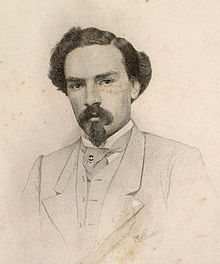
- Tomás Ribeiro (1831–1901), journalist, poet and politician, multiple minister
- José Manuel de Carvalho (1844–1904), Bishop of Macau and the Azores
- Cândido de Figueiredo (1846–1925), philologist and author
- António Quadros (1933–1994), painter and writer
- Nuno Claro (* 1977), football player (goalkeeper)
- Samuel Úria (* 1979), musician
- Nuno Piloto (* 1982), soccer player
Web links
- Map of the Freguesia Tondela at the Instituto Geográfico do Exército
- Portal of the City of Tondela Online
Individual evidence
- ↑ a b www.ine.pt - indicator resident population by place of residence and sex; Decennial in the database of the Instituto Nacional de Estatística
- ↑ a b Overview of code assignments from Freguesias on epp.eurostat.ec.europa.eu
- ↑ Address of the Junta de Freguesia ( page no longer available , search in web archives ) Info: The link was automatically marked as defective. Please check the link according to the instructions and then remove this notice. , from pai.pt, Portuguese, accessed May 20, 2010
- ↑ www.ine.pt - indicator resident population by place of residence and sex; Decennial in the database of the Instituto Nacional de Estatística
- ^ João Fonseca: Dicionário do Nome das Terras. 2nd edition, Casa das Letras, Cruz Quebrada 2007, p. 251f ( ISBN 978-9724617305 )
- ↑ www.monumentos.pt (under Cronologia ), accessed on March 14, 2013
- ↑ www.monumentos.pt , accessed on March 14, 2013
- ↑ www.cm-tondela.pt , accessed on March 14, 2013
- ↑ www.cm-tondela.pt ( Memento of the original from May 24, 2013 in the Internet Archive ) Info: The archive link was inserted automatically and has not yet been checked. Please check the original and archive link according to the instructions and then remove this notice. , accessed March 14, 2013
- ^ Publication of the administrative reorganization in the Diário da República gazette of January 28, 2013, accessed on March 16, 2014
- ↑ www.cm-tondela.pt , accessed on March 14, 2013
- ↑ ditto
- ↑ ditto
- ↑ www.cm-tondela.pt , accessed on March 14, 2013


