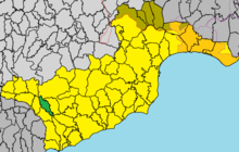
Vavla
|
Vavla Βάβλα |
||
|---|---|---|
|
|
||
| Basic data | ||
| State : |
|
|
| District : | Larnaka | |
| Geographic coordinates : | 34 ° 50 ′ N , 33 ° 16 ′ E | |
| Height above d. M .: |
470 m |
|
| Surface: | 9.81591 km² | |
| Residents : | 52 (2011) | |
| LAU-1 code no .: | CY-03 | |
| Website: | www.vavlavillage.com/en/ | |
Vavla ( Greek Βάβλα ) is a place in the Larnaka district in Cyprus . At the last official census in 2011, the place had 52 inhabitants.
location
Vavla is located in the south-eastern center of the island of Cyprus at an altitude of about 470 meters, about 36 km southeast of the capital Nicosia , 31 km west of Larnaka and 24 km northeast of Limassol .
The place is located about 14 km from the Mediterranean Sea in the southeastern foothills of the Troodos Mountains . To the east is the Agios Minas monastery . In the southwest there is a reservoir, the Kalavasos Reservoir . Mainly olives , carob , citrus fruits , wine and grain are grown. Vavla can be reached from the west, east and south via winding roads.
The landscape around the place is rather sparsely populated. Places in the area are Pano Lefkara and Kato Lefkara in the northeast, Kato Drys in the east and Lageia in the west.
Web links
- The community site (English)
Individual evidence
- ^ Statistical Service. cystat.gov.cy, accessed March 24, 2019 . (Download)
- ↑ Nature: Natural Environment , vavlavillage.com, accessed April 4, 2019.


