
Scharndorf
|
Scharndorf
|
||
|---|---|---|
| coat of arms | Austria map | |
 |
|
|
| Basic data | ||
| Country: | Austria | |
| State : | Lower Austria | |
| Political District : | Bruck an der Leitha | |
| License plate : | BL | |
| Surface: | 25.82 km² | |
| Coordinates : | 48 ° 6 ' N , 16 ° 48' E | |
| Height : | 187 m above sea level A. | |
| Residents : | 1,175 (January 1, 2020) | |
| Postal code : | 2403 | |
| Area code : | 02163 | |
| Community code : | 3 07 22 | |
| NUTS region | AT127 | |
| Address of the municipal administration: |
Floor line 1b 2403 Scharndorf |
|
| Website: | ||
| politics | ||
| Mayor : | Leopold Zwickelstorfer ( ÖVP ) | |
|
Municipal Council : ( 2020 ) (19 members) |
||
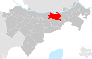
| Location of Scharndorf in the Bruck an der Leitha district | ||
  |
||
 The municipal office in Scharndorf |
||
| Source: Municipal data from Statistics Austria | ||

Scharndorf (Croatian Šarica also: Šundrof) is a municipality with 1175 inhabitants (as of January 1, 2020) in the district of Bruck an der Leitha in Lower Austria .
geography
Geographical location
Scharndorf is located in the industrial district in Lower Austria. The towns of Regelsbrunn and Wildungsmauer are located directly on the southern bank of the Danube , the main town is further south. The area of the municipality covers 25.82 square kilometers. 16.67 percent of the area is forested.
Community structure
The municipal area includes the following three localities or cadastral communities of the same name (population in brackets as of January 1, 2020):
- Regelsbrunn (326)
- Scharndorf (422)
- Wildungsmauer (427)
history
In ancient times the area was part of the province of Pannonia .
The Scharndorf defense tower , today part of the Roman Catholic parish church, was built around 1043. In 1072 Scharndorf was mentioned in the Salbuch (lease list) of the Göttweig monastery for the first time under the name "Scorindorf".
In the course of the first Turkish siege of Vienna in 1529, the region was devastated by the Turks and the population killed or captured. Resettlement did not follow until 1540. For this purpose, Croats who fled the Turks were settled in Scharndorf and the current districts of Wildungsmauer and Regelsbrunn.
In 1659 Scharndorf was hit by the plague . During the second Turkish siege of Vienna in 1683, a large part of the Ottoman army was encamped in the village. After the Ottomans left, the place had to be repopulated again.
In 1687 Caspar Wolf from Pressburg delivered a bell that is still in the tower today. The plague hit the village again in 1739 and cholera in 1831 .

In 1848/49 the municipal council was constituted according to the imperial patent. A large fire incinerated the west side of the village in 1866. In 1882 the volunteer fire brigade Scharndorf was founded, which won the state competition in 1978. The communities of Scharndorf, Regelsbrunn and Wildungsmauer were merged on January 1st, 1972. In 1989 and 1994 the community of Scharndorf won the competition "Lower Austria in flower arrangements".
Population development
According to the results of the 2001 census, there were 1046 inhabitants. In 1991 the municipality had 997 inhabitants, in 1981 973 and in 1971 945 inhabitants.
Culture and sights
- Filial church hl. Nikolaus in Wildungsmauer
- Parish church hl. James d. Ä. in Regelsbrunn
Economy and Infrastructure
In 2001 there were 30 non-agricultural workplaces, and there were 56 in agriculture and forestry according to the 1999 survey. According to the 2001 census, the number of people in employment at the place of residence was 475. In 2001, the activity rate was 46.94 percent.
mayor
- 1994–2020 Hubert Zwickelstorfer (ÖVP)
- since 2020 Leopold Zwickelstorfer (ÖVP)
Web links
- 30722 - Scharndorf. Community data, Statistics Austria .
Individual evidence
- ^ Nikolaus Wilhelm-Stempin: The settlement area of the Burgenland Croats . Ed .: Books on Demand GmbH, Norderstedt.
- ↑ Statistics Austria: Population on January 1st, 2020 by locality (area status on January 1st, 2020) , ( CSV )
- ↑ Statistics Austria: dissolutions or associations of municipalities from 1945

Au am Leithaberge | Bad Deutsch-Altenburg | Mountain | Bruck an der Leitha | Ebergassing | Enzersdorf an der Fischa | Fischamend | Göttlesbrunn-Arbesthal | Götzendorf an der Leitha | Gramatneusiedl | Hainburg an der Donau | Haslau-Maria Ellend | Himberg | Hof am Leithaberge | Höflein | Hundsheim | Klein-Neusiedl | Lanzendorf | Leopoldsdorf | Mannersdorf am Leithagebirge | Maria-Lanzendorf | Moosbrunn | Petronell-Carnuntum | Prellenkirchen | Rauchwarth | Rohrau | Scharndorf | Schwadorf | Schwechat | Summer one | Trautmannsdorf an der Leitha | Wolfsthal | Twelve axing
Cadastral municipalities: Regelsbrunn | Scharndorf | Wildungsmauer
Locations: Regelsbrunn | Scharndorf | Wildungsmauer
Villages: Regelsbrunn • Scharndorf • Wildungsmauer
Counting district: Scharndorf | Regelsbrunn | Wildungsmauer