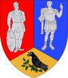
Sântămăria-Orlea
Sântămăria-Orlea | |
|---|---|
| Country | |
| County | Hunedoara County |
| Population (2002)[1] | 3,522 |
| Time zone | UTC+2 (EET) |
| • Summer (DST) | UTC+3 (EEST) |
Sântămăria-Orlea (Hungarian: Őraljaboldogfalva) is a commune in Hunedoara County, Romania. It is composed of nine villages: Balomir (Balomir), Bărăștii Hațegului (Baresd), Bucium-Orlea (Bucsum), Ciopeia (Csopea), Săcel (Szacsal), Sânpetru (Szentpéterfalva), Sântămăria-Orlea, Subcetate (Hátszegváralja) and Vadu (Vád).
Sânpetru Formation
Near Sânpetru, one of the villages comprising the commune, Sânpetru Formations (Sânpetru Beds) are located.
References
- ^ Romanian census data, 2002 Retrieved on April 9, 2016.
45°35′26″N 22°58′14″E / 45.5906°N 22.9706°E

