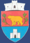
Beriu
|
Beriu Bear Village Berény |
||||
|
||||
| Basic data | ||||
|---|---|---|---|---|
| State : |
|
|||
| Historical region : | Transylvania | |||
| Circle : | Hunedoara | |||
| Coordinates : | 45 ° 47 ' N , 23 ° 11' E | |||
| Time zone : | EET ( UTC +2) | |||
| Height : | 269 m | |||
| Area : | 184.79 km² | |||
| Residents : | 3,138 (October 20, 2011) | |||
| Population density : | 17 inhabitants per km² | |||
| Postal code : | 337075 | |||
| Telephone code : | (+40) 02 54 | |||
| License plate : | HD | |||
| Structure and administration (as of 2016) | ||||
| Community type : | local community | |||
| Structure : | Beriu, Căstău , Cucuiș , Măgureni , Orăștioara de Jos , Poieni , Sereca , Sibișel | |||
| Mayor : | Emil Moise Bîc ( PNL ) | |||
| Postal address : | Str. Principală, no. 131 loc. Beriu, jud. Hunedoara, RO-337075 |
|||
| Website : | ||||
Beriu ( German Bärendorf , Hungarian Berény ) is a municipality in the Hunedoara district in Transylvania , Romania .
The place Beriu is also known under the German name Lammdorf .
Geographical location
The municipality of Beriu is located with its six villages and two hamlets in the southwest of the Transylvanian Basin north of the Șureanu Mountains ( Mühlbacher Mountains ) in the historic Brooser Stuhl . At Orăştie - a left tributary of the Mureş ( Mieresch ) - and the county road ( Drum județean ) DJ 705A, about seven kilometers south of the European route 68 , the place is about six kilometers south of the small town of Orăştie ( Broos ); the district capital Deva ( Diemrich ) is 34 kilometers northwest of Beriu.
The incorporated villages are approx. 2–33 kilometers away from the municipality and can be reached partly on field or forest roads .
history
The place Beriu was first mentioned in 1332. According to information from V. Roth and J. Braun about archaeological finds, the place was already settled in Roman times. According to reports by C. Gooss, Grigore Tocilescu , Gábor Téglás and others, on the area of the incorporated village of Sibișel ( Altschebeschel ) a. Dacian coins from the La Tène period found. Some of the coins are in museums in Budapest and Vienna .
Because of the Turkish invasions from 1420 to 1430, the population of the Germans settled here declined; afterwards, mostly Romanians moved into the villages.
The main occupations of the population are agriculture , livestock and wood processing .
population
In 1850 there were 4281 inhabitants on the territory of the municipality. 3745 of them were Romanians , 235 Roma , 218 Germans , 78 Hungarians and five others. In that year the largest population - and at the same time that of Romanians and Romanian Germans - was determined. The highest number of Roma (333) was registered in 1956 and that of Hungarians (259) in 1880. In addition, one resident identified himself as a Serb and some as Ukrainian for almost every recording , the largest number (12) being in 1966. In 1880 two residents were registered as Slovaks and in 1956 one resident . At the 2002 census, 3354 people lived in the area of the municipality, of whom 3335 were Romanians, eight Hungarians, seven Roma, three Romanian Germans and one Ukrainian.
Attractions
- The ruins of a medieval castle on the Bordul Cetății mountain in the incorporated village of Sibișel ( Altschebeschel ).
Web links
Individual evidence
- ↑ 2011 census in Romania at citypopulation.de
- ^ Dictionary of the localities in Transylvania
- ↑ a b Heinz Heltmann, Gustav Servatius (Ed.): Travel Guide Siebenbürgen. Kraft, Würzburg 1993, ISBN 3-8083-2019-2 .
- ^ Institute Of Archeology - Beriu, accessed May 27, 2011 (Romanian)
- ^ Institute of Archeology - Sibișel, accessed on May 27, 2011 (Romanian)
- ↑ Census, last updated November 4, 2008, p. 53 (Hungarian; PDF; 1.1 MB)


