Autoroute A 23
| Autoroute A23 in France | |||||||||||||||||||||||||||||||||||||||||||

|
|||||||||||||||||||||||||||||||||||||||||||
| map | |||||||||||||||||||||||||||||||||||||||||||
| Basic data | |||||||||||||||||||||||||||||||||||||||||||
| Operator: | DIR North | ||||||||||||||||||||||||||||||||||||||||||
| Overall length: | 43 km | ||||||||||||||||||||||||||||||||||||||||||
|
Regions : |
|||||||||||||||||||||||||||||||||||||||||||
| The A 23 at Péronne-en-Mélantois | |||||||||||||||||||||||||||||||||||||||||||
|
Course of the road
|
|||||||||||||||||||||||||||||||||||||||||||
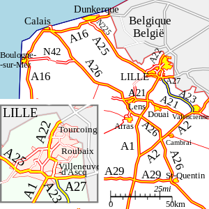
The Autoroute A 23 is a French motorway and connects Lesquin with Valenciennes . It has a length of 43 km.
This road was the C27 until 1982. The southern section from Orchies to Valenciennes was mainly made by upgrading the old N 49 , while the northern section from Orchies to Lille , which opened first, was completely rebuilt.
The use of the motorway is free of charge. It is maintained by the DIR Nord motorway company.
history
- January 15, 1974: opening of the Lesquin - Orchies section (A 27 - exit 2)
- August 24, 1976: opening of the Orchies - La Sentinelle section (exit 2 - A 2)
Web links
- Autoroute A 23 in German and French version of the SARATLAS
- Autoroute A 23 on WikiSara (French)


