
Binswangen
| coat of arms | Germany map | |
|---|---|---|

|
Coordinates: 48 ° 33 ' N , 10 ° 38' E |
|
| Basic data | ||
| State : | Bavaria | |
| Administrative region : | Swabia | |
| County : | Dillingen on the Danube | |
| Management Community : | Wertingen | |
| Height : | 440 m above sea level NHN | |
| Area : | 11.91 km 2 | |
| Residents: | 1325 (Dec. 31, 2019) | |
| Population density : | 111 inhabitants per km 2 | |
| Postal code : | 86637 | |
| Area code : | 08272 | |
| License plate : | DLG, WHO | |
| Community key : | 09 7 73 116 | |
| LOCODE : | DE ISW | |
| Community structure: | 2 parts of the community | |
| Association administration address: | Schulstr. 12 86637 Wertingen, Germany |
|
| Website : | ||
| First Mayor : | Anton Winkler ( Free Association of Voters ) | |
| Location of the municipality of Binswangen in the district of Dillingen on the Danube | ||
  |
||

Binswangen is a municipality in the Swabian district of Dillingen on the Danube and a member of the Wertingen administrative community .
geography
Binswangen is located in the Augsburg region between Wertingen and Dillingen on the Danube .
There are two officially named parts of the municipality (the type of settlement is given in brackets ):
- Binswangen ( parish village )
- Customs house ( wasteland )
There is only the district Binswangen.
history
The first written mention of the place comes from the year 1182. Binswangen came into the possession of Konrad Ramschwag in 1300 and in 1334 into the possession of the Lords of Ellerbach. The barons of Langenmantel (1412–1563) followed. Later, the Schertlin von Burtenbach (1569–1638) and the Barons von Knöringen (1638–1769) appear as local lords. Subsequently, Binswangen was under the feudal rule of the prince monastery Kempten . Since the Reichsdeputationshauptschluss of 1803, the place has belonged to Bavaria.
During the November pogrom in 1938 , the synagogue in Binswangen was plundered and desecrated by SA men from Augsburg . In the last days of April 1945 the place was still being shelled by the Americans.
After the Second World War, up to 400 displaced persons were housed in the village.
Population development
- 1961: 936 inhabitants
- 1970: 1011 inhabitants
- 1987: 1094 inhabitants
- 1991: 1100 inhabitants
- 1995: 1211 inhabitants
- 2000: 1249 inhabitants
- 2005: 1338 inhabitants
- 2010: 1357 inhabitants
- 2015: 1308 inhabitants
Between 1988 and 2018 the municipality grew from 1,083 to 1,356 by 273 inhabitants or by 25.2%.
politics
mayor
Mayor is Anton Winkler (Free Association of Voters). In 2002 he succeeded Heinz Petz (CSU). In the municipal elections in Bavaria in 2014 , he was confirmed in office with 86.99% of the votes and on March 15, 2020 he was elected with 84.8% for a further six years.
Municipal council
The 2020 election resulted in the following distribution of seats in the municipal council (twelve members):
- Free community of voters 3
- CSU 4
- Citizens' bloc / non-party 3
- Green 2
coat of arms
|
|
Blazon : “Above a stepped gable split by green and gold in the shield base split by gold and green; in front a heraldic lily, behind three heraldic roses on a leafy stem in mixed up colors. " |
Architectural monuments
Economy and Infrastructure
Economy including agriculture and forestry
According to official statistics, there were no employees subject to social insurance contributions at the place of work in 1998 in the manufacturing sector 92 or in the trade and transport sector. There were a total of 447 employees at the place of residence subject to social security contributions. There were none in the manufacturing sector and two in the construction sector. In addition, in 1999 there were 42 farms with an agricultural area of 1571 ha, of which 1425 ha were arable land and 144 ha were permanent green space.
education
The following institutions exist (as of 2005):
- Kindergarten: 20 kindergarten places with 39 children
- primary school
Sons and daughters of the church
- Samson Gunzenhauser (1830-1893), rabbi
See also
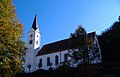
St. Nicholas

Lady Chapel

Village fountain

synagogue

Judenhaus, called "Schillingshaus"


Web links
Individual evidence
- ↑ "Data 2" sheet, Statistical Report A1200C 202041 Population of the municipalities, districts and administrative districts 1st quarter 2020 (population based on the 2011 census) ( help ).
- ↑ Municipal Council. Binswangen municipality, accessed on June 1, 2020 .
- ^ Binswangen municipality in the local database of the Bavarian State Library Online . Bayerische Staatsbibliothek, accessed on August 31, 2019.
- ^ Local history of Binswangen , accessed on June 22, 2014.
- ↑ Entry on the coat of arms of Binswangen in the database of the House of Bavarian History

Aislingen | Bachhagel | Bächingen an der Brenz | Binswangen | Bissingen | Blind home | Buttenwiesen | Dillingen on the Danube | Finningen | Glött | Gundelfingen an der Donau | Haunsheim | Höchstädt on the Danube | Holzheim | Laugna | Lauingen | Lutzingen | Medlingen | Mödingen | Schwenningen | Syrgenstein | Villenbach | Wertingen | Wittislingen | Ziertheim | Zöschingen | Zusamaltheim